![]()
ANDESITE FALLS |
|
|
RATING -
44.0
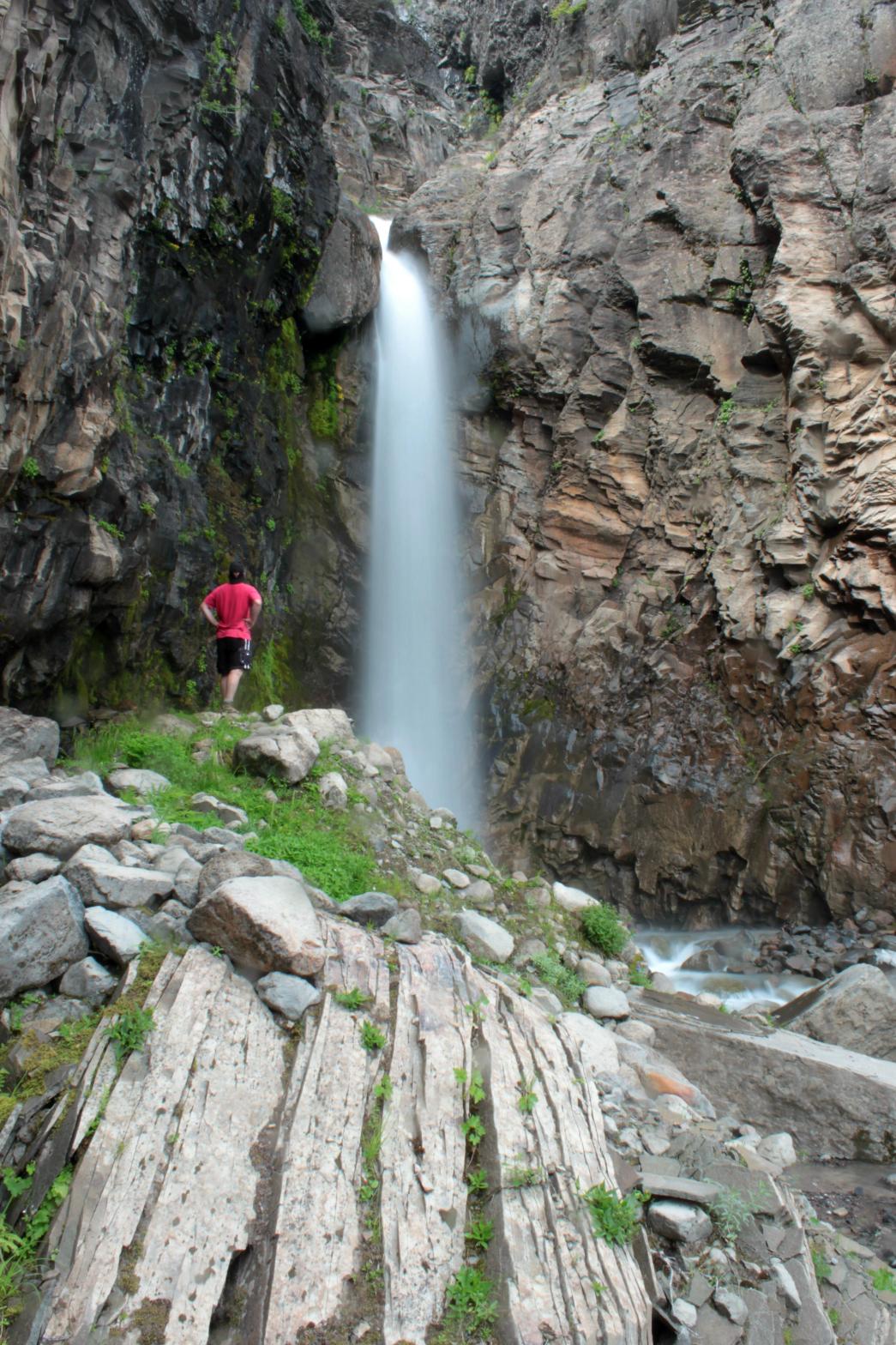
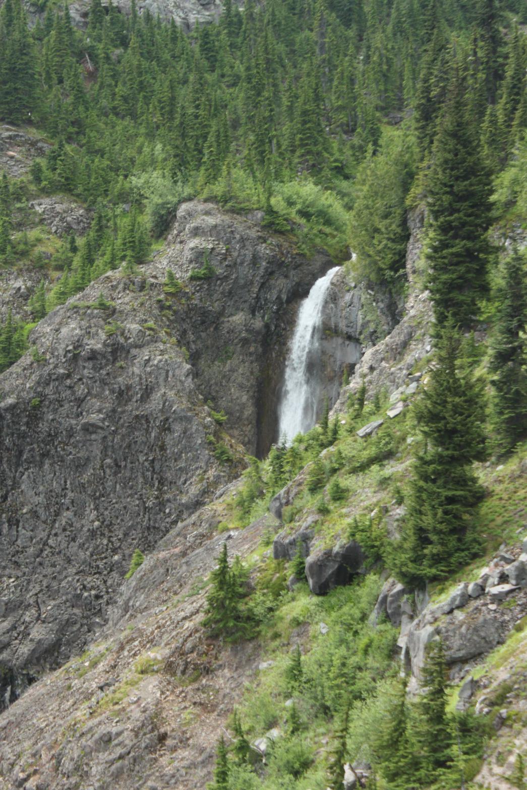
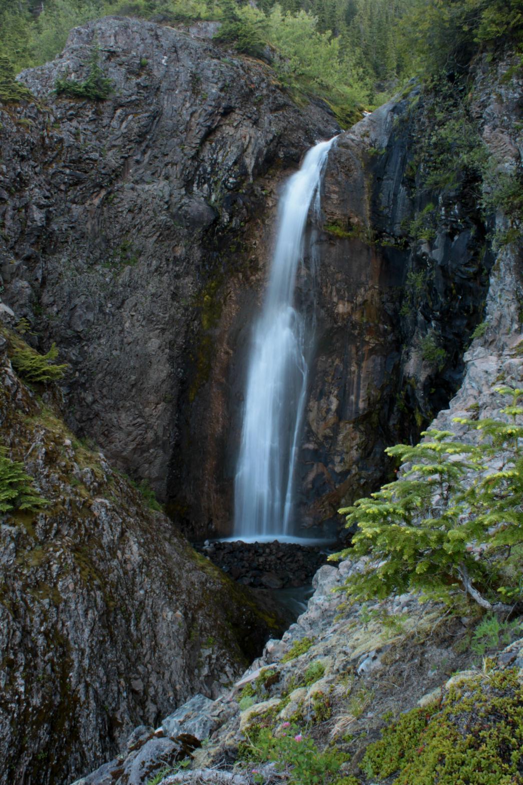
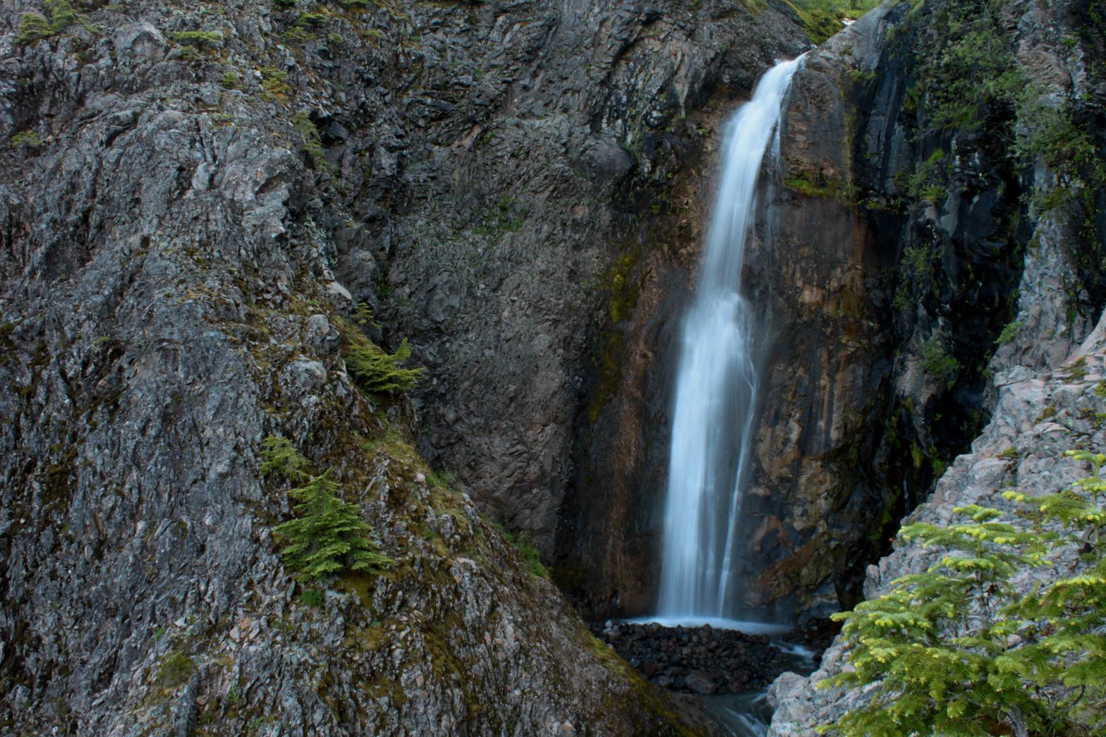
VR - 4 (Med/Sm) HR - 7 SR - 16/20 TYPE OF APPROACH - Bushwhack DIFFICULTY - Extremely Difficult LOCATION - Mt. Baker Recreation Area TYPE - Tiered HEIGHT - 256' WIDTH - 10' ELEVATION - 4088' GPS - N 48.7339919, W 121.795201 |
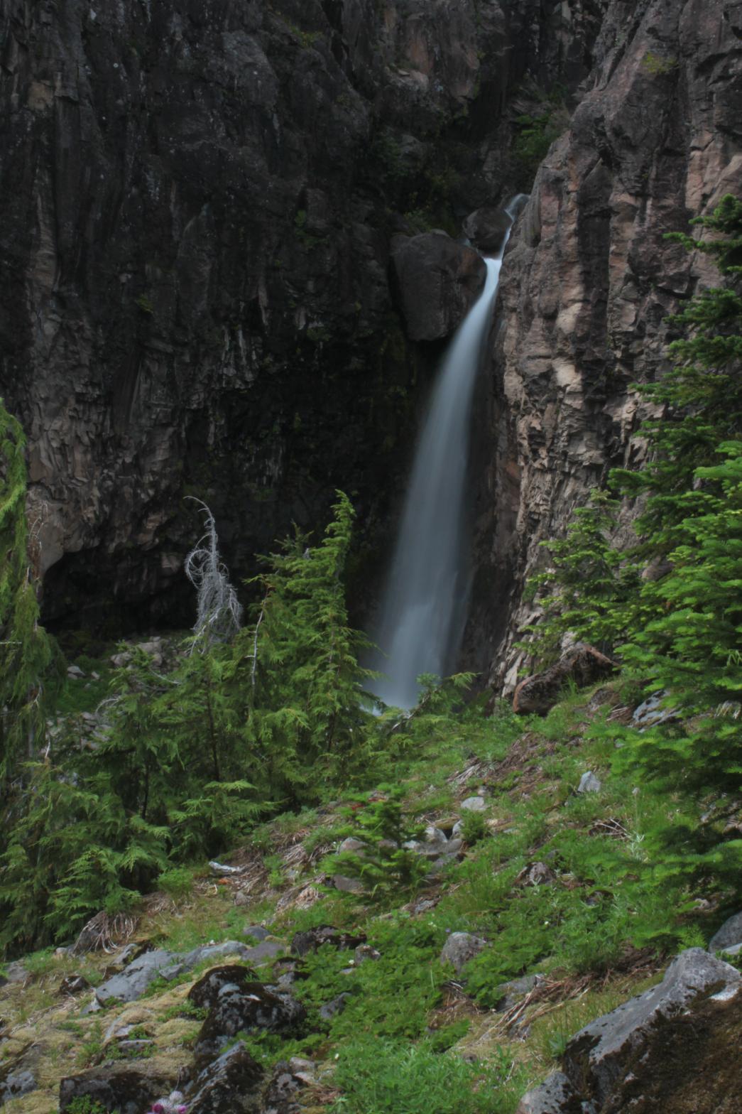
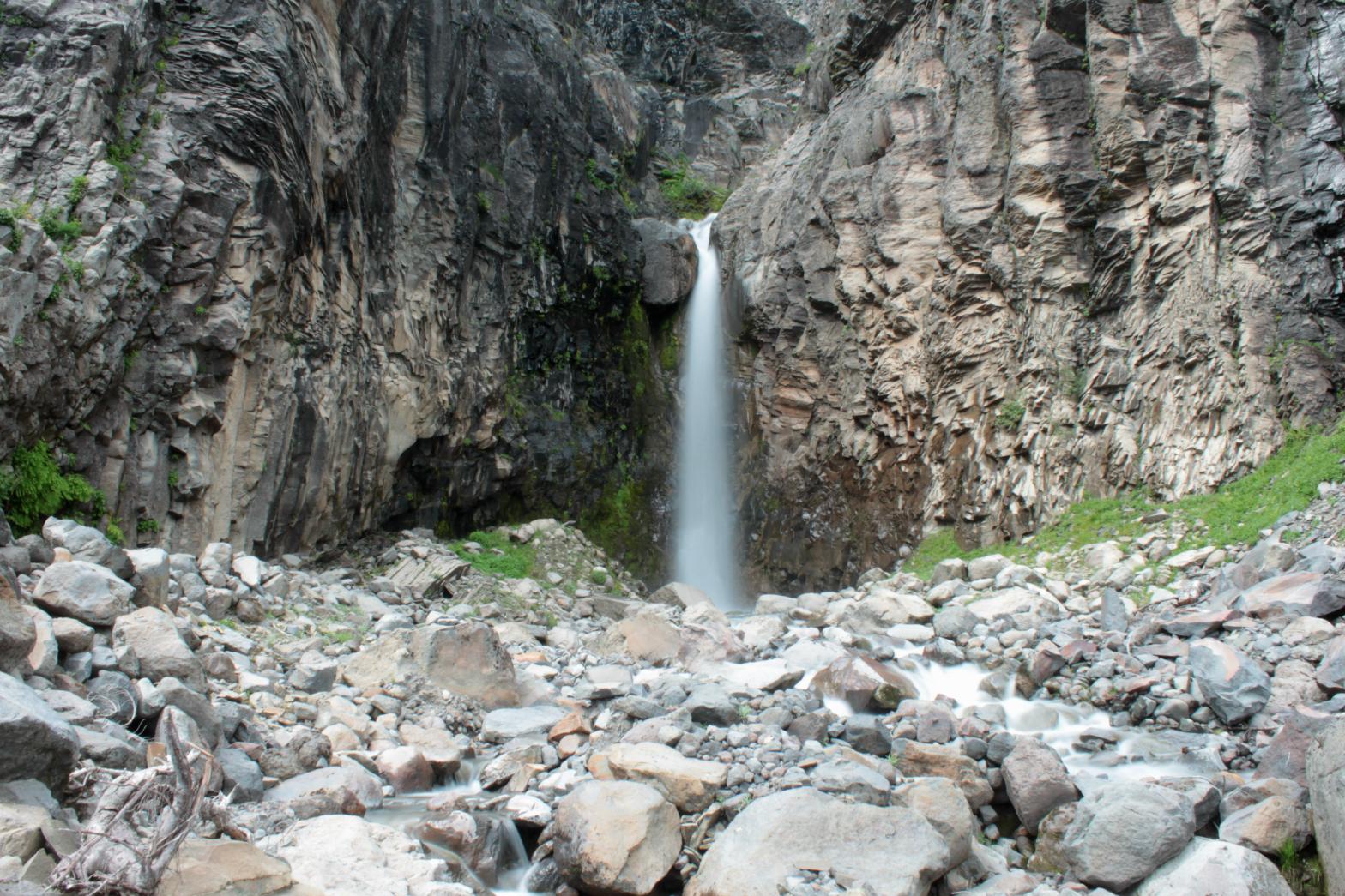
The Sandy Creek Basin is one of the most desolate, rugged, and most difficult to access locations on all of Mt. Baker. However, the area is also home to a plethora of waterfalls and some of the most unique and amazing geology on the entire mountain. Three major streams flow out of the Squak Glacier in the area and each one contains multiple waterfalls along their courses. Andesite Falls is an amazing waterfall that occurs on the same stream as South Squak Glacier Falls (although the creek has picked up more water at this point). The waterfall drops over an absolutely amazing rock formation. The entire waterfall stands 256' tall, but only the bottom tier can be seen clearly without putting your life at risk. The falls begin with a plunging drop that stands 66' in height. The creek then makes a horseshoe turn in the middle of the formation over what looks to be two or three tiers. The creek then exits the mini-canyon via the 70' tall bottom tier. Were the entire waterfall visible from one location, this would be one of the better waterfalls on Baker. However, there doesn't seem to be anyway to see the majority of the falls. The bottom tier alone makes this a very worthy location though. The journey is extremely difficult, but when you add in several other great waterfalls in the area, it's worth the effort. I've named the waterfall for the Andesite rock that the cliff is made out of. |
|
DIRECTIONS - Follow the directions to
Middle Andesite Falls. This one is literally right downstream, but
you have to do some work to get from one to the other safely. Climb
back uphill to the north until you reach the top of the ride on the opposite
side of a tributary stream and follow that downhill to the base.
You'll get a decent view of the upper tier on the way down. NEARBY WATERFALLS - Double Falls, Kathryn Falls, Middle Andesite Falls, Middle Sandy Creek Falls, Skaleek Falls, South Squak Glacier Falls, Squak Glacier Falls, Upper Andesite Falls, Upper Sandy Creek Falls |
|
ADDITIONAL PICTURES (CLICK TO ENLARGE) AND
VIDEO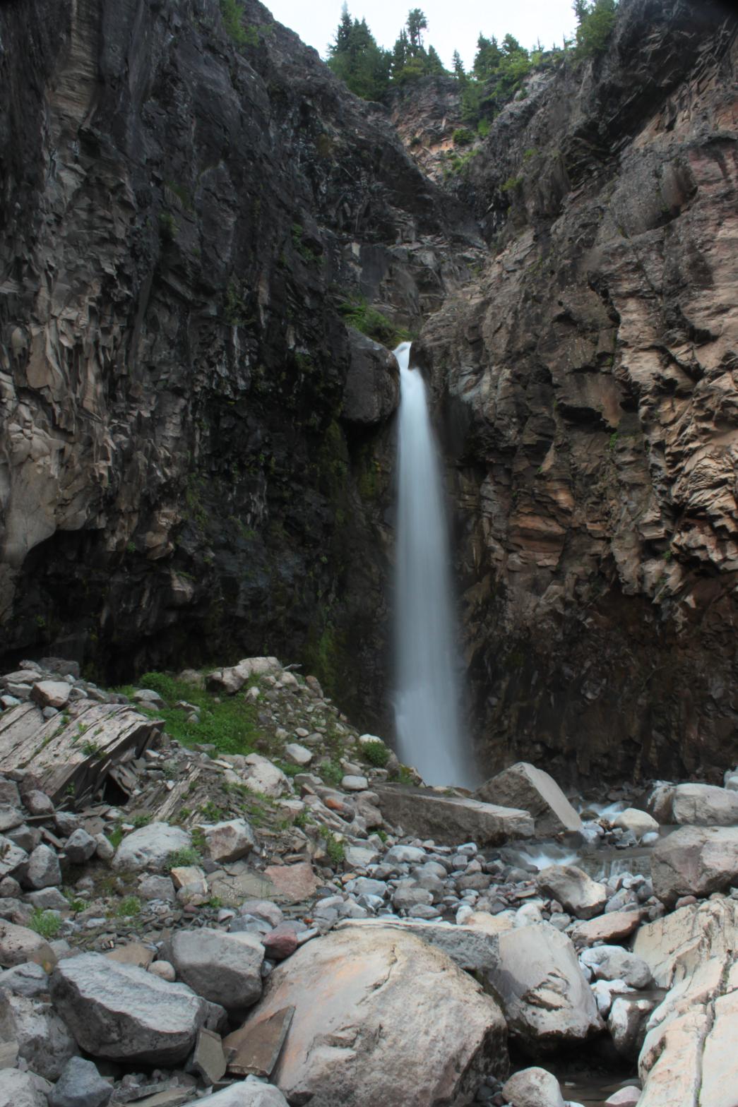
 |
|
HOME/a> WHATCOM COUNTY LINKS BEST IN THE NW WATERFALLS FOR KIDS FLICKR FACEBOOK STORE |
|