![]()
DAVIS CREEK FALLS |
|
|
RATING - 23.0
VR - 1.8 (Small) HR - 5 SR - 14/20 TYPE OF APPROACH - Bushwhack DIFFICULTY - Fairly Difficult LOCATION - Mt. Baker Highway TYPE - Plunge HEIGHT - 103' WIDTH - 10' GPS - N48 52.509', W121 55.806' ELEVATION - 1649' |
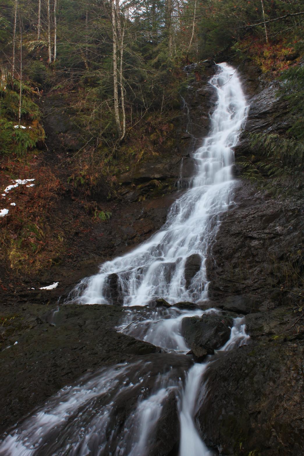 This
is the best of the four smallish waterfalls located on Davis Creek near
Glacier. Here Davis Creek drops nearly vertically for about 78' before
striking the bedrock and horsetailing, sliding, and cascading for another
25'. There appears to be one
more waterfall a short distance upstream that we will bag in the spring as
well. Thus far the upper falls has been in the snow and we prefer to
avoid snow if at all possible. If you scramble down to the base of the
falls be careful. The rocks near the base are amazingly slippery. This
is the best of the four smallish waterfalls located on Davis Creek near
Glacier. Here Davis Creek drops nearly vertically for about 78' before
striking the bedrock and horsetailing, sliding, and cascading for another
25'. There appears to be one
more waterfall a short distance upstream that we will bag in the spring as
well. Thus far the upper falls has been in the snow and we prefer to
avoid snow if at all possible. If you scramble down to the base of the
falls be careful. The rocks near the base are amazingly slippery. |
|
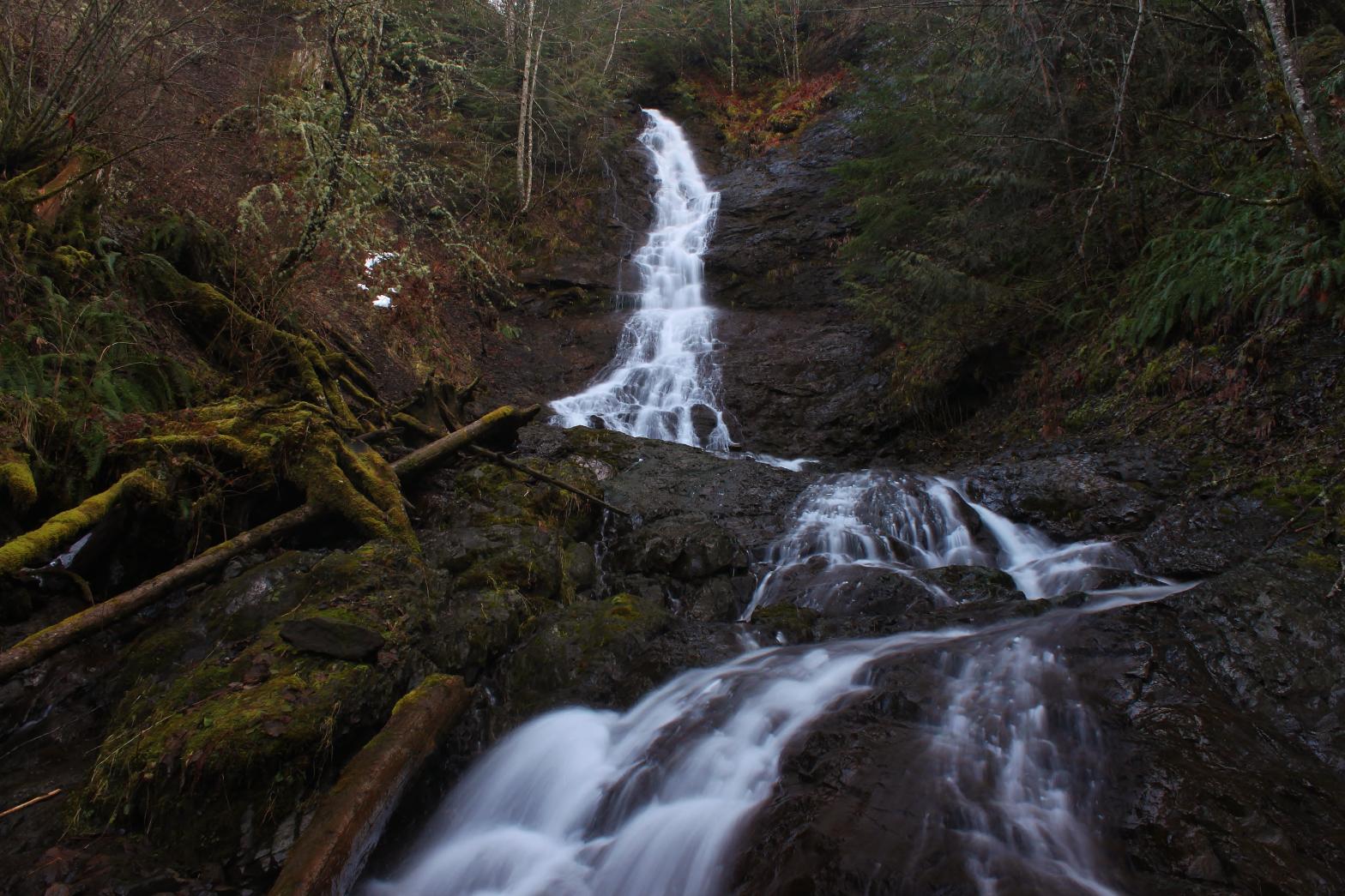
DIRECTIONS - Follow the directions to
Middle Davis Creek Falls. This waterfall is located about 1/4 of a
mile upstream from there. The easiest route is up the east side of the
creek, following game trails and a mountain bike path for much of the way. A through the trees
view can be had from the top of the ridge. If your goal is the base,
head down towards the creek as soon as the falls become visible. The
slope gets much steeper and less stable closer to the falls. NEARBY WATERFALLS - Lower Davis Creek Falls, Middle Davis Creek Falls |
|
ADDITIONAL PICTURES (CLICK TO ENLARGE) AND VIDEO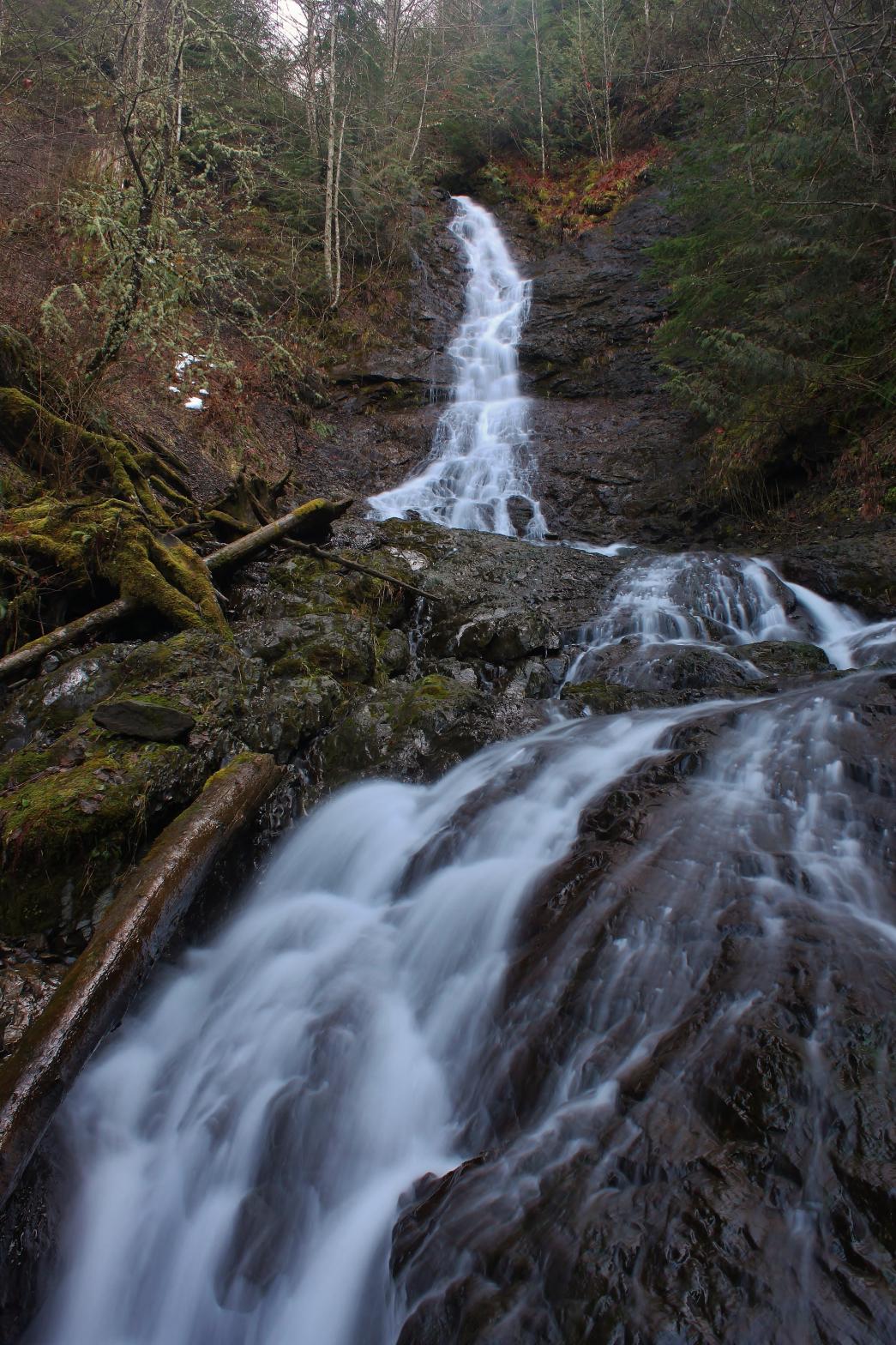
 |
|
HOME WHATCOM COUNTY LINKS BEST IN THE NW WATERFALLS FOR KIDS FLICKR FACEBOOK STORE |
|