![]()
DEADHORSE FALLS |
|
|
RATING - 62.0
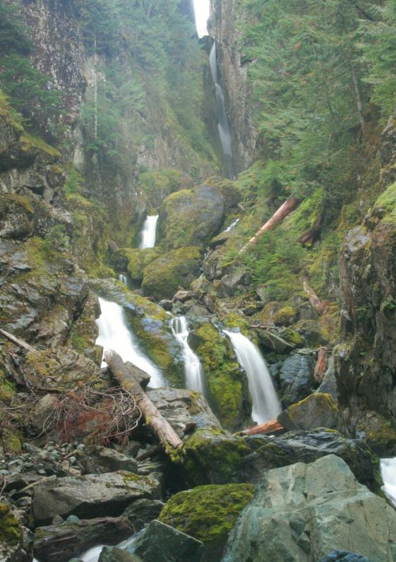
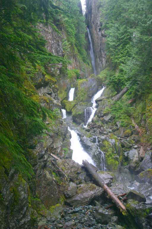
VR - 6 (Med) HR - 8 SR - 14/20 TYPE OF APPROACH - Bushwhack DIFFICULTY - Very Difficult LOCATION - Deadhorse Creek Road TYPE - Tiered HEIGHT - 393' WIDTH - 40' GPS - N48 53.393 W121 49.152 ELEVATION - 2880' |
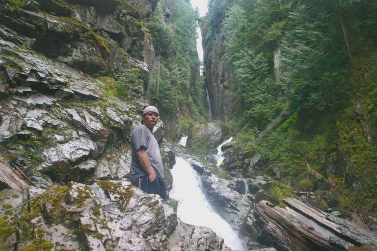
Deadhorse Falls is not an easy waterfall to get to, but it's
worth the effort. Along the way, you will be required to ford Deadhorse Creek
several times, scoot along steep hillsides above the creek bed, and climb over slippery
rocks and logs. In the end, Deadhorse Falls awaits. After a
recent trip to the falls, Bryan Swan was able to measure the falls and it
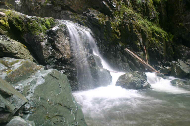
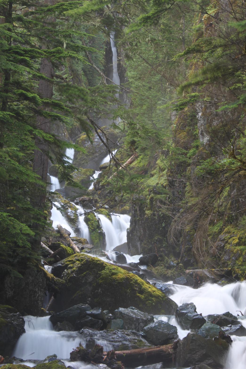
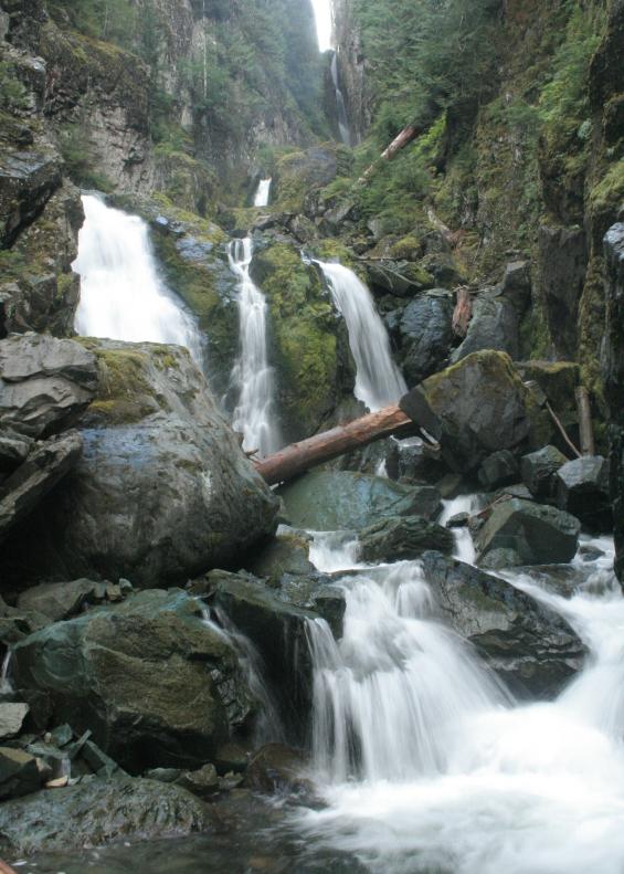
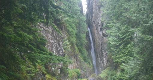
turns out they were much taller than I previously thought. The falls consist of four main drops with several smaller drops below. The top tier is a plunge of 262' that is cut very deeply into the cliff face. From there the creek splits around a huge rock and runs over two segmented drops of about 30' and 60'. Finally, it splits into three segments and drops over a final tier of 39'. The total of all these drops comes out at just under 400' in height. The entire canyon is among the most rugged looking places I've ever seen and is a true adventure in every sense of the word. |
| DIRECTIONS - Take
the Mt Baker Highway east to Glacier and turn right onto Glacier Creek Road.
Immediately turn left onto Deadhorse Creek Road. Follow it for around 6 miles past
lovely Cascade Creek Falls. Once at the creek,
work your way upstream into the rugged canyon to views of the falls. Getting close
will require at least one ford of the creek. NEARBY WATERFALLS - Boyd Creek Falls, Cascade Creek Falls, Lower Deadhorse Falls |
|
|
ADDITIONAL PICTURES (CLICK TO ENLARGE)
|
|
HOME WHATCOM COUNTY LINKS BEST IN THE NW WATERFALLS FOR KIDS FLICKR FACEBOOK STORE |
|