![]()
DICKS CREEK FALLS |
|
|
RATING - 48.0
VR - 4 (Med/Sm) HR - 7.5 SR - 8/20 TYPE OF APPROACH - Trail + Bushwhack DIFFICULTY - Extremely Difficult LOCATION - Lake Cavanaugh Area TYPE - Tiered HEIGHT - 350' WIDTH - 20' GPS - N48 18.687 W121 49.987 ELEVATION - 2050' |
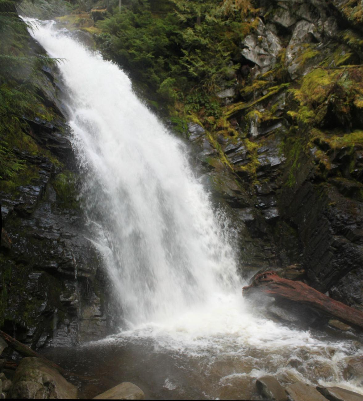
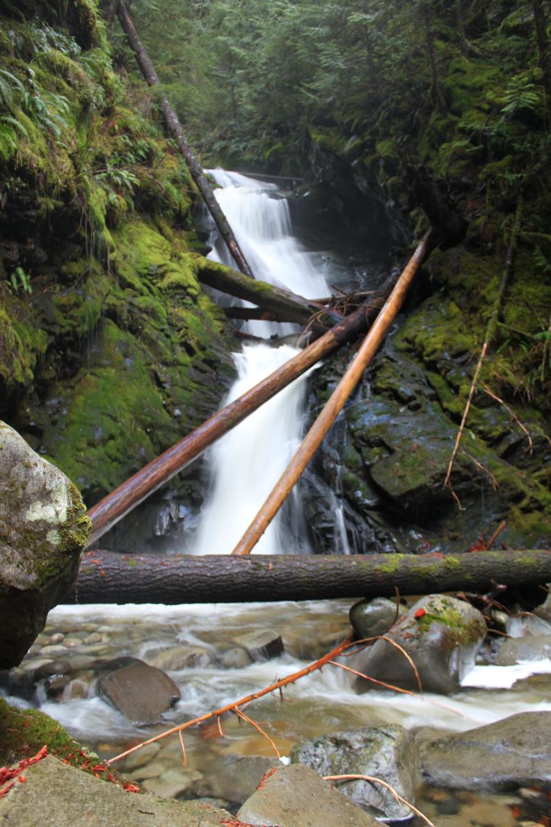
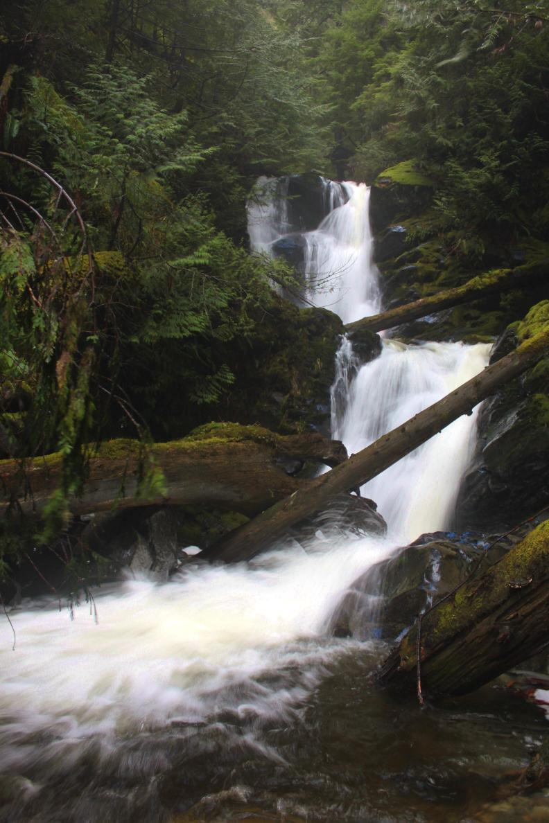
The falls begin with a 75' tall, three-stepped drop, the bottom of which is covered with logs and trees. Below here, the creek plunges 65' in a sheer drop, immediately followed by a 15' drop. From there the creek drops over my favorite tier, a back-to-back drop about 75' tall. Drop #4 seems to be about 50' tall, but I couldn't get a clear view of it from the west side of the canyon. Finally, the falls finishes up with two similar tiers; each of which consists of a 25' drop and a 10' drop. The total height of the falls is well over 300' in height. There appear to be more tiers above the "upper tier" listed above but I haven't seen them yet. Some people might want to split the falls up into individual sections, but there really is no reason or simple way to do this. Getting a view of Dicks Creek Falls involves scrambling up and down very steep slopes and if you are not very comfortable with steep bushwhacks, leave this one alone. A mistake in this canyon will kill you. If you are comfortable with this then a great waterfall awaits you. The tragic Oso Landslide occured very close to this waterfall and I suspect that the road used to access the trail and waterfall has been at least partially destroyed. It may no longer be possible to visit this waterfall. |
|
DIRECTIONS - Drive east of Arlington along Highway 530 and turn left onto C
Post Road about a mile east of the huge "School Bus Turnaround". Follow
this rough road across the river and turn left. The road gets pretty rough
but I was able to make it to end in the Honda Accord (barely). Park at the
end of the road and find the trail on the old road heading up and to the
right. The trail climbs very steeply for around a mile until it gets close
to the canyon. Leave the trail here and begin a very steep scramble
down the slopes and towards the creek. As you follow the creek down,
you will see more and more tiers of the falls. From the bottom, you
can head upstream and slightly west where you will eventually run into a
very overgrown old road (it's only noticeable because it's flat).
Follow this west until it runs into the trail. NEARBY WATERFALLS - McGillicuddys Falls |
|
ADDITIONAL PICTURES (CLICK TO ENLARGE) AND
VIDEOS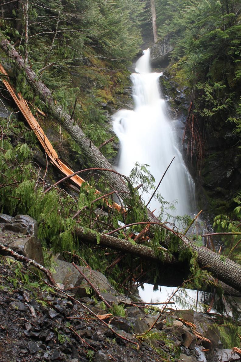
|
|
HOME SKAGIT COUNTY LINKS BEST IN THE NW WATERFALLS FOR KIDS FLICKR FACEBOOK STORE |
|
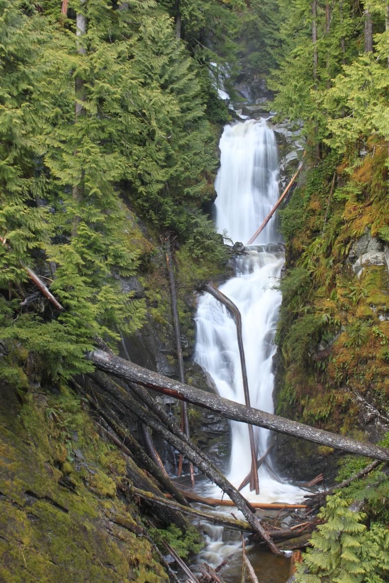 Dicks Creek flows out of Myrtle Lake on the west end of Mt. Higgins
near Darrington, WA. After meandering for a short distance, the creek
begins a drop through an extremely steep and rugged canyon. Along the
way it drops over six major tiers, totally about 350' in height.
Dicks Creek flows out of Myrtle Lake on the west end of Mt. Higgins
near Darrington, WA. After meandering for a short distance, the creek
begins a drop through an extremely steep and rugged canyon. Along the
way it drops over six major tiers, totally about 350' in height.