![]()
DOUBLE EAGLE FALLS |
|
|
RATING - 34.0
VR - 4 (Med/Sm) HR - 6 SR - 10/20 TYPE OF APPROACH - Bushwhack DIFFICULTY - Very Difficult LOCATION - Mountain Loop Highway TYPE - Tiered HEIGHT - 145' WIDTH - 20' GPS - N48 06.738 W121 32.566 ELEVATION - 3183' |
|
|
DIRECTIONS - Follow the directions to
Lower Double Eagle Falls. Continue along the old road through two
more switchbacks. The road continues to deteriorate and becomes more
and more difficult to travel. About 1/4 of a mile past the 3rd
switchback, leave the road for a spur road heading up to the right.
This road will run out shortly in a field of brush. You can fight your
way through this towards the creek or climb steeply uphill into the woods
where the brush is less. Once in the woods, head towards the creek and
you should come out near the uppermost tier. Be sure to have a GPS for
this trip. It would be very easy to get lost. NEARBY WATERFALLS - Lower Double Eagle Falls |
|
|
ADDITIONAL PICTURES (CLICK TO ENLARGE) AND VIDEO
|
|
HOME SNOHOMISH COUNTY LINKS BEST IN THE NW WATERFALLS FOR KIDS FLICKR FACEBOOK STORE |
|
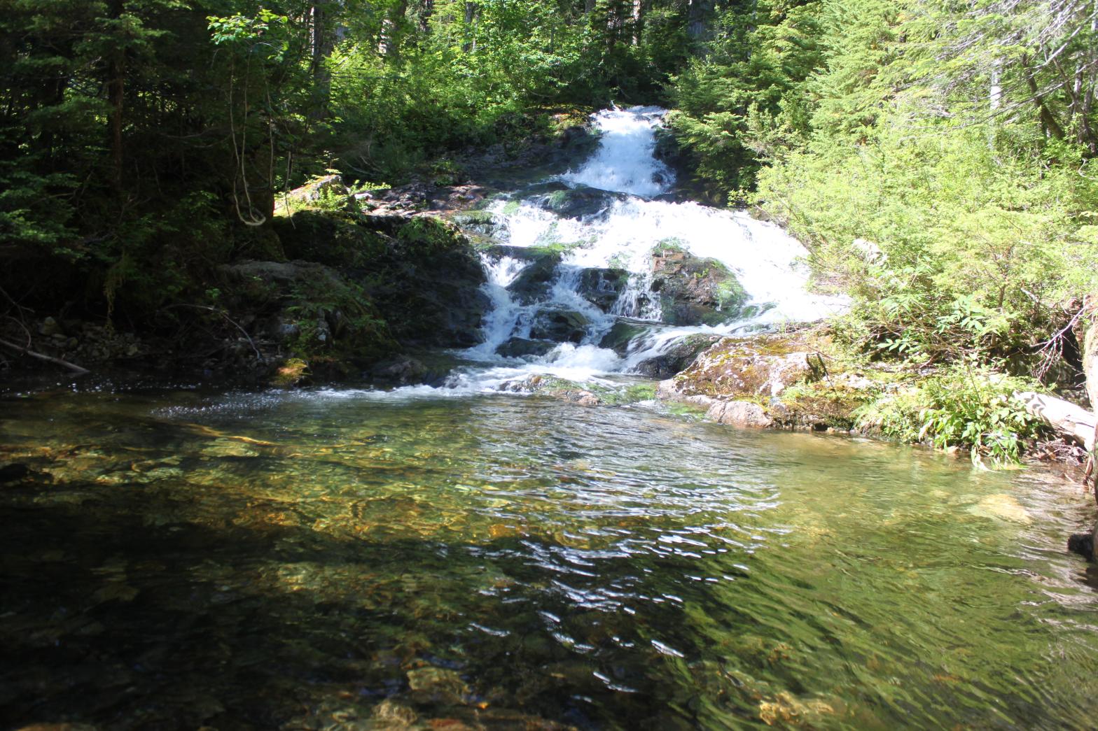
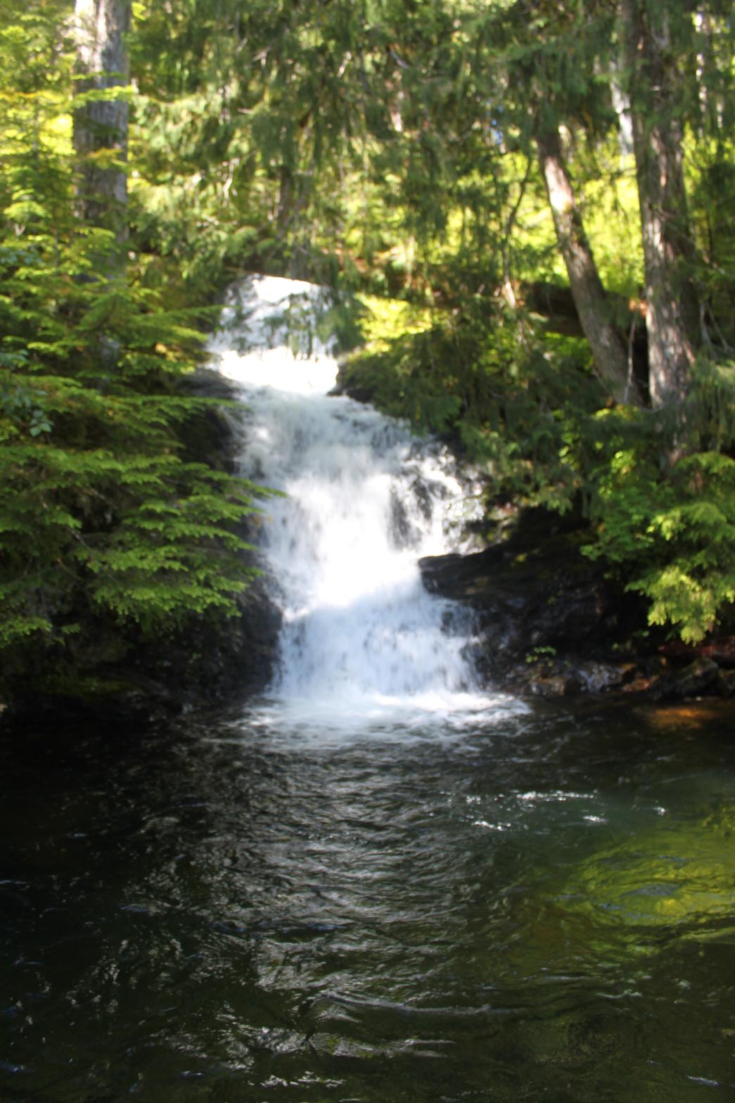 Double
Eagle Falls is named after the nearby Double Eagle Mine. The falls
begin with a 30' series of cascades into a gorgeous pool. In fact, the
pool is so pretty that I took a swim in it to cool down on my first visit to
the falls. Just around the corner from here, the falls continue with a
40' tall back-to-back drop pictures to the left. This ends in another
nice pool, this one probably 15' deep. Finally (as far as I can tell),
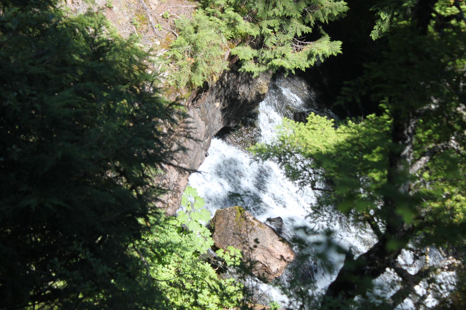
the waterfall culminates in a 75ish' tall segmented drop. The left
hand segment appears to emerge from a cave of some sort. From my view
high above the falls, I couldn't tell if this was just a short tunnel under
a rock arch, or if it was an actual cave. Getting to the base of this
drop would probably involve bushwhacking upstream from above the lower
falls, something I will do on my next trip. If I can reach the bottom,
this appears to be a very unique waterfall. Since I wasn't at the
base, and saw no evidence of a mine, there is a chance this is not the
actual Double Eagle Falls. The Topo maps certainly promote the
possibility of at least one more waterfall upstream from this location.
I plan on fully exploring this creek in the future when I have more time and
traveling all the way to Devils Lake. Stay tuned.
Double
Eagle Falls is named after the nearby Double Eagle Mine. The falls
begin with a 30' series of cascades into a gorgeous pool. In fact, the
pool is so pretty that I took a swim in it to cool down on my first visit to
the falls. Just around the corner from here, the falls continue with a
40' tall back-to-back drop pictures to the left. This ends in another
nice pool, this one probably 15' deep. Finally (as far as I can tell),
the waterfall culminates in a 75ish' tall segmented drop. The left
hand segment appears to emerge from a cave of some sort. From my view
high above the falls, I couldn't tell if this was just a short tunnel under
a rock arch, or if it was an actual cave. Getting to the base of this
drop would probably involve bushwhacking upstream from above the lower
falls, something I will do on my next trip. If I can reach the bottom,
this appears to be a very unique waterfall. Since I wasn't at the
base, and saw no evidence of a mine, there is a chance this is not the
actual Double Eagle Falls. The Topo maps certainly promote the
possibility of at least one more waterfall upstream from this location.
I plan on fully exploring this creek in the future when I have more time and
traveling all the way to Devils Lake. Stay tuned.