|
RATING - 48.0
|
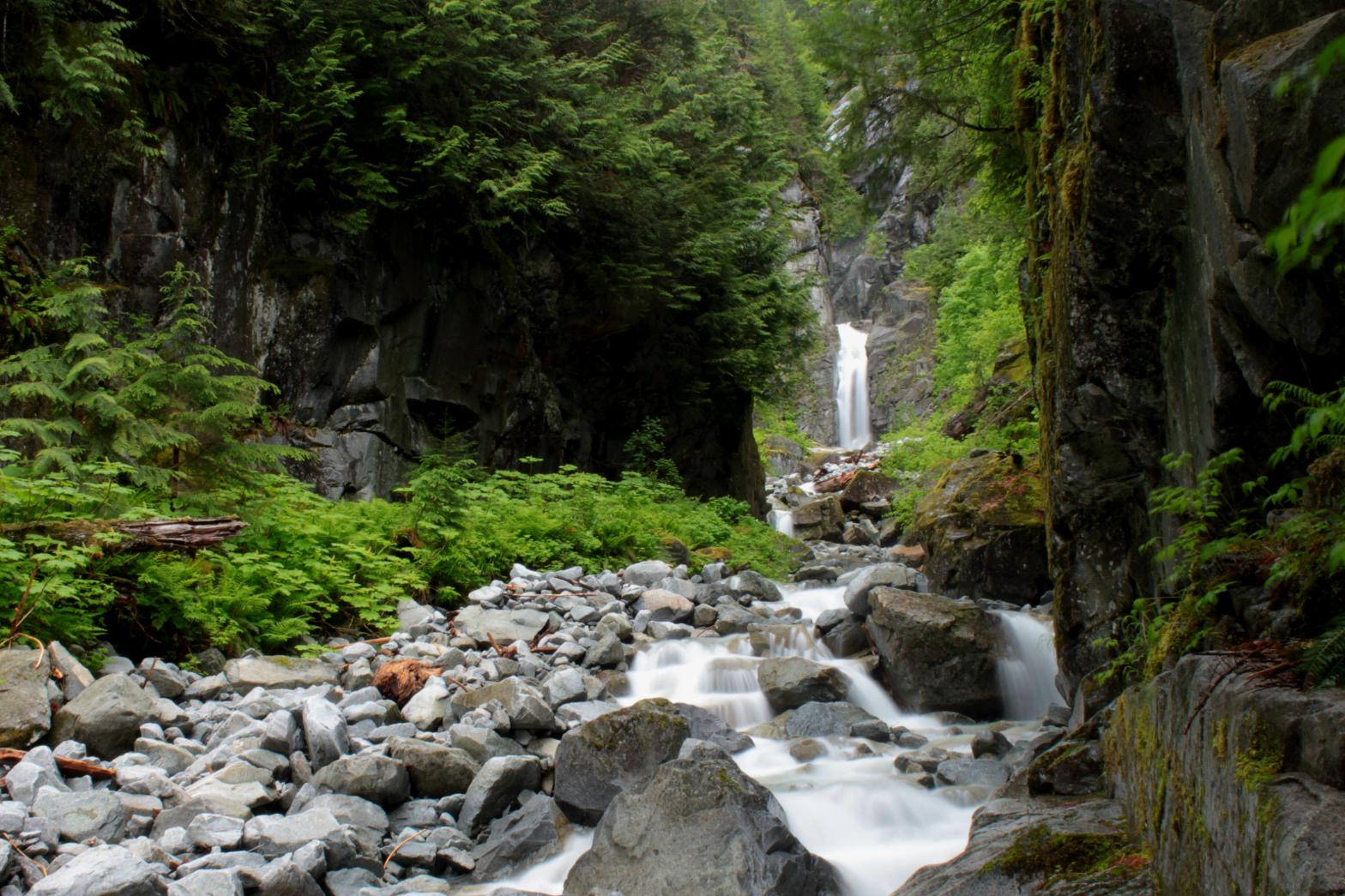 With a name like Great Falls Creek, one would expect this to be a great location for a large waterfall. Turns out that the name is a little bit off. Pretty Good Falls might be more accurate but whatever. Great Falls is a nice two-tiered waterfall located in the middle of one of the coolest canyons I've ever seen. The lower tier of the falls drops 71' in a 15' wide curtain of water. What doesn't show up well in pictures is that this lower tier is incised a good 10' into the cliff. There is a small "cave" on the right side of the falls where the cliff overhangs a little bit. It's a neat (and dry) place to hang out if it starts to rain. Tucked into the extremely narrow upper part of the canyon is a 134' tall plunge that starts out about a foot wide and gradually widens to five feet by the time it hits the rocks. The little alcove around this upper tier is narrow, tight, and extremely difficult to get into. The cliffs continue to rise above the upper tier, so it's possible there is more to the waterfall above, but it's not possible to get there from inside the canyon. The trip into Great Falls is pretty interesting. It involves climbing about 3/4 of a mile up the dry creek bed from the river. Just before you get to a view up the canyon towards the falls, the water in the creek magically appears. Like many of the other streams in the area, this one runs underground for part of its journey. The canyon itself is amazing! It is almost perfectly straight for 1/4 mile downstream of the falls with vertical canyon walls rising hundreds of feet above the rocky stream bed. Abundant mosses and ferns throughout the canyon give it an almost Jurassic look to it. One gets the impression that a velociraptor could jump out and attack at any moment. |
OTHER PICTURES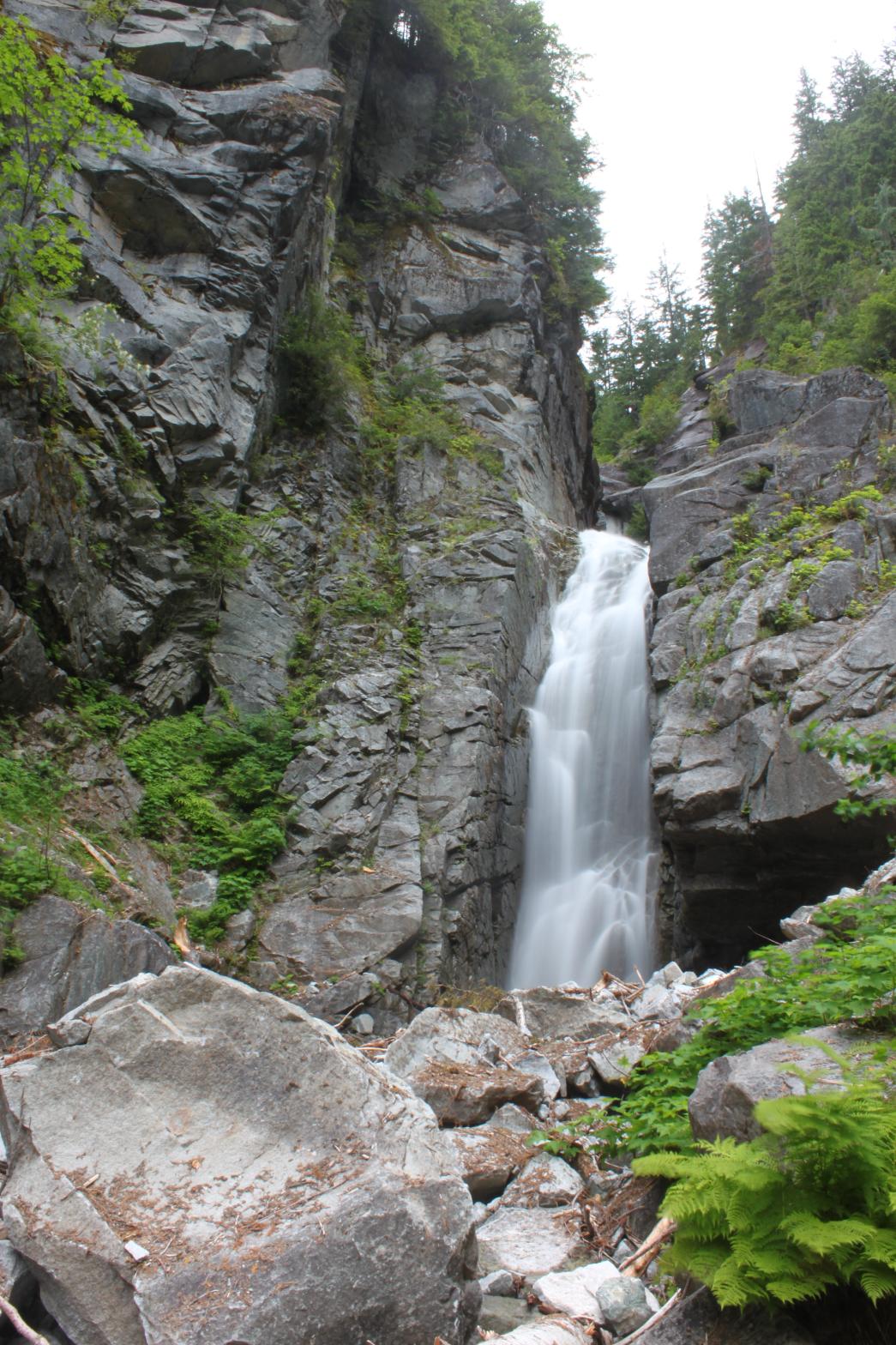 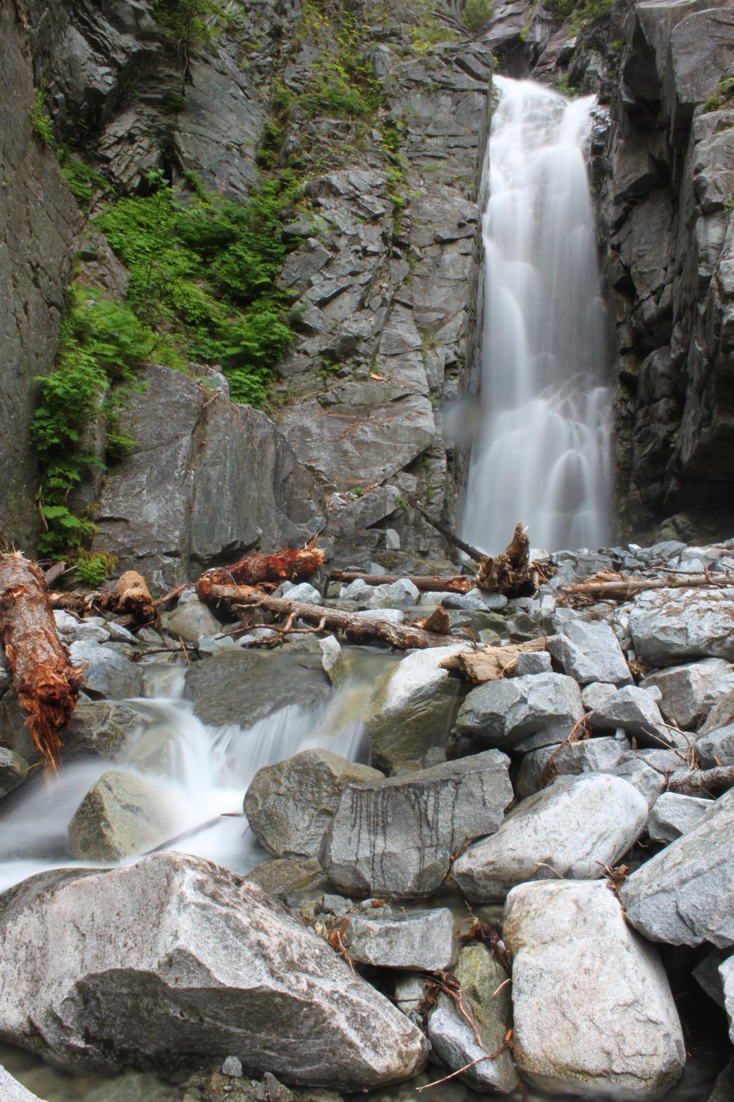 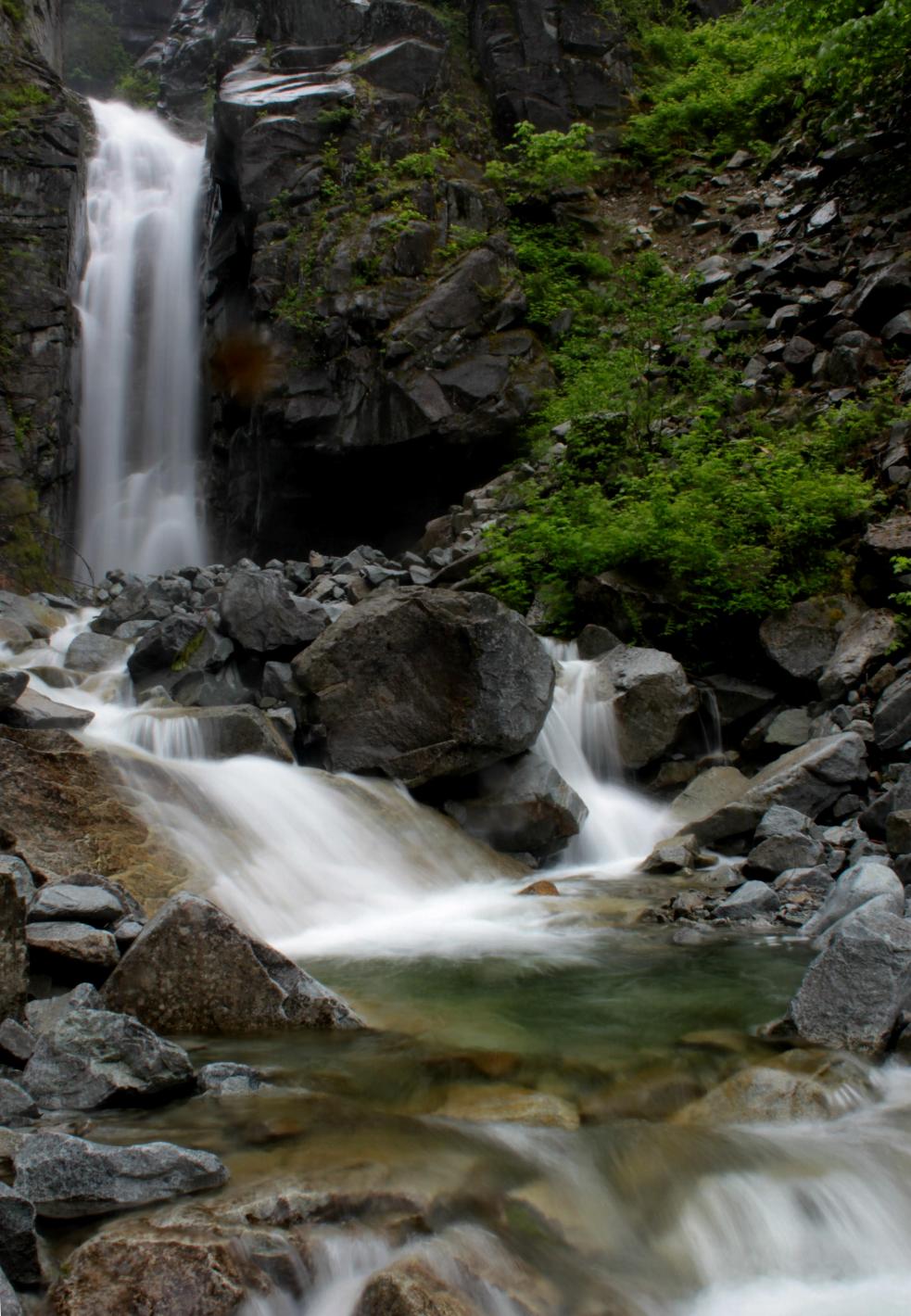 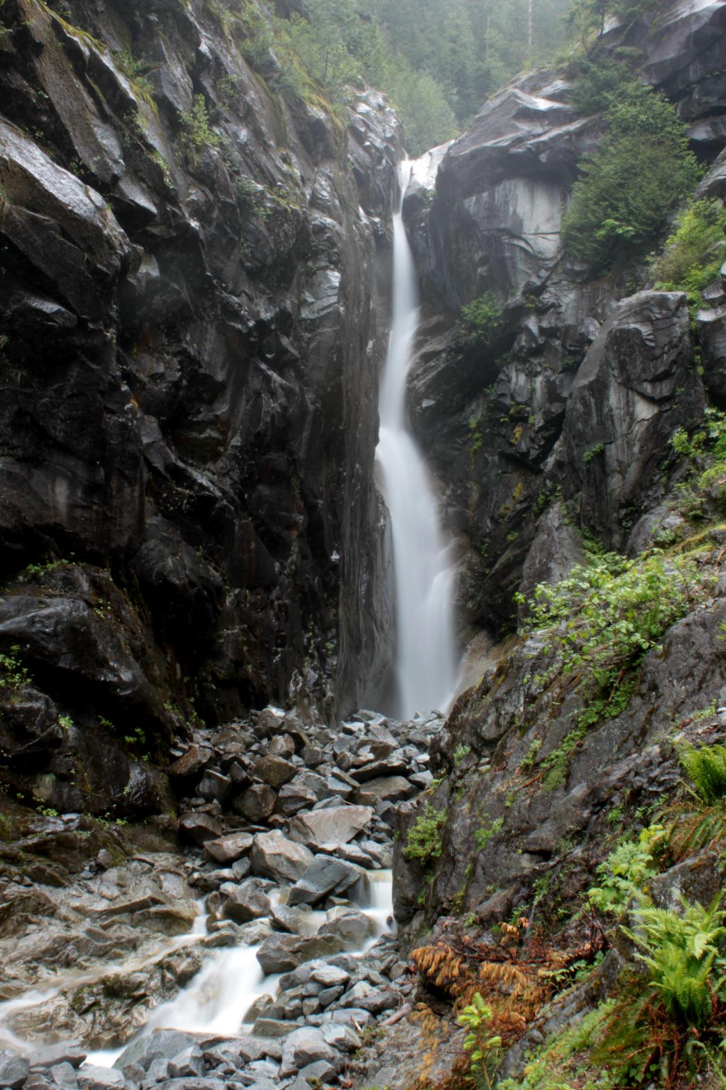 |
|
VR - 4.0 (Med/Small) HR - 7.0 SR - 20/20 TYPE OF APPROACH - Bushwhack DIFFICULTY - Fairly Difficult LOCATION - Miller River Road TYPE - Tiered HEIGHT - 215' * WIDTH - 10' |
||
| DIRECTIONS - Turn off of Highway 2 onto Money Creek Road about 3 miles west of Skykomish. In 1 mile, turn onto Miller River Road and follow it for several miles, crossing the West Fork and then the East Fork of the river. Park just before you cross Purvis Creek (it's the only creek you literally drive through on the road) and follow it downstream to the river. From here you have to cross the river. I was able to cross on a log without getting wet but it's also possible to just ford the creek upstream a short distance. This crossing is probably not safe when the river is running high. Almost directly across from Purvis Creek is the dry creek bed of Great Falls Creek. Follow it upstream, constantly climbing for about 1/2 of a mile until you reach the bottom of the canyon. Climb another 1/4 of a mile up the canyon to base of the falls. The trip is physically demanding but is almost entirely brush-free. Just be very careful crossing the river and the rest isn't too bad. |