|
RATING - 56.0
|
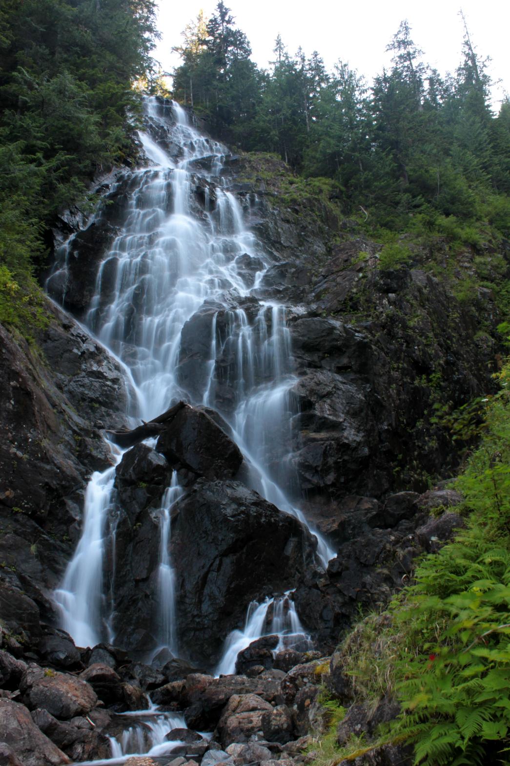 Greider Falls is a massive waterfall
located just downstream from Little Greider Lake. The falls begin with
back-to-back 15' tall drops before plunging off the edge of the world,
finally reaching the bottom over 300' below. Along the way, the creek
spreads out to around 40' in width as it bounces here and there along the
cliff. The view from the top is dangerous and not very good. The
view from the bottom is much better, although it's extremely difficult to
get there and you can "only" see 260' worth of the falls from there. I
suspect that when the creek is running at full volume it might not even be
possible to get to the bottom. Greider Falls is a massive waterfall
located just downstream from Little Greider Lake. The falls begin with
back-to-back 15' tall drops before plunging off the edge of the world,
finally reaching the bottom over 300' below. Along the way, the creek
spreads out to around 40' in width as it bounces here and there along the
cliff. The view from the top is dangerous and not very good. The
view from the bottom is much better, although it's extremely difficult to
get there and you can "only" see 260' worth of the falls from there. I
suspect that when the creek is running at full volume it might not even be
possible to get to the bottom.While Greider Falls is one of the better waterfalls along the Highway 2 corridor, the fact that it is so difficult and dangerous to reach makes this an area that most people just can't get to. |
OTHER PICTURES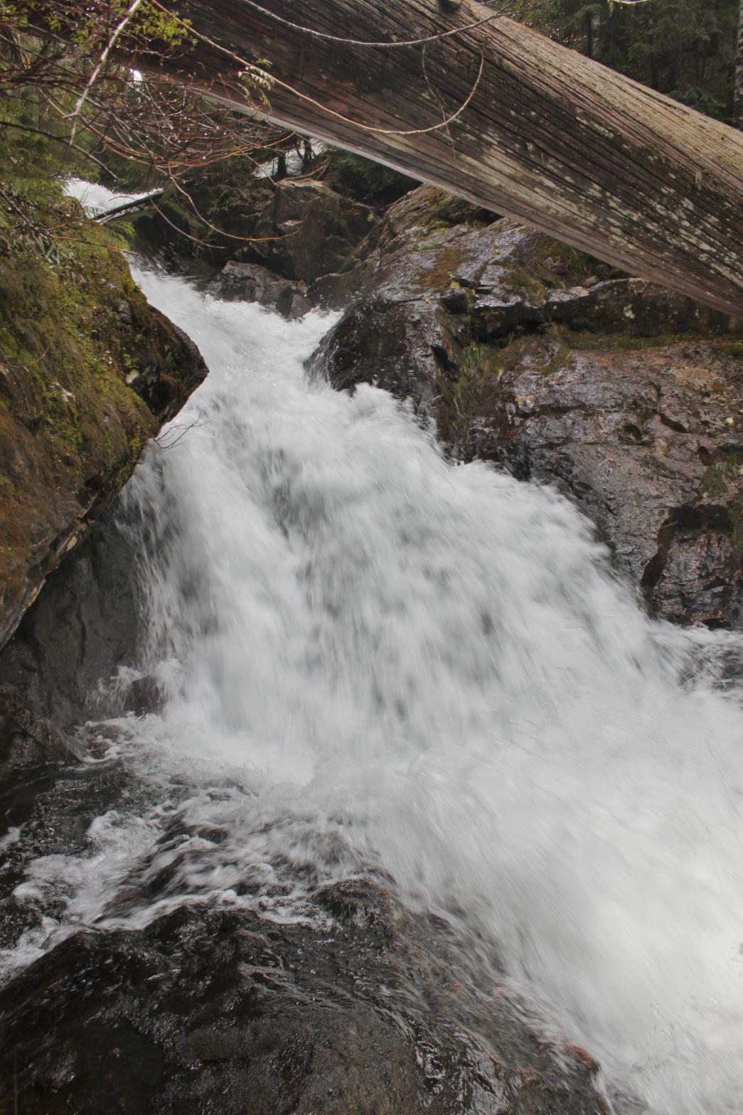 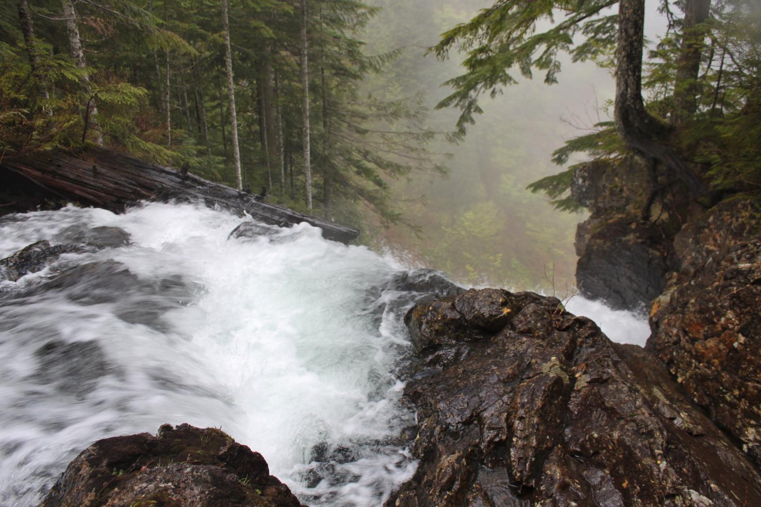 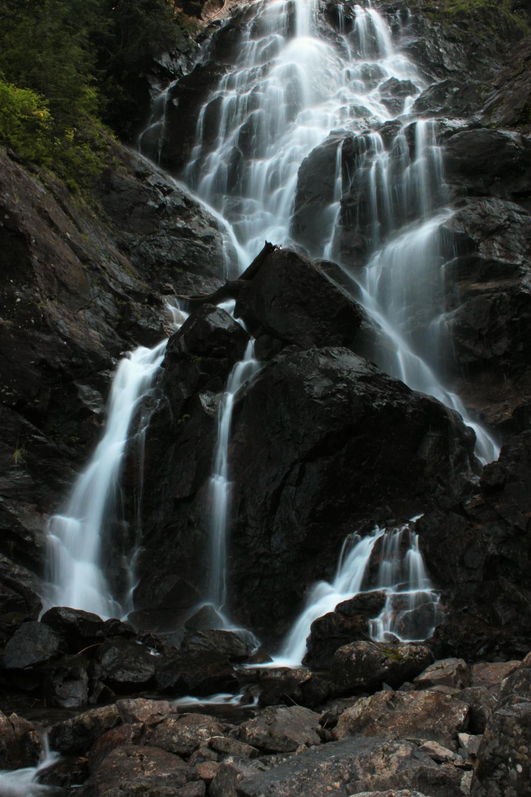 |
|
VR - 6.0 (Medium) HR - 7.0 SR - 14/20 TYPE OF APPROACH - Bushwhack DIFFICULTY - Very Difficult LOCATION - Sultan Basin TYPE - Tiered HEIGHT - 300' WIDTH - 40' |
||
| DIRECTIONS - Drive East of Everett on Highway 2. In the town of Sultan, turn left onto Sultan Basin Road. Sign in at Olney Pass and take the right hand road to the Greider Lakes Trailhead. The trail follows the old road for about 2 miles until it reaches the old trailhead. From here you have two options: head up the creek, hike 2 steep miles up to the lake and then scramble down to the top of the falls. |