![]()
LOWER SUIATTLE FALLS |
|
|
RATING - 31.2
VR - 3.6 (Small) HR - 7.0 SR - 6/20 TYPE OF APPROACH - Bushwhack DIFFICULTY - Fairly Easy LOCATION - Suiattle River Road TYPE - Tiered HEIGHT - 300' WIDTH - 10' GPS - N48 22' 08.22" W121 30' 28.39" ELEVATION - 646'
|
Climbing up the side of the creek will reveal many more tiers of the falls, culminating in the 150' plunge of Suiattle Falls. Be careful if you do climb upstream. The canyon gets steeper and deeper. Cross valley views indicate even more falls above that. In total, the creek may drop over 1000'. It's a little difficult to split the waterfall up and if someone wanted to call this one continuous waterfall I wouldn't argue with them. I decided to split it in two at the bottom of the horsetail below the plunging portion of Suiattle Falls. |
| DIRECTIONS -
From Rockport, head south on HWY 530 and turn onto the Suiattle River Road
(FR 26). Follow the road for 2.7 miles to where it makes a sharp right at
the creek. Park and follow the creek upstream for a few hundred feet. NEARBY WATERFALLS - Bryson Falls, Huckleberry Falls, Suiattle Falls, Teepee Falls, Uproot Falls |
|
ADDITIONAL PHOTOS (CLICK TO ENLARGE)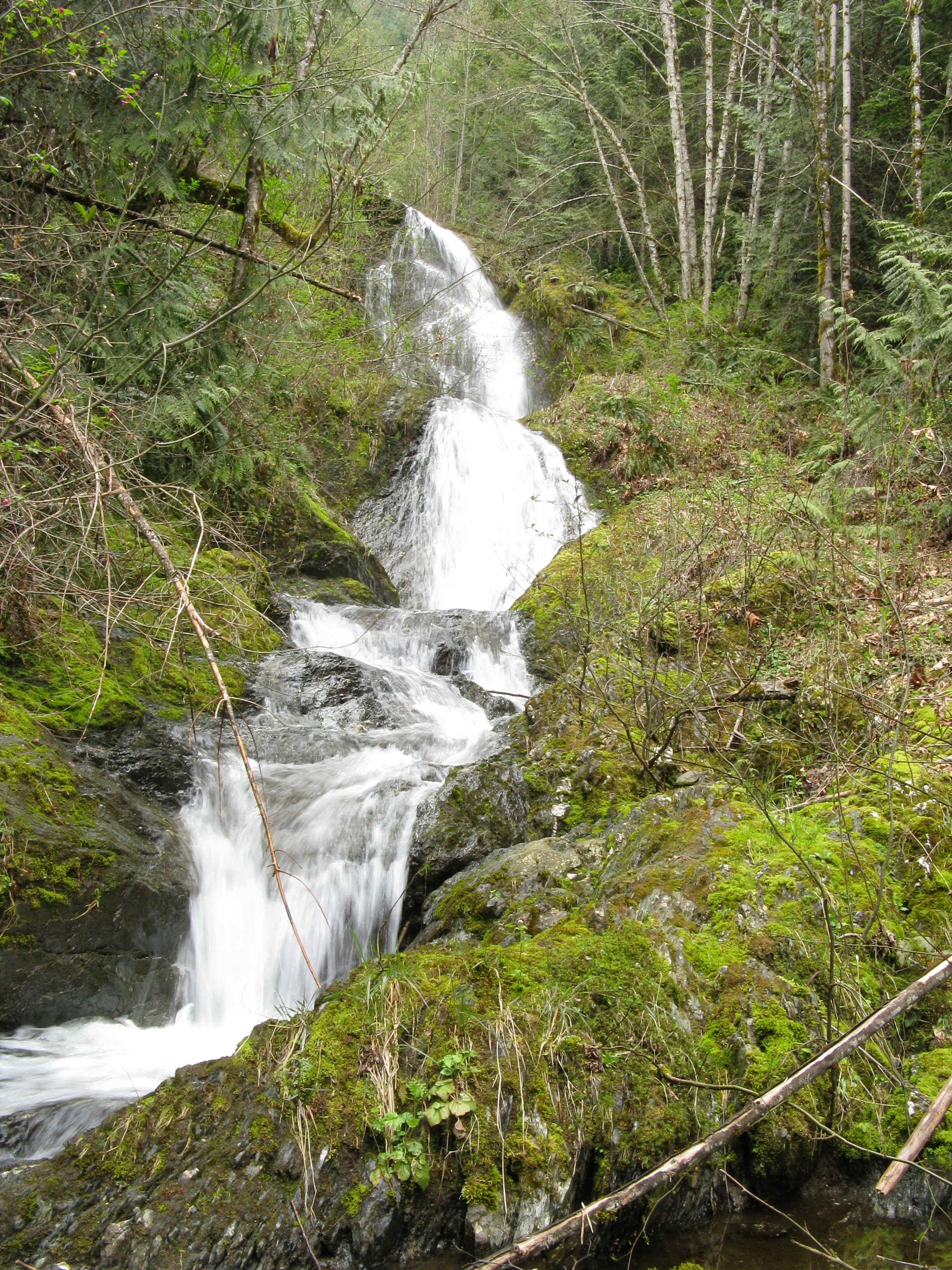
 |
|
HOME SKAGIT COUNTY LINKS BEST IN THE NW WATERFALLS FOR KIDS FLICKR FACEBOOK STORE |
|