![]()
MIDDLE BLUE LAKE FALLS |
|
|
RATING - 28.0
VR - 4 (Med/Sm) HR - 5.5 SR - 6/20 TYPE OF APPROACH - Bushwhack DIFFICULTY - Very Difficult LOCATION - Baker Lake Road TYPE - Tiered HEIGHT - 124' * WIDTH - 20' GPS - N48 38.446 W121 45.640 ELEVATION - 1656' |
I used to refer to this as Blue Lake Falls but changed the name after confirming that there is a small waterfall directly at the outlet of the lake. Then I found the true lower falls on my most recent trip, so this waterfall has changed its name yet again to Middle Blue Lake Falls. |
| DIRECTIONS - Drive out Baker Lake Road for about 9 miles and park in the pullout just over Bear Creek. Cross the road and start walking up the gated road on the north side of the road. Continue straight at the fork in the road (instead of going over the bridge on the left). At this point the road starts to climb, giving you some nice views. At about 1600' elevation the road switches back to the left. Leave the road here and head into the trees. The creek and falls are about 600' ahead of you but you'll have to do some tricky side hilling to get there; try to stay at the same elevation that you left the road. Total distance from the car to the switchback is around 2 miles. | |
VIDEO AND OTHER PICTURES (CLICK TO ENLARGE)
|
|
| HOME SKAGIT COUNTY LINKS BEST IN THE NW WATERFALLS FOR KIDS FLICKR FACEBOOK STORE | |
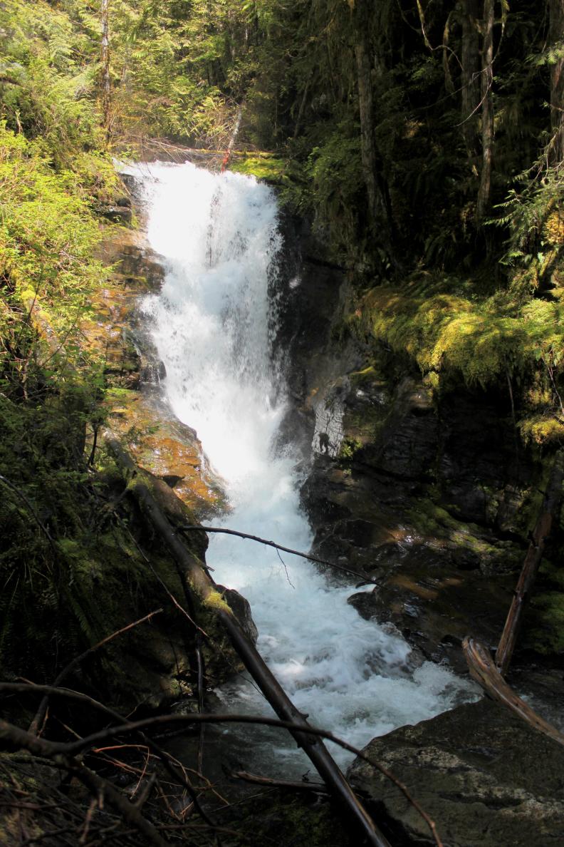
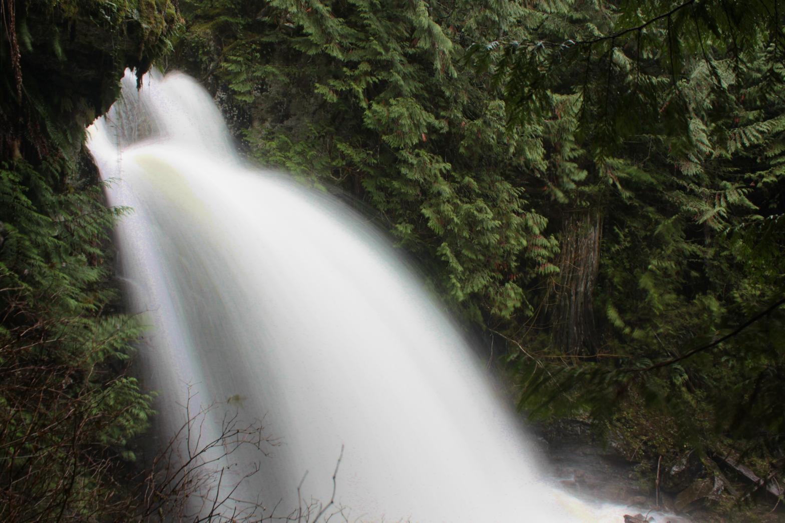
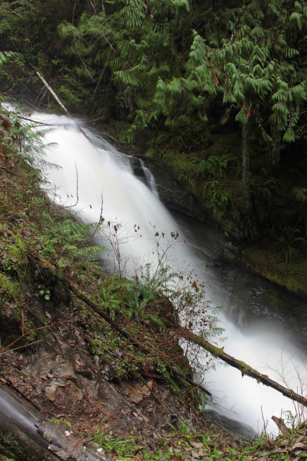
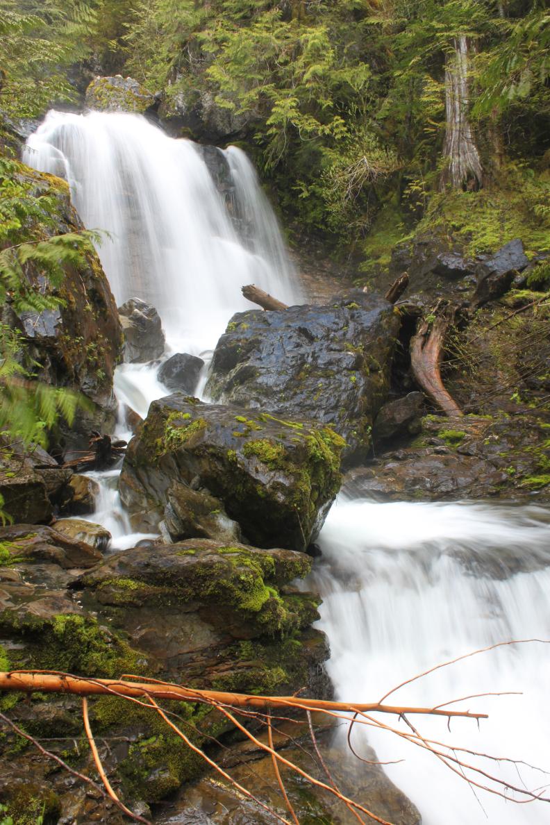 The
creek that drains out of Blue Lake runs over two difficult to
access waterfalls about halfway between the lake and the convergence with
Bear Creek. This is the better and upper of the two falls and consists
of three tiers. The upper tier is a 47' plunging drop hidden in a
tight portion of the canyon that is a little difficult to see. The
next section is a 45' tall, 25' wide curtain of water that is the best of
the three. After a couple short cascades the creek rolls down the 32'
tall bottom tier which begins nearly vertically and gradually flattens out
as it drops. The difficult
trip as well as the modest size of the falls makes this one probably not
worth the effort except for extremely dedicated waterfall hunters.
I've been to the falls twice. My most recent trip was during extremely
high volume and while the waterfall was really impressive, it made
photography difficult. During normal flow this is a really pretty
spot.
The
creek that drains out of Blue Lake runs over two difficult to
access waterfalls about halfway between the lake and the convergence with
Bear Creek. This is the better and upper of the two falls and consists
of three tiers. The upper tier is a 47' plunging drop hidden in a
tight portion of the canyon that is a little difficult to see. The
next section is a 45' tall, 25' wide curtain of water that is the best of
the three. After a couple short cascades the creek rolls down the 32'
tall bottom tier which begins nearly vertically and gradually flattens out
as it drops. The difficult
trip as well as the modest size of the falls makes this one probably not
worth the effort except for extremely dedicated waterfall hunters.
I've been to the falls twice. My most recent trip was during extremely
high volume and while the waterfall was really impressive, it made
photography difficult. During normal flow this is a really pretty
spot.