![]()
MIDDLE FURLAND FALLS |
|
|
RATING -
30.0
VR - 4 (Med/Sm) HR - 4.0 SR - 14/20 TYPE OF APPROACH - Trail + Bushwhack DIFFICULTY - Fairly Difficult LOCATION - Darrington area TYPE - Tiered HEIGHT - 80' WIDTH - 15' GPS - N48 14.702 W121 42.376 ELEVATION - 1212' |
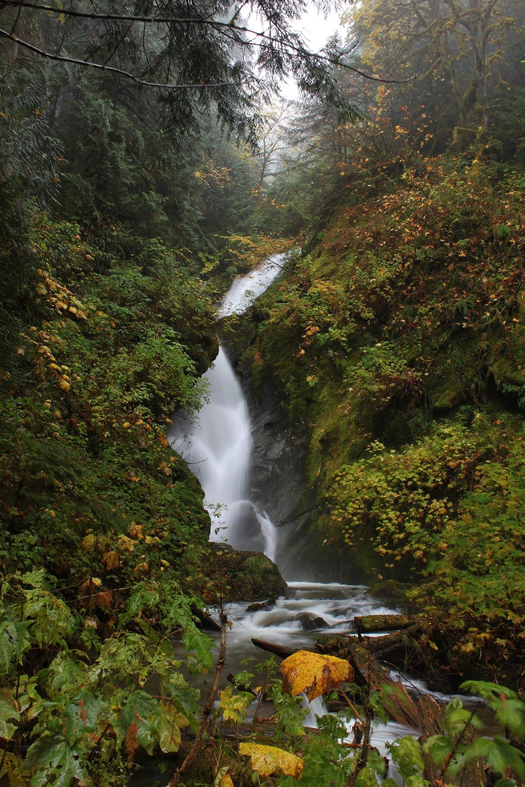 Middle
Furland Falls is a gorgeous, 2-tiered waterfall, dropping 35' in a wide
curtain before turning 90 degrees to the left and plunging another 45'.
On my visit to the falls, the creek was running very high, which is both a
blessing and a curse. It is probably possible to get up closer by
fording the creek, but it was a little too high for my tastes on this trip.
As you can see, the falls look particularly nice in autumn when the devils
club around the creek turns yellow and the big maple on the top right dumps
its leaves. Middle
Furland Falls is a gorgeous, 2-tiered waterfall, dropping 35' in a wide
curtain before turning 90 degrees to the left and plunging another 45'.
On my visit to the falls, the creek was running very high, which is both a
blessing and a curse. It is probably possible to get up closer by
fording the creek, but it was a little too high for my tastes on this trip.
As you can see, the falls look particularly nice in autumn when the devils
club around the creek turns yellow and the big maple on the top right dumps
its leaves. |
|
DIRECTIONS - From Lower Furland Falls,
continue upstream for a couple hundred feet to a view of the falls.
The canyon gets steeper and, as a result, more difficult as you progress
further upstream. You'll have to do some fairly steep side-hilling
around the creek to get a good view of this one. NEARBY WATERFALLS - Furland Falls, Lower Furland Falls, Snow Gulch Falls |
|
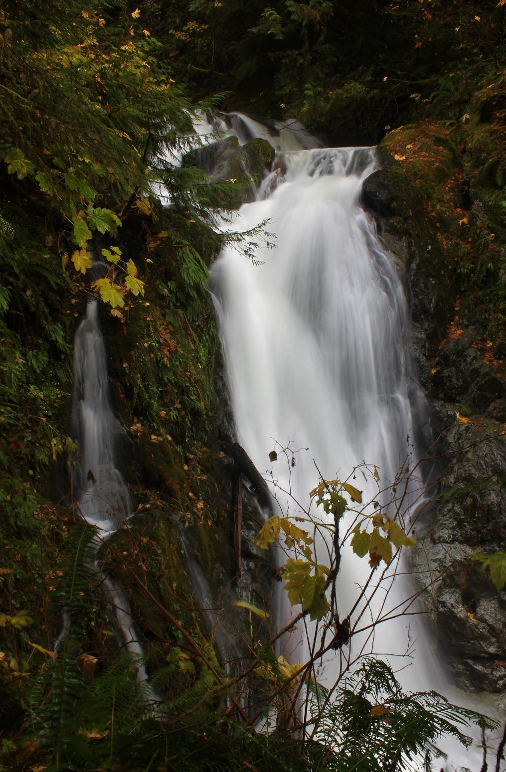
ADDITIONAL
PICTURES (CLICK TO ENLARGE) AND VIDEO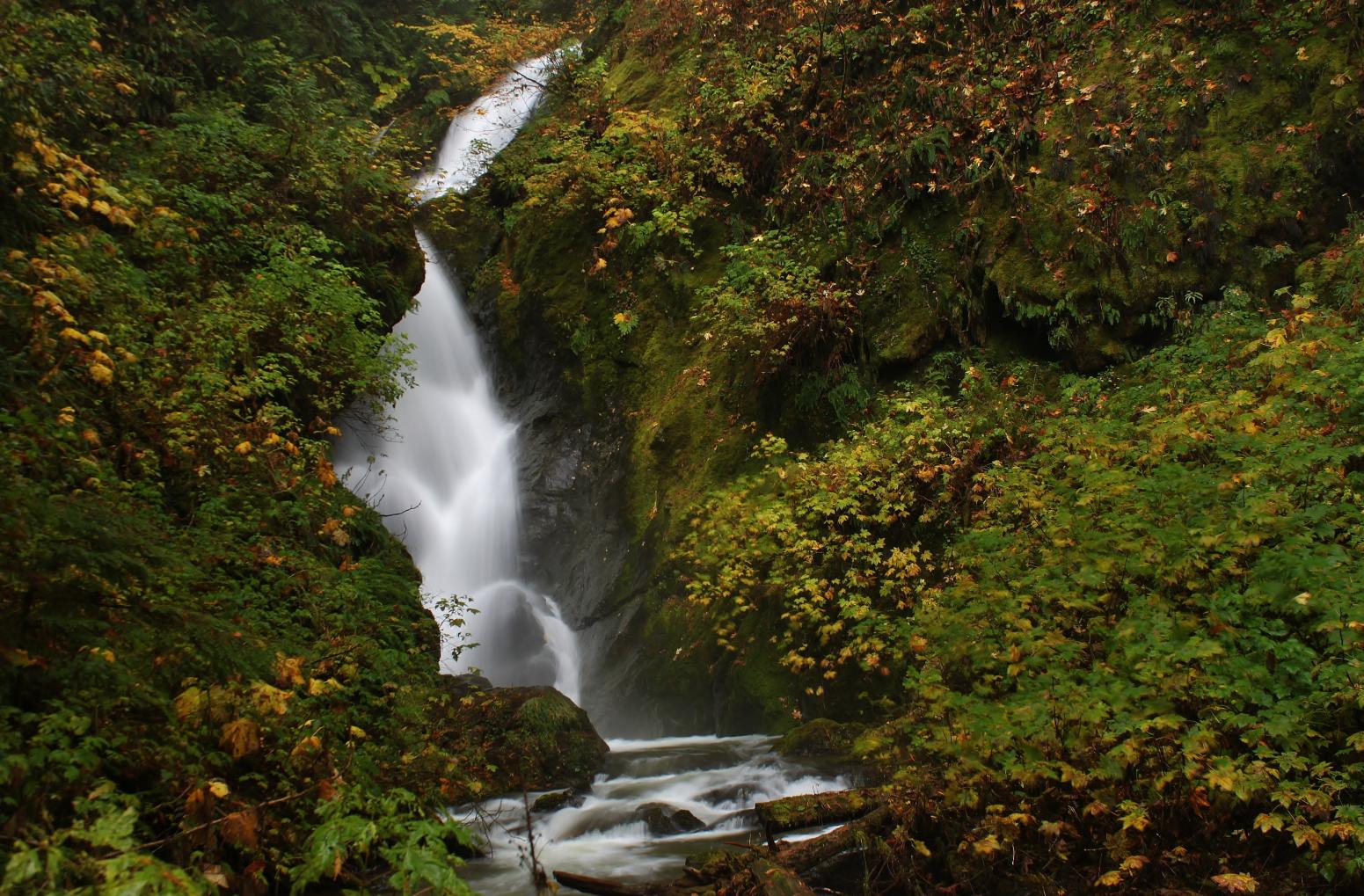
|
|
HOME SNOHOMISH COUNTY LINKS BEST IN THE NW WATERFALLS FOR KIDS FLICKR FACEBOOK STORE |
|