|
RATING - 51.6
|
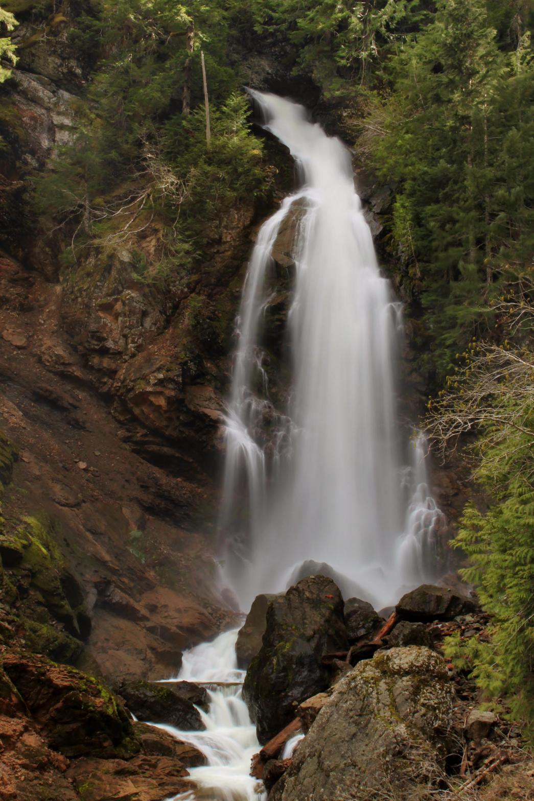 Monument
Falls is a very impressive waterfall located in the midst of a burly, bad,
rugged canyon south of Mt. Baker. This unnamed, though large volume
creek drops a total of 132' in a powerful fashion. The falls begin
with a sliding 44' tall drop before launching outwards and plunging 88'.
The waterfall is 25' wide at the bottom as well. In addition, there is
a small bonus waterfall to the right of the main drop when the creek is
running high. I suspect there may be another tier above and around the
corner but I couldn't figure out how to get a view of it. The canyon
around the falls is almost vertical cliff walls rising hundreds of feet
above the creek. On my trip to the falls I had several mountain goats
kicking rocks down at me from high above (I'm assuming it was an accident).
Just downstream is an enormous rockslide where the side of the mountain fell
off in gigantic boulders, many the size of houses. The slide is nearly
as impressive as the waterfall. Monument
Falls is a very impressive waterfall located in the midst of a burly, bad,
rugged canyon south of Mt. Baker. This unnamed, though large volume
creek drops a total of 132' in a powerful fashion. The falls begin
with a sliding 44' tall drop before launching outwards and plunging 88'.
The waterfall is 25' wide at the bottom as well. In addition, there is
a small bonus waterfall to the right of the main drop when the creek is
running high. I suspect there may be another tier above and around the
corner but I couldn't figure out how to get a view of it. The canyon
around the falls is almost vertical cliff walls rising hundreds of feet
above the creek. On my trip to the falls I had several mountain goats
kicking rocks down at me from high above (I'm assuming it was an accident).
Just downstream is an enormous rockslide where the side of the mountain fell
off in gigantic boulders, many the size of houses. The slide is nearly
as impressive as the waterfall.As great of a waterfall as this is, it is extremely difficult to get to. The climb down from the road is steep and brushy, then you have to ford a fairly large volume Winlick Creek. Once you find the correct creek, there are very nice game trails leading up the creek for most of the journey. You'll have to ford Monument Creek several times along the way and then climb over a small lower falls at the site of the landslide. It's all quite enjoyable, but very difficult and very tiring as well. Later in the year the trip will probably be easier as the creeks will be much lower and easier to ford, but the waterfall will be less impressive as well. |
OTHER PICTURES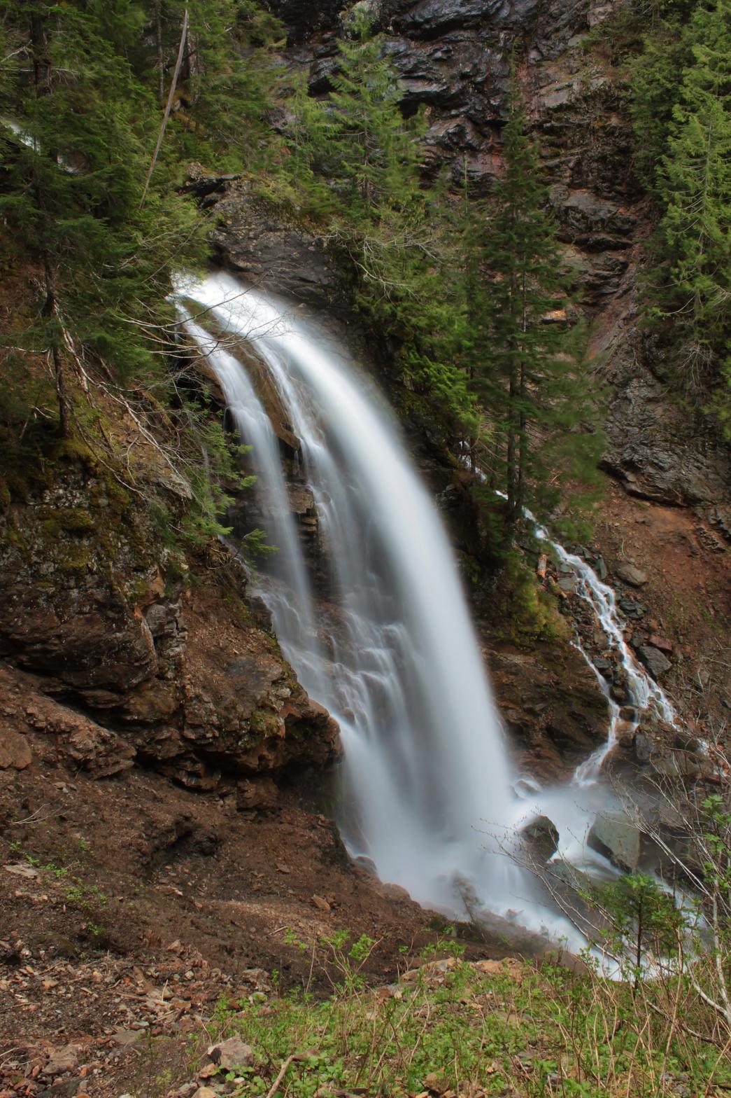 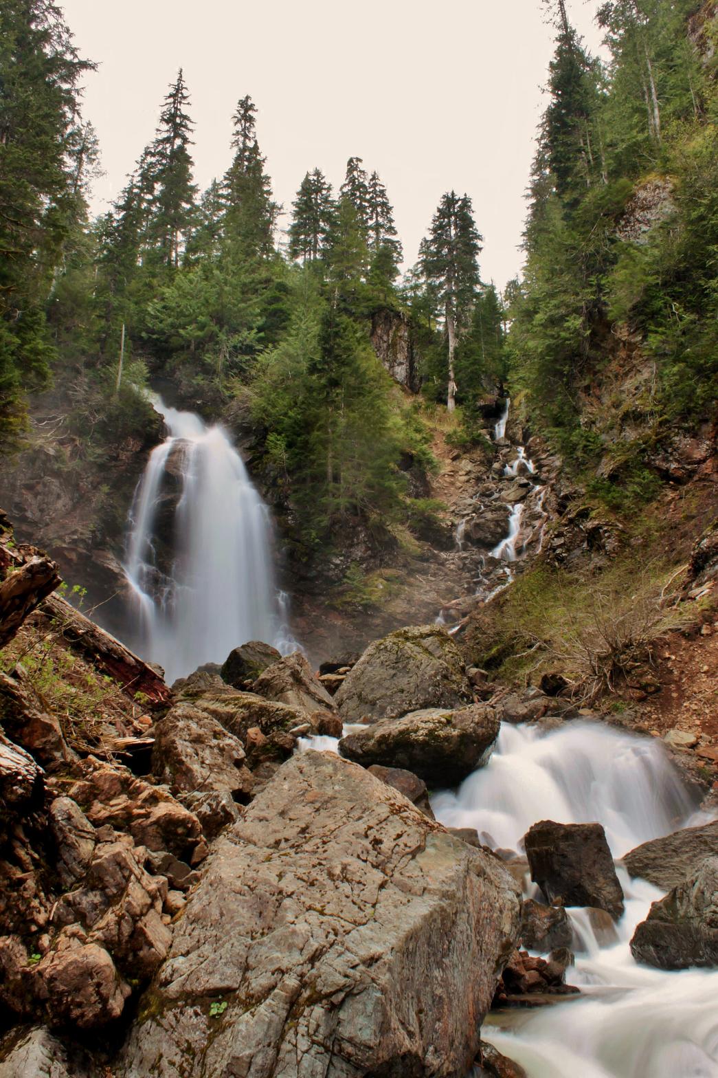 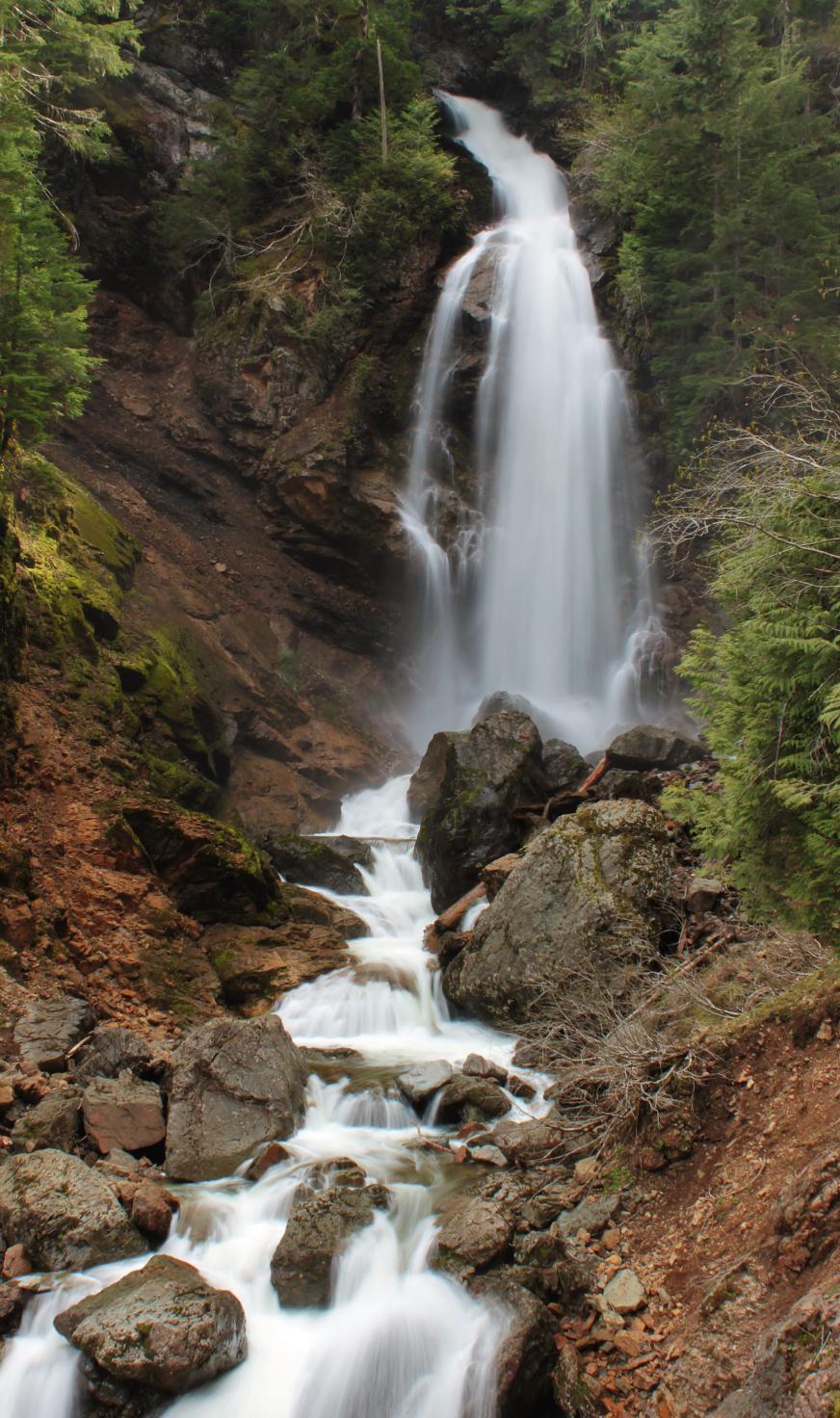 |
|
VR - 5.6 (Medium) HR - 6.0 SR - 18/20 TYPE OF APPROACH - Bushwhack DIFFICULTY - Extremely Difficult LOCATION - South Fork Nooksack TYPE - Tiered HEIGHT - 132' * WIDTH - 25' |
||
| DIRECTIONS - You will probably want a GPS or good map-reading skills for this one. Drive out Baker Lake Road for about 10 miles and turn right onto FR 12. At the first fork stay straight and take a right at the pass when the road splits again (the left goes up to Blue Lake). In a little over a mile the road goes over Loomis Creek. In another mile or so, leave the road and scramble down the steep hill to Wanlick Creek. Cross it, and find the unnamed creek on the other side. Follow the creek upstream for a little over a mile to the falls. |