![]()
SHOLES GLACIER FALLS |
|
|
RATING -
24.0
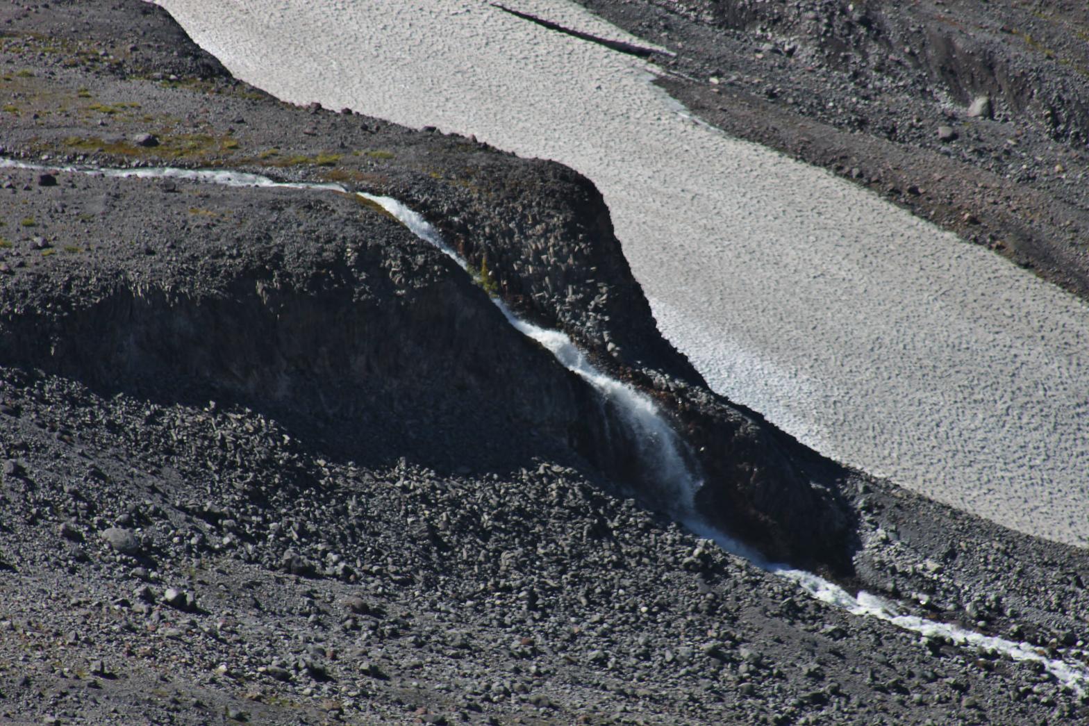
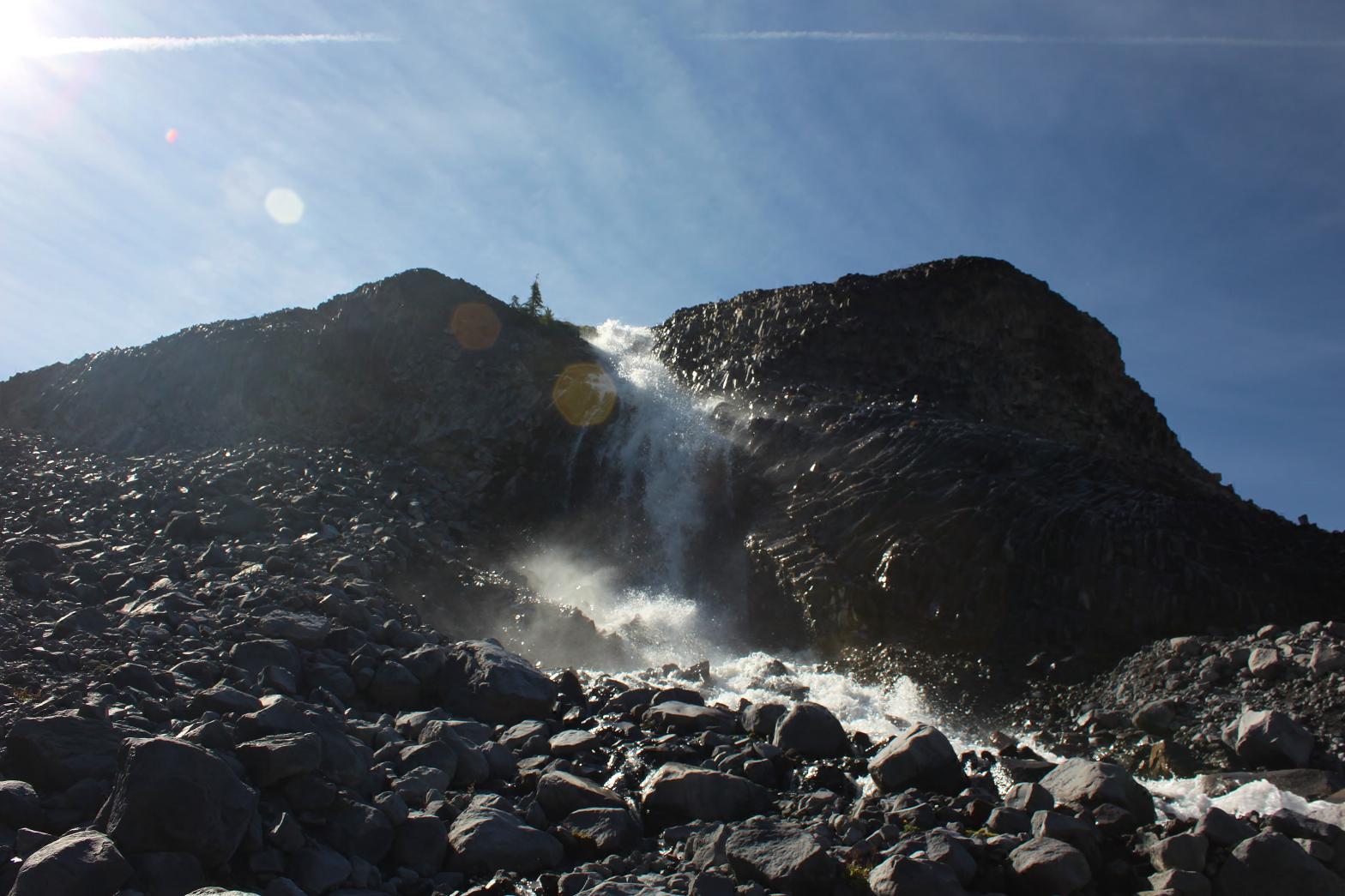
VR - 4.0 (Med/Sm) HR - 4.0 SR - 8/20 TYPE OF APPROACH - Trail DIFFICULTY - Fairly Difficult LOCATION - Ptarmigan Ridge TYPE - Horsetail HEIGHT - 60' WIDTH - 5' GPS - N48 49' 15.16" W121 45' 55.67 ELEVATION - 5290' |
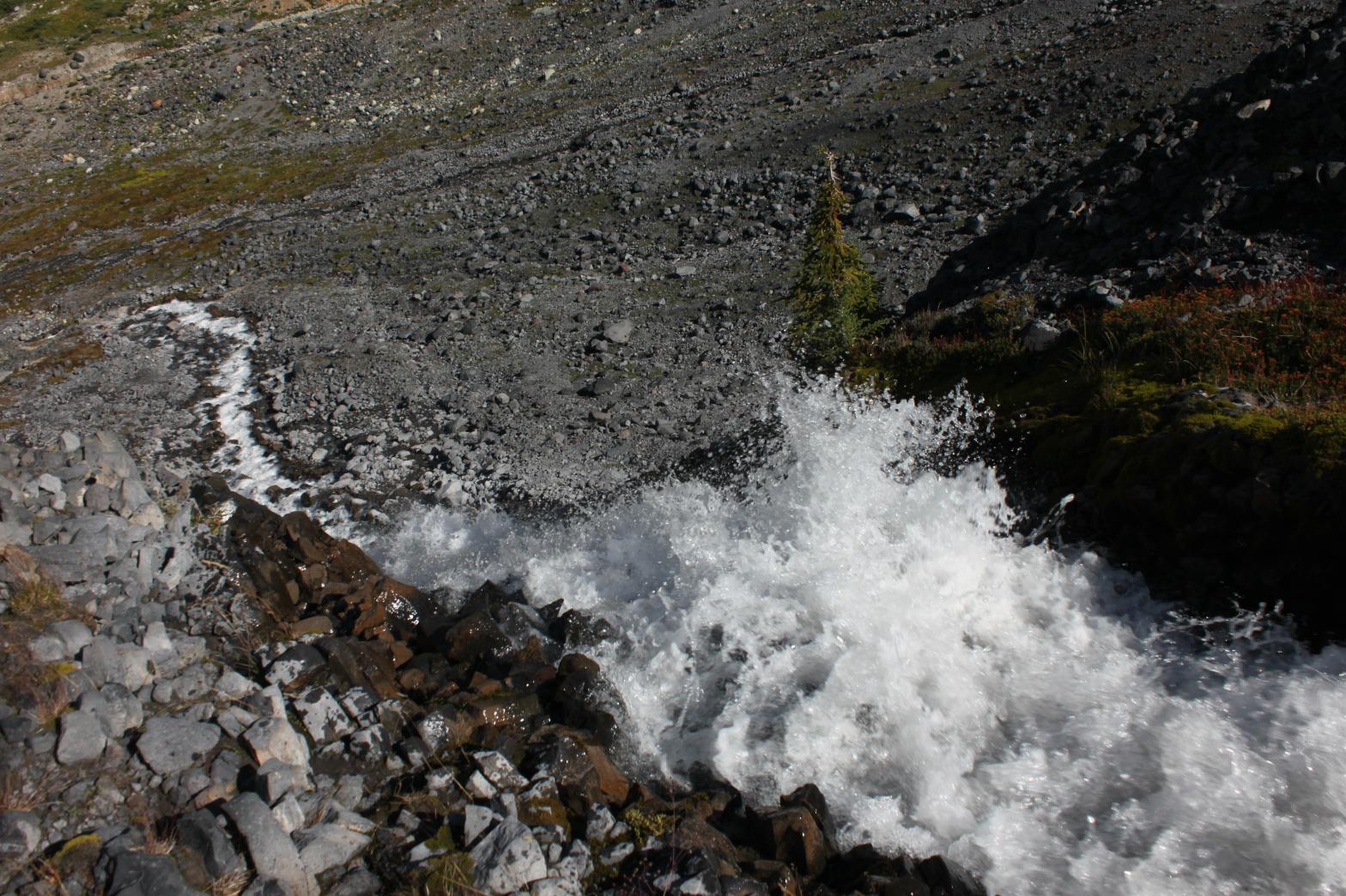
Sholes Creek begins its life at the toe of the Sholes Glacier and flows northwest to join Bar Creek. Along its route, there are at least four major waterfalls. The first of these is Sholes Glacier Falls. Just downstream from the glacier, Sholes Creek encounters a bedrock shelf and drops 60' in two steps. The cliff itself is an amazing basalt formation that can only be appreciated from upclose. The waterfall is located in the barren wasteland left over from the retreating glacier. The waterfall can be viewed from just off the Ptarmigan Ridge Trail near Camp Kiser. An upclose view is possible by scrambling down the loose rocks to the falls. |
| DIRECTIONS -
Drive to Artists Point at the end of the Mt. Baker Highway and take the
Ptarmigan Ridge Trail. In 4.5 miles, the trail will travel along
the south side of Coleman Pinnacle and then climb up to the top of the ridge
above the Sholes Creek Valley. Sholes Glacier Falls can be seen by
looking northwest from the top of the ridge. NEARBY WATERFALLS - 22 Goat Lake Falls, Avalanche Gorge Falls, Bar Divide Falls, Rainbow Glacier Falls, Upper Bar Divide Falls, Upper Sholes Creek Falls |
|
ADDITIONAL PICTURES (CLICK TO ENLARGE) AND
VIDEO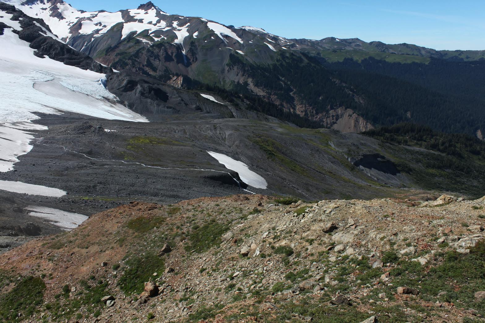
 |
|
HOME WHATCOM COUNTY LINKS BEST IN THE NW WATERFALLS FOR KIDS FLICKR FACEBOOK STORE |
|