![]()
UPPER STANDARD FALLS |
|
|
RATING -
24.2
VR - 3.6 (Med/Sm) HR - 4.5 SR - 8/20 TYPE OF APPROACH - Bushwhack DIFFICULTY - Very Difficult LOCATION - Van Zandt Area TYPE - Tiered HEIGHT - 80' WIDTH - 10' |
|
| DIRECTIONS - Follow
the directions to Standard Falls. The Middle Falls
is about 1/8 of a mile upstream. The Upper Falls are another 1/8 of a mile past
this. Getting a good view will require climbing down the steep, very deep canyon.
Keep your eyes on the creek below as you hike up the top of the ridge and you
should see a way down once you spot the falls. Be careful! NEARBY WATERFALLS - Hard Scrabble Falls, Middle Standard Falls, Potter Falls, Standard Falls, Sygitowicz Falls, Tinling Falls, Van Zandt Falls |
|
ADDITIONAL PICTURES (CLICK TO ENLARGE)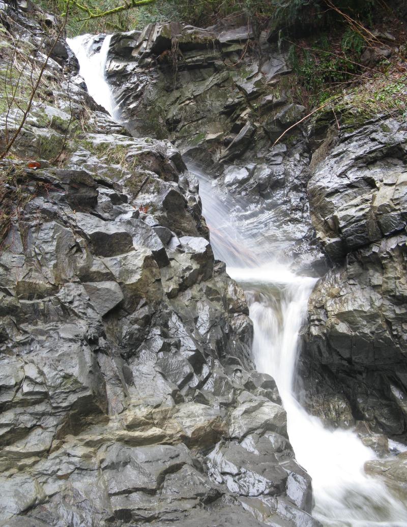
 |
|
HOME WHATCOM COUNTY LINKS BEST IN THE NW WATERFALLS FOR KIDS FLICKR FACEBOOK STORE |
|
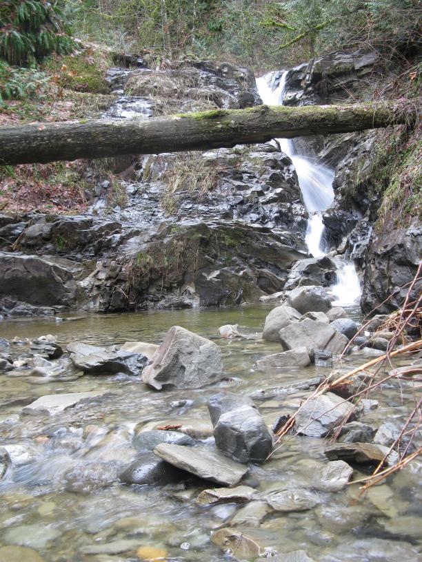
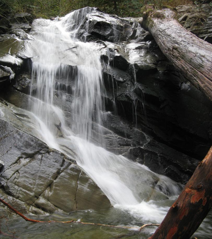
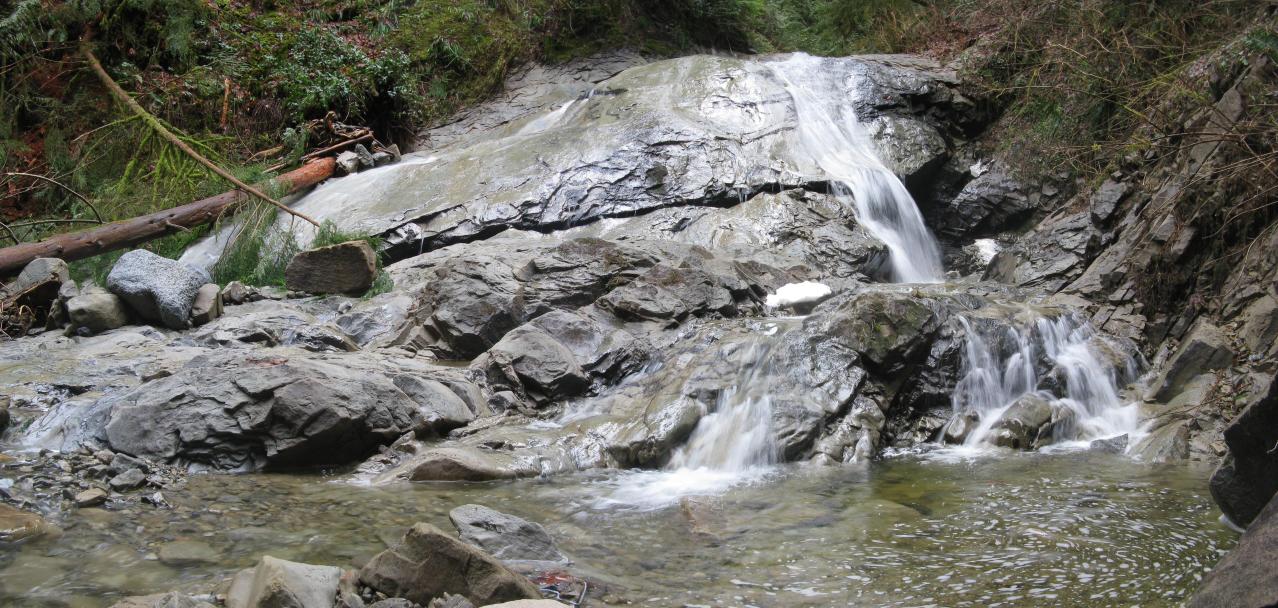
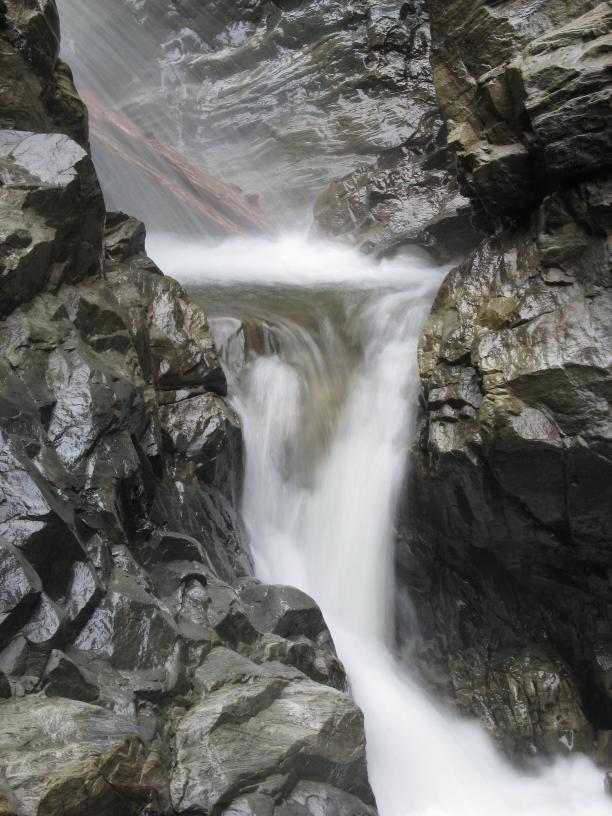 The Upper Falls on
Standard Creek is a little difficult to describe. There are three main drops around
25-30' tall each. In addition to these there are many smaller drops in the 5' tall
range. The bottom of the three main tiers drops about 25' through a narrow crack in
the rock. The middle tier is about 20' tall and is choked with a massive amount of
logs making it difficult to get a good view of. The upper of the three main drops
falls about 25' over a dome shaped rock similar to
The Upper Falls on
Standard Creek is a little difficult to describe. There are three main drops around
25-30' tall each. In addition to these there are many smaller drops in the 5' tall
range. The bottom of the three main tiers drops about 25' through a narrow crack in
the rock. The middle tier is about 20' tall and is choked with a massive amount of
logs making it difficult to get a good view of. The upper of the three main drops
falls about 25' over a dome shaped rock similar to