| DIRECTIONS - Follow the directions to Brownie Falls. From there, continue another half mile or so to Jennings Creek. The lower tier is visible from the road. You can get better views by climbing up the creek. To view the upper tier, head up the bank on the right side of the creek, staying at the top of the little canyon. Eventually you should see a way to work down to the creek right above the lower tier for a somewhat clear view. | |
| LOCATION - Randle/Packwood area TYPE - Tiered HEIGHT - 140' WIDTH - 5' |
RATING -  TYPE OF APPROACH - Roadside or Bushwhack DIFFICULTY - Very Easy or Medium |
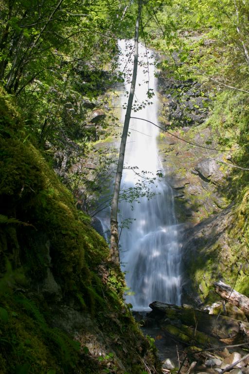
| NEARBY WATERFALLS - Brownie Falls | Jennings Creek drops over a fairly impressive little waterfall on its way to joining Johnson Creek. The first tier is a plunge of around 80'. Below this the creek runs along for about 100' before dropping over a cascading/horsetailing drop around 40' tall. The lower tier can be seen from the road. Better views are available by climbing up the creek. The upper tier is difficult to view but is by far the better of the two sections. |
|
Left and above - Upper tier of Jennings Falls |
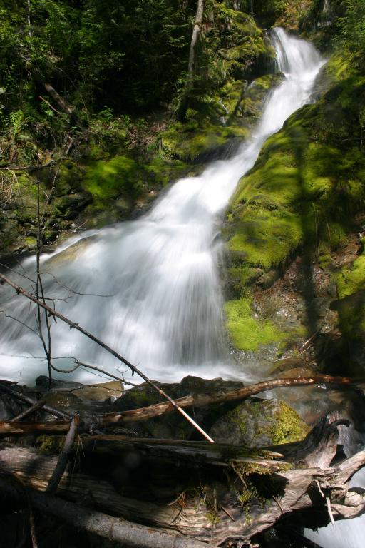 |
Left and Above - Lower tier of Jennings Falls |