![]()
ANDERSON FALLS |
|
|
RATING -
46.4
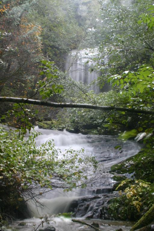
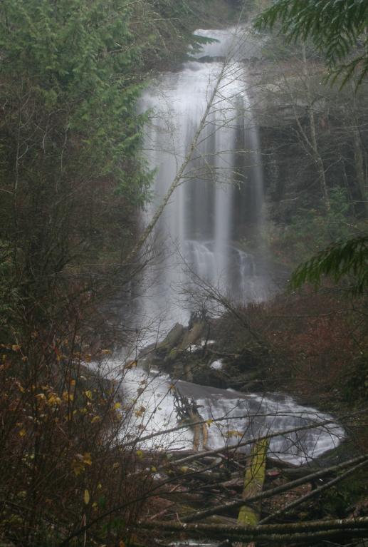
VR - 5.4 (Med) HR - 6 SR - 14/20 TYPE OF APPROACH - Road walk + Bushwhack DIFFICULTY - Fairly Difficult LOCATION - Bellingham Area TYPE - Tiered HEIGHT - 145' WIDTH - 30' GPS - N48 47.701 W122 17.429 ELEVATION - 1808' |
 A
few miles east of Bellingham, along the Mount Baker Highway, lies the very nice Anderson
Falls. The falls are located about 300' up the creek from the road and the trip up
the creek is fairly easy . . . with one exception. Sierra Pacific has the road
closed off by a gate so a walk of 3 3/4 miles is required to get to the creek. The
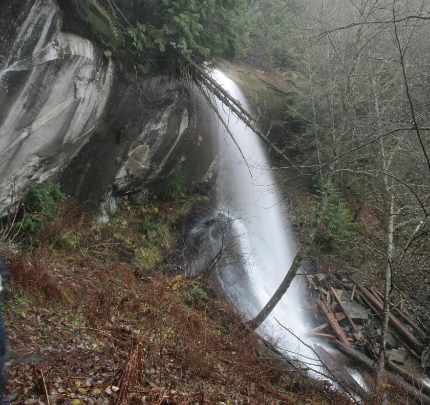
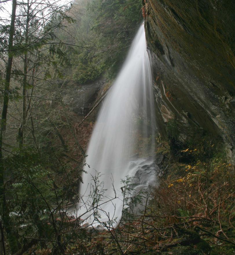
bottom tier is a really nice slide of about 40' tall. Above this is a big logjam
where the 60-65' tall curtain drops into. The unseen portion of the falls seems to
be another slide of about 30' directly above the main drop and another plunge of around
40' above that but it is very difficult to see through the trees. Part of the logjam
at the base of the curtain has washed down and stuck itself halfway down the slide at the
bottom, basically destroying the gorgeous look of that part of the falls. A
few miles east of Bellingham, along the Mount Baker Highway, lies the very nice Anderson
Falls. The falls are located about 300' up the creek from the road and the trip up
the creek is fairly easy . . . with one exception. Sierra Pacific has the road
closed off by a gate so a walk of 3 3/4 miles is required to get to the creek. The
bottom tier is a really nice slide of about 40' tall. Above this is a big logjam
where the 60-65' tall curtain drops into. The unseen portion of the falls seems to
be another slide of about 30' directly above the main drop and another plunge of around
40' above that but it is very difficult to see through the trees. Part of the logjam
at the base of the curtain has washed down and stuck itself halfway down the slide at the
bottom, basically destroying the gorgeous look of that part of the falls.
|
| DIRECTIONS - Take the Mt Baker Highway east from Bellingham and turn right onto Y Road. At the second turn in the road you will see a gated logging road heading off to the left. Park somewhere and walk/bike up the road for 3.75 miles (take the right at the major fork) until the road crosses Anderson Creek. Make your way upstream a few hundred feet to the falls. Part of the road crosses over private property and the land owner told us he doesn't really want people crossing his land but he still let us go up. Go at your own risk I guess but make sure you are respectful if you do. | |
|
ADDITIONAL PICTURES (CLICK TO ENLARGE) AND VIDEO
 |
|
HOME WHATCOM COUNTY LINKS BEST IN THE NW WATERFALLS FOR KIDS FLICKR FACEBOOK STORE |
|