![]()
BUCKEYE BASIN FALLS |
|
|
RATING - 16.4
VR - 1.8 (Small) HR - 8 SR - 2/20 TYPE OF APPROACH - Roadside DIFFICULTY - Very Easy LOCATION - Darrington area TYPE - Horsetail HEIGHT - 400' WIDTH - 5' GPS - N48 12' 43.16" W121 39' 10.20" ELEVATION - 2800' |
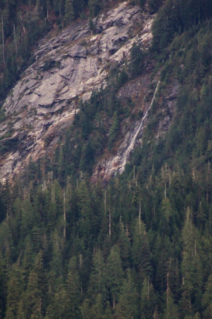
Buckeye Basin is located on the northeast side of Whitehorse Mountain.
Inside the basin, a series of small streams flow off the mountain over
fairly tall waterfalls. From the town of Darrington, one of these
falls is clearly visible when it is flowing well. Once all the streams
combine, they form Buckeye Creek which flows over its own waterfall as it
leaves the basin. This falls, as well as the basin, should be
reachable via a roadwalk/bike ride and then a relatively lengthy bushwhack.
I plan on viewing both of these waterfalls up close next spring and you can
then expect the rating to go way up. The 400' height is a very rough
estimate based on the Topo maps and aerial imagery.
|
| DIRECTIONS - Drive into the town of Darrington and turn south on the Mountain Loop Highway. This waterfall can be seen by looking south into Buckeye Basin. The best view is from around the Old School Park in the middle of town. It should be possible to get into the basin itself for a close up view, but I haven't done so yet. | |
HOME SNOHOMISH COUNTY LINKS BEST IN THE NW WATERFALLS FOR KIDS FLICKR FACEBOOK STORE |
|