![]()
CLEARWATER FALLS |
|
|
RATING -
60.0
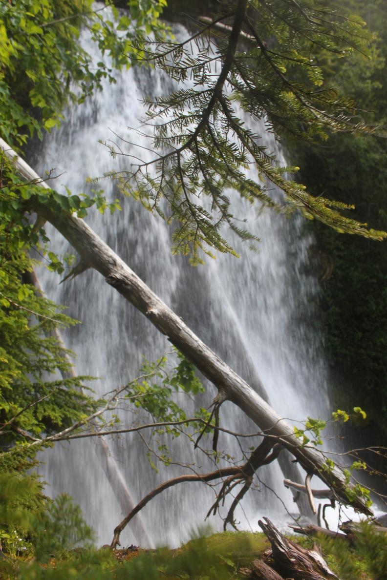
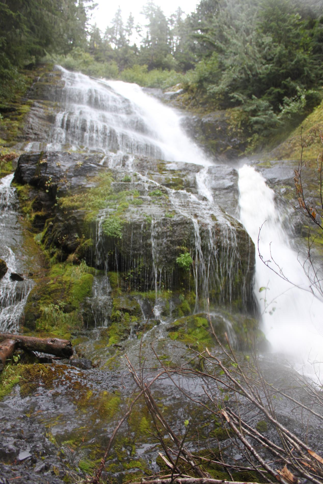
VR - 6 (Med) HR - 8 SR - 12/20 TYPE - Tiered HEIGHT - 436' WIDTH - 30' TYPE OF APPROACH - Bushwhack DIFFICULTY - Very Difficult LOCATION - Glacier Creek Road COORDINATES - N48 47.888 W121 55.855 ELEVATION - 3936' |
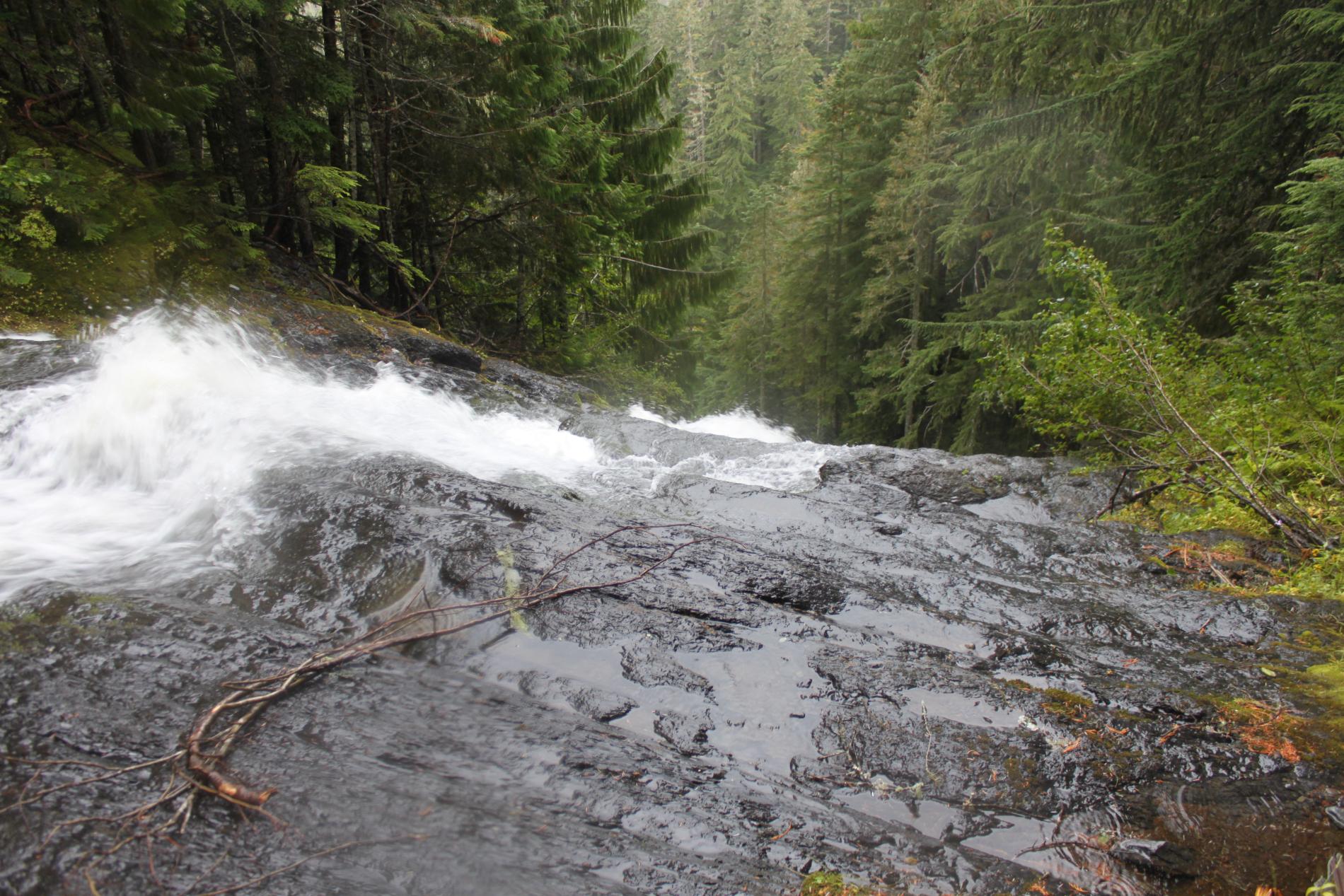
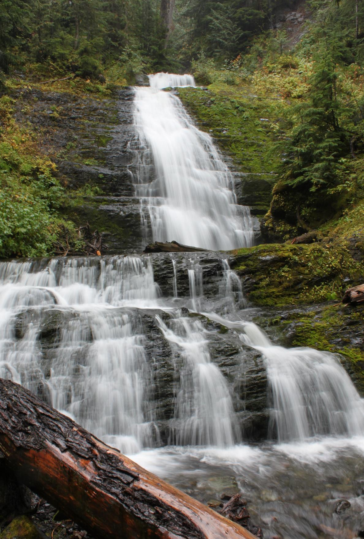 Clearwater
Falls is one of the most impressive waterfalls in the Baker area, dropping
over 400' down a massive cliff on the west side of the mountain. The stream
begins high on Grouse Ridge, meanders along, and then drops off the side of
the cliff. The falls begin with a pretty little 10' drop that is followed
almost immediately by a 35' tall, 15' wide plunge. Below that, the creek
zigzags down the mountain in a series of tiers of about 90', 80', 150', and
50'. From the base of the falls, the 50' lower section (pictured on the
right) can be clearly seen. Through-the-trees views showing most of the
waterfall can also be had, but from no place is the entire waterfall
visible. It may be possible to get a view of most of the biggest section
from the south side of the creek, but that's just speculation. It is also
possible to get a good view of the 80' tall 4th tier from directly atop the
150' 5th tier. Clearwater
Falls is one of the most impressive waterfalls in the Baker area, dropping
over 400' down a massive cliff on the west side of the mountain. The stream
begins high on Grouse Ridge, meanders along, and then drops off the side of
the cliff. The falls begin with a pretty little 10' drop that is followed
almost immediately by a 35' tall, 15' wide plunge. Below that, the creek
zigzags down the mountain in a series of tiers of about 90', 80', 150', and
50'. From the base of the falls, the 50' lower section (pictured on the
right) can be clearly seen. Through-the-trees views showing most of the
waterfall can also be had, but from no place is the entire waterfall
visible. It may be possible to get a view of most of the biggest section
from the south side of the creek, but that's just speculation. It is also
possible to get a good view of the 80' tall 4th tier from directly atop the
150' 5th tier.I used to call this waterfall Grouse Ridge Falls, but I have changed the name after seeing the entire waterfall, which is surely the best waterfall in the Clearwater Creek drainage. |
|
DIRECTIONS - Drive out Mt. Baker Highway and then turn right onto Glacier
Creek Road. Follow the road for around 8 miles and then turn right
onto FR 36 (Grouse Butte Road). Follow this road, climbing high above
the valley. Go left at the first 2 forks and then right at the third.
Follow this new road for 3/4 of a mile to the second right-hand switchback
and park. Head off the road to the east, climbing very steeply into
the canyon. When you reach the first creek, heading downstream until
you reach the bottom of Grouse Butte Falls.
Work your way around the hillside to the south until you see Clearwater
Creek and then scramble uphill to the falls. This is a difficult trip. |
|
MORE PICTURES (CLICK TO ENLARGE) AND VIDEO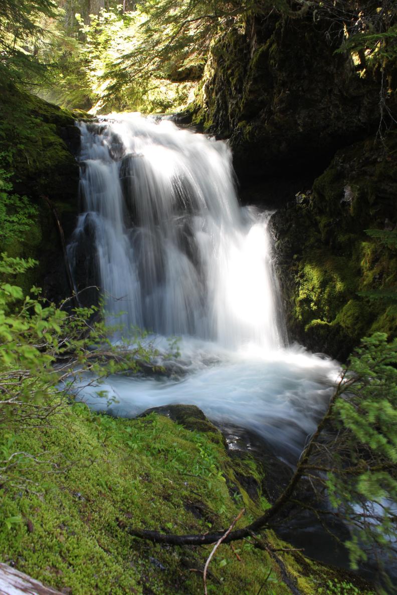
 |
|
HOME WHATCOM COUNTY LINKS BEST IN THE NW WATERFALLS FOR KIDS FLICKR FACEBOOK STORE |
|