![]()
COUGAR CREEK FALLS |
|
|
RATING - 48.0
VR - 6 (Med) HR - 5 SR - 18/20 TYPE OF APPROACH - Trail DIFFICULTY - Fairly Difficult LOCATION - Mountain Loop Highway TYPE - Curtain HEIGHT - 111' WIDTH - 20' GPS - N48 04' 26.71" W121 19' 29.52" ELEVATION - 3052' |
Experienced hikers may scoff at the "fairly difficult" rating I've given this one. I felt that the river crossings and steep trail made this a little too difficult for a medium rating. If you're in remotely decent shape and take your time, you should have no problem making it to the falls. |
|
DIRECTIONS - Drive out the Mountain Loop Highway and turn onto the North
Fork Sauk Road. In about 4 miles, pull off at the Sloan Peak Trail on
the south side and begin hiking up the trail. In 2 difficult miles you
will reach the falls. NEARBY WATERFALLS - Big Cat Falls, Lower Cougar Creek Falls, Middle Cougar Creek Falls |
|
ADDITIONAL PICTURES (CLICK TO ENLARGE) AND
VIDEO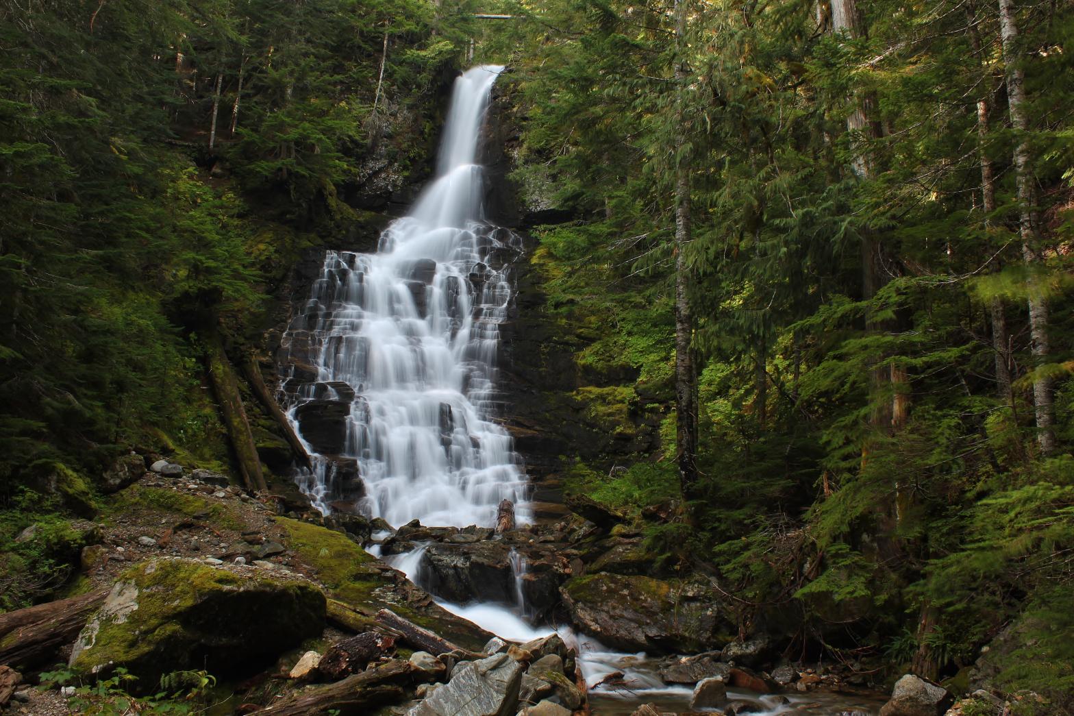
 |
|
HOME SNOHOMISH COUNTY LINKS BEST IN THE NW WATERFALLS FOR KIDS FLICKR FACEBOOK STORE |
|
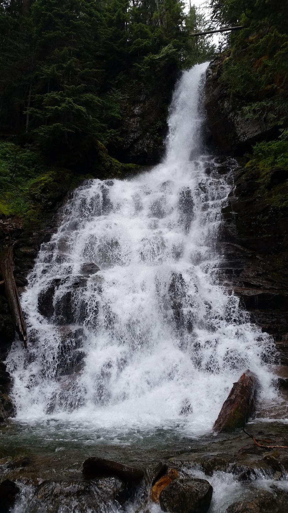
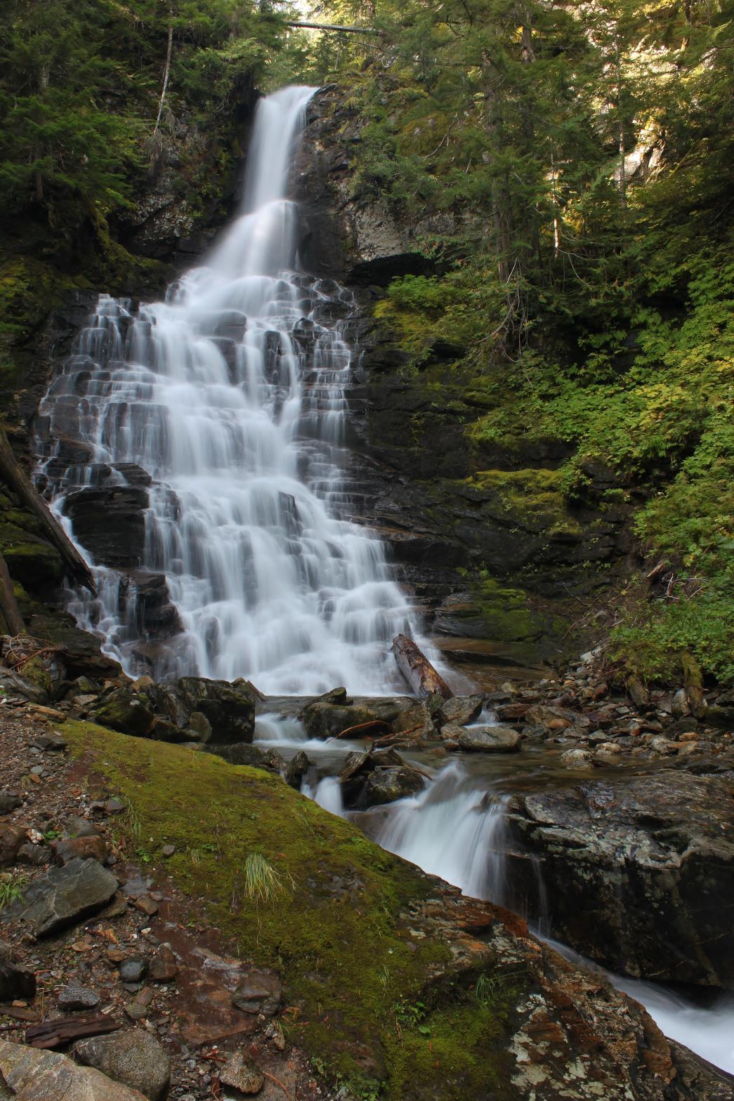 Cougar
Creek Falls is a stunning 111 foot tall waterfall located along the Sloan
Peak Trail. The falls begin with a freefalling plunge that strikes the
cliff face partway down and skips its way down in a myriad of directions and
shapes. The area around the falls is gorgeous as well with lovely moss
and greenery, combined with large trees that provide both shade and
additional beauty to the scene. This waterfall, combined with two more
just downstream, make Cougar Creek one of the premier destinations along the
Mountain Loop for waterfall lovers.
Cougar
Creek Falls is a stunning 111 foot tall waterfall located along the Sloan
Peak Trail. The falls begin with a freefalling plunge that strikes the
cliff face partway down and skips its way down in a myriad of directions and
shapes. The area around the falls is gorgeous as well with lovely moss
and greenery, combined with large trees that provide both shade and
additional beauty to the scene. This waterfall, combined with two more
just downstream, make Cougar Creek one of the premier destinations along the
Mountain Loop for waterfall lovers.