![]()
COUNTY LINE FALLS |
|
|
RATING -
28.0
VR - 6 (Med) HR - 2 SR - 16/20 TYPE OF APPROACH - Bushwhack DIFFICULTY - Very Difficult LOCATION - Baker Lake Area TYPE - Plunge HEIGHT - 35' WIDTH - 10' GPS - N48 38.746 W121 43.635 ELEVATION - 915' |
 This small, but very
pretty waterfall occurs on Rocky Creek just downstream from where Baker Lake Road crosses
over the creek. It can be seen through the trees from just off the road.
Getting up close views requires a short but very steep climb down the hillside.
The pool at the base of the falls is a beautiful green color and would be a nice
spot to cool off in the summer time. I named this one County Line Falls because of
its close proximity to the boundary between Whatcom and Skagit Counties. I believe there
may be at least one more waterfall a short distance downstream from this
one, but the canyon is very steep and deep and I haven't had the chance to
fully explore it. This small, but very
pretty waterfall occurs on Rocky Creek just downstream from where Baker Lake Road crosses
over the creek. It can be seen through the trees from just off the road.
Getting up close views requires a short but very steep climb down the hillside.
The pool at the base of the falls is a beautiful green color and would be a nice
spot to cool off in the summer time. I named this one County Line Falls because of
its close proximity to the boundary between Whatcom and Skagit Counties. I believe there
may be at least one more waterfall a short distance downstream from this
one, but the canyon is very steep and deep and I haven't had the chance to
fully explore it. |
| DIRECTIONS - Follow Baker Lake Road for around 12 miles until the county line and pull off at a gated road on the left shortly before the bridge over Rocky Creek. Cross the road and enter the woods just north of an old clear cut (there may be blue ribbons on the trees). Walk through the woods to the edge of the canyon and look for the falls (you might have to move up or downstream for a clear view). For those who don't mind a very steep scramble down the canyon wall will eventually provide you with a clear view of the falls. | |
OTHER PICTURES (CLICK TO ENLARGE) AND VIDEO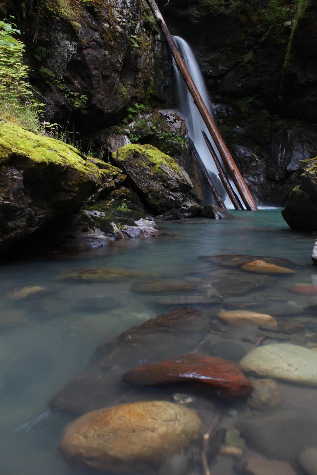

|
|
HOME WHATCOM COUNTY LINKS BEST IN THE NW WATERFALLS FOR KIDS FLICKR FACEBOOK STORE |
|