![]()
JORDAN CREEK FALLS |
|
|
RATING -
88.0
VR - 8 (Big) HR - 9.0 SR - 16/20 TYPE OF APPROACH - Road walk DIFFICULTY - Difficult LOCATION - Marblemount Area TYPE - Tiered HEIGHT - 588' WIDTH - 80' GPS - N48 28.478 W121 23.264 ELEVATION - 2511' |
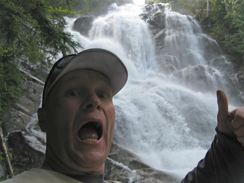
No matter how impressive the pictures may be, they don't come anywhere close to showing this falls. If you possibly can, make the difficult journey into the falls. |
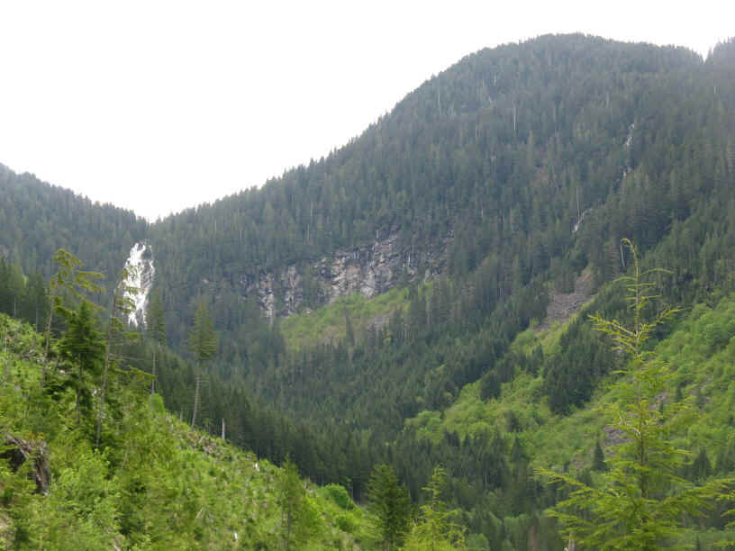
| DIRECTIONS - Drive
up Cascade River Road for about a half a mile and turn right onto Rockport-Cascade
Road. In around a mile the road crosses over Jordan Creek. Park at the turnout
just before the creek and head up the gated logging road on the left side of the
road. About 4 miles into the hike you will get your first view of the falls.
There are 4 forks along the way: right, right, left, left. The final fork
heads up a fairly brushy old logging road. When it ends, head steeply up the hill
into the woods, following pink ribbons. In a couple hundred feet
you'll come out of the trees at the base of the falls. NEARBY WATERFALLS - Falls Lake Falls |
|
|
ADDITIONAL PICTURES (CLICK TO ENLARGE) AND VIDEO
|
|
HOME SKAGIT COUNTY LINKS BEST IN THE NW WATERFALLS FOR KIDS FLICKR FACEBOOK STORE |
|
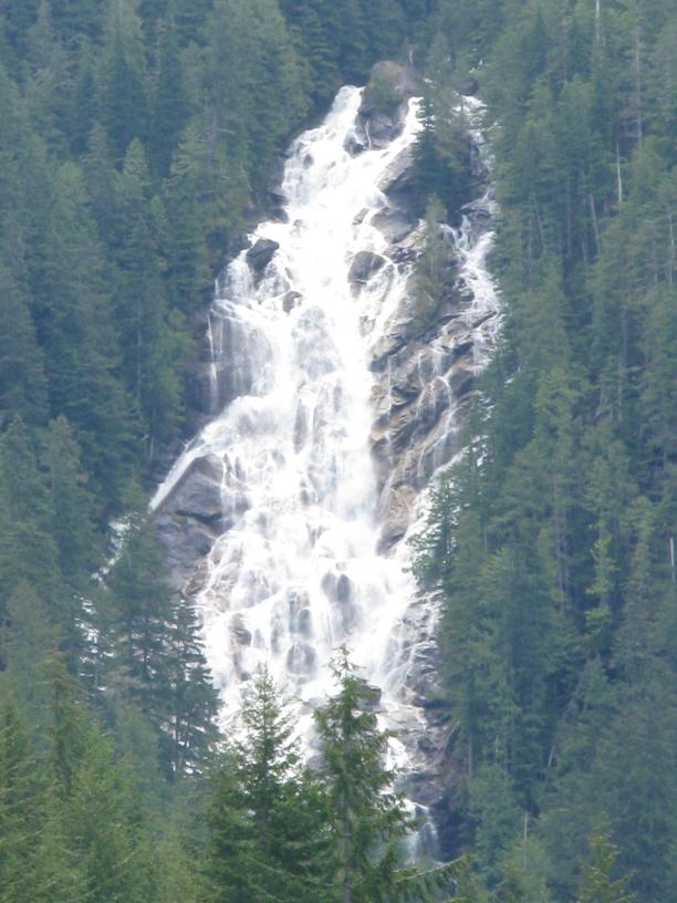
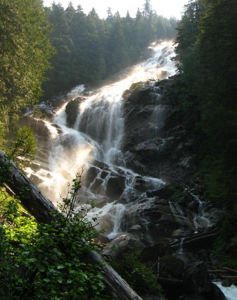
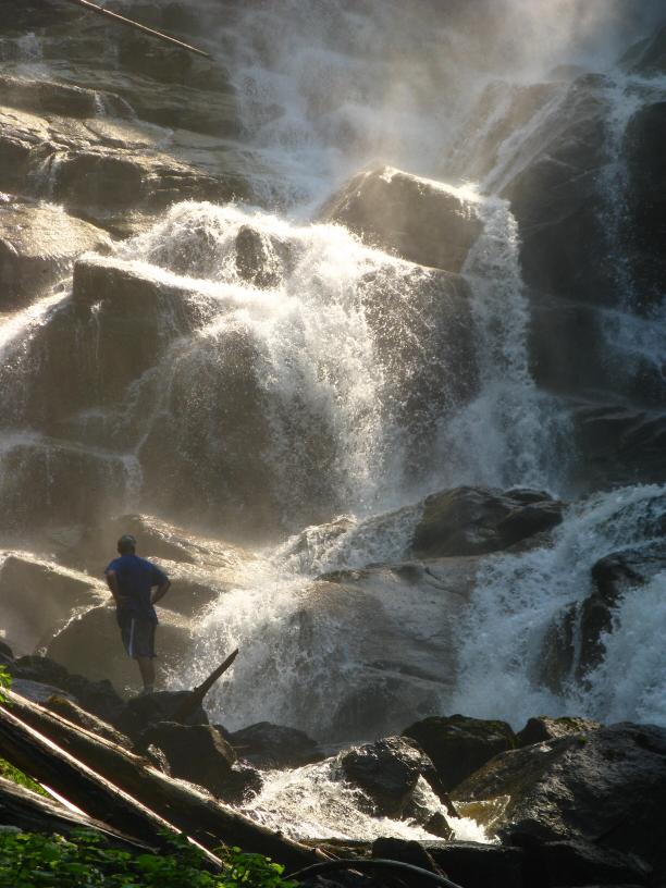
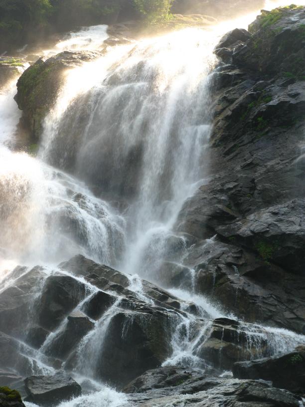
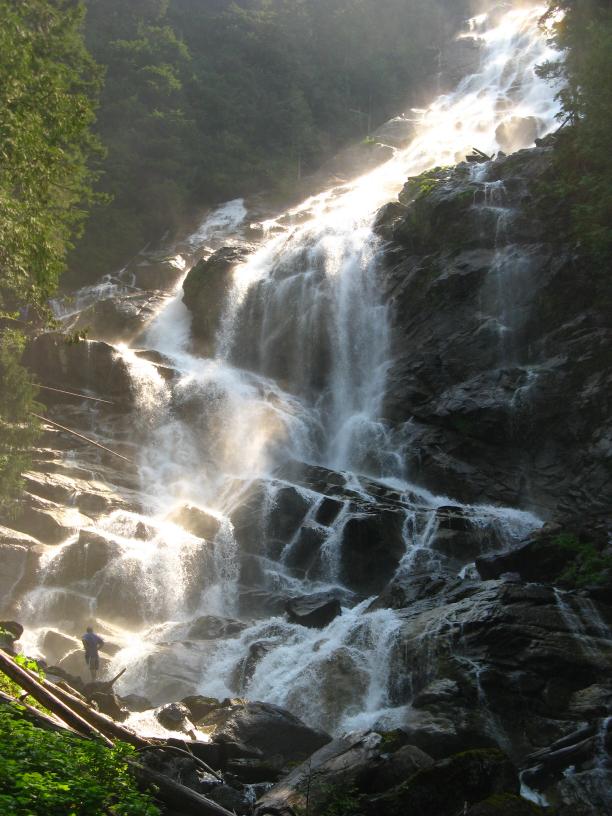 Jordan Creek Falls is
the best waterfall I've ever seen. Not only is it around 600' tall, it's almost
100' wide at the bottom and the amount of water coming down is massive.
During the early summer months when the snow in the basin above is melting,
standing at the base of the falls is like being in a hurricane. The
wind and spray coming off the falls is absolutely gargantuan. The
temperature at the bottom of the waterfall tends to be 20-30 degrees cooler
than the forest surrounding the falls which can make it pretty uncomfortable
to stand near the base. If you want to take decent pictures of the
waterfall, you almost have to visit when the volume is lower.
Otherwise the spray makes it difficult to work with.
Jordan Creek Falls is
the best waterfall I've ever seen. Not only is it around 600' tall, it's almost
100' wide at the bottom and the amount of water coming down is massive.
During the early summer months when the snow in the basin above is melting,
standing at the base of the falls is like being in a hurricane. The
wind and spray coming off the falls is absolutely gargantuan. The
temperature at the bottom of the waterfall tends to be 20-30 degrees cooler
than the forest surrounding the falls which can make it pretty uncomfortable
to stand near the base. If you want to take decent pictures of the
waterfall, you almost have to visit when the volume is lower.
Otherwise the spray makes it difficult to work with.