![]()
| LAZY BEAR FALLS | |
|
RATING -
44.0
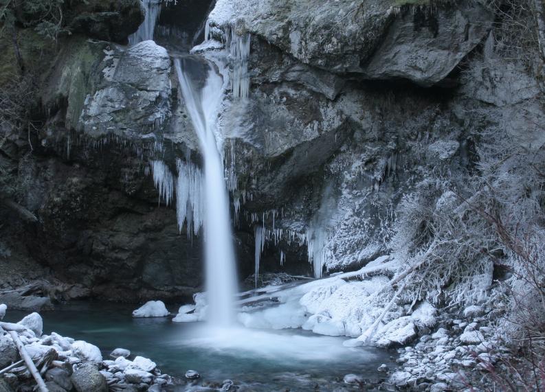
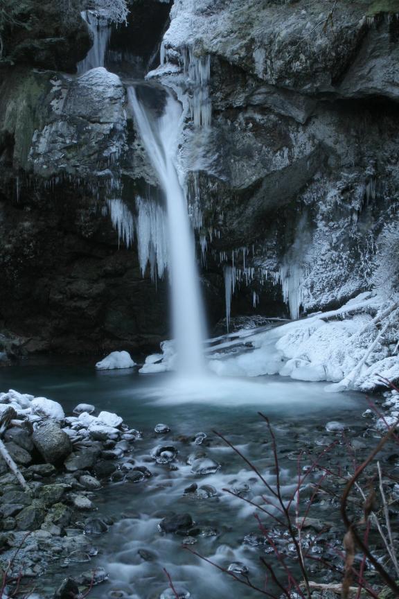
VR - 6 (Med) HR - 4.0 SR - 20/20 TYPE OF APPROACH - Trail DIFFICULTY - Easy LOCATION - Bacon Creek Road TYPE - Tiered HEIGHT - 70' WIDTH - 15' |
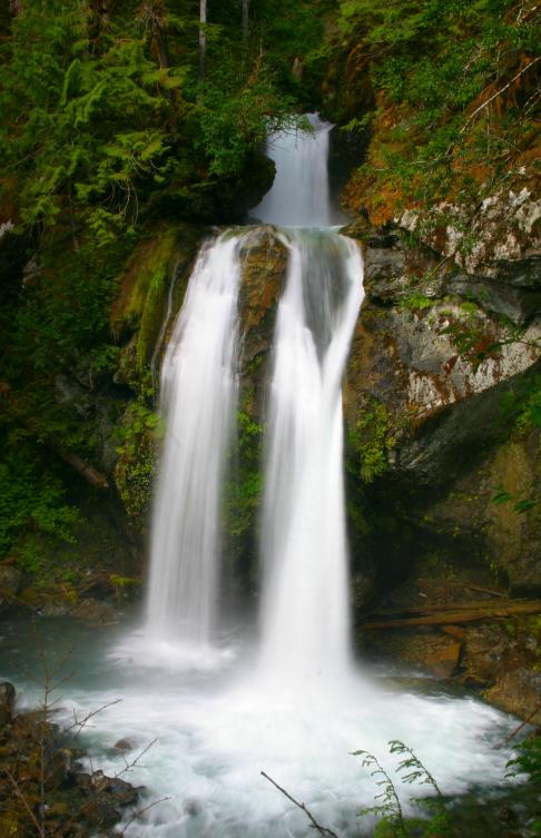
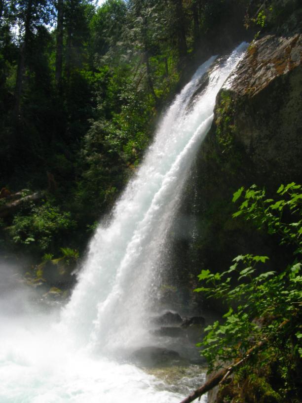
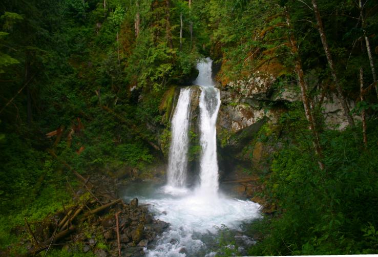
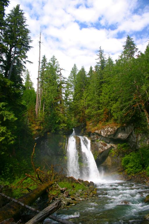
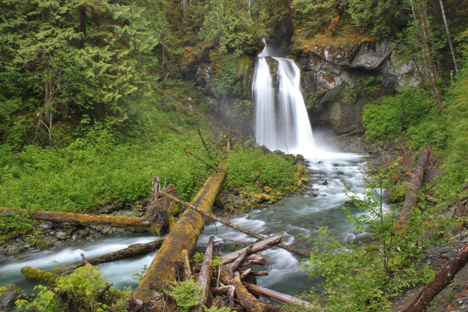
Lazy Bear falls starts off by dropping over a 20' plunge, followed immediately by the main drop, a 50' tall segmented drop into a beautiful pool. This is a great falls for photography because there are a ton of different angles to play with once you get to the creek. The falls are one of the few falls that look good with both a slow and fast shutter speed. Lazy Bear Falls quickly became one of my favorites after my first two visits and I will definitely keep returning. I originally heard about this waterfall on Falls Creek via a picture taken by Pat Buller. There are too many Falls Creek Falls already and this falls is nice enough to get a special name. I couldn't come up with anything until my second trip to the falls. I drove into the camp area to see a black bear sitting right next to the fire pit munching on something. I expected him to take off when he saw me but he just sat there so I honked. He slowly looked up at me then went back to eating. I honked again . . . same thing. My camera was in the trunk so I started to back up so I could safely get it out. When he heard me backing up he slowly got up and wandered off into the woods. I later found an empty bag of Sun Chips by the fire pit so I think he was licking the salt from the inside. I found his laziness to be both quite humorous but also insulting to other hard working bears out there (Yogi, Smokey, etc). I named the falls Lazy Bear Falls after this guy. |
| DIRECTIONS - Take HWY 20 east from Burlington and through Marblemount. In about 5 miles, turn left onto Bacon Creek Road and follow it for around 5 miles to a 3-way fork. Take the left fork over the bridge across Bacon Creek. From here the road gets pretty bumpy but is still drivable. In 1/2 a mile stay straight onto FR 1065 instead of turning back to the right. Follow this road for around 2/3 of a mile until it ends at a large, informal campsite. Find the trail on the north east side of the turnout and follow it around 500' down to the creek. To view the upper section, follow the trail that heads east from the turnout for about 100' to the creek. | |
VIDEO AND OTHER PICTURES
(CLICK TO ENLARGE)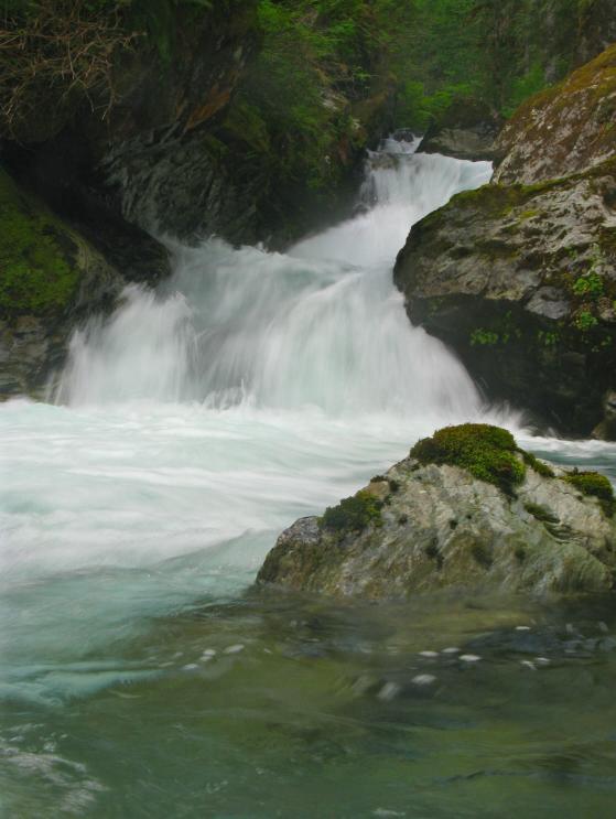

 |
|
| HOME SKAGIT COUNTY LINKS BEST IN THE NW WATERFALLS FOR KIDS FLICKR FACEBOOK STORE | |