![]()
LITTLE MOUNTAIN FALLS |
|
|
RATING -
51.2
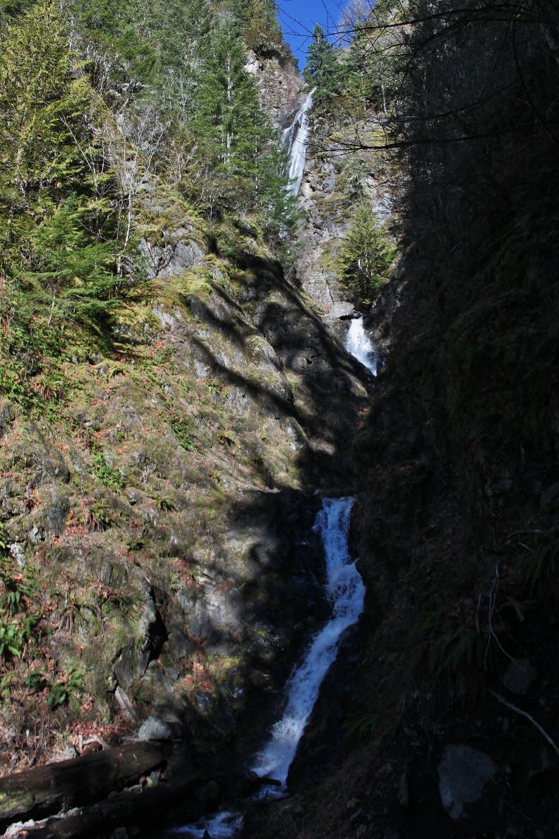
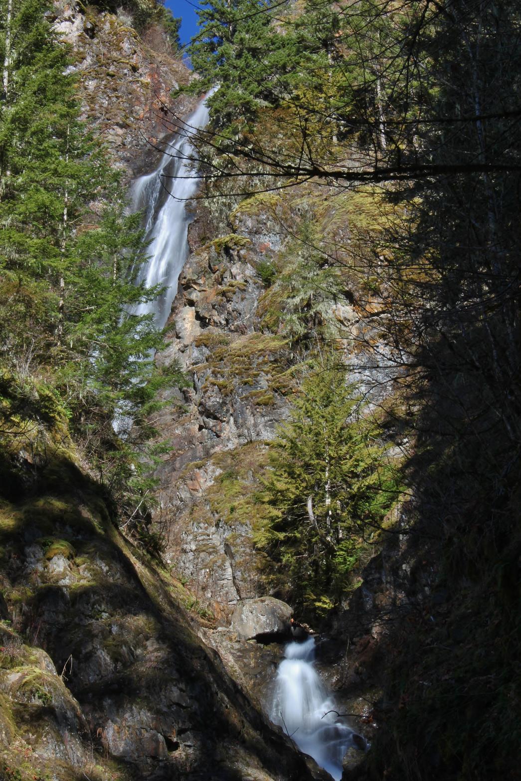
VR - 5.4 (Med) HR - 8.0 SR - 8/20 TYPE OF APPROACH - Bushwhack DIFFICULTY - Very Difficult LOCATION - Mt. Baker Highway TYPE - Tiered HEIGHT - 475' WIDTH - 30' GPS - N48 54.736 W121 53.379 ELEVATION - 2132' |
Little Mountain Falls drops somewhere around 475' in two main sections. The main portion of the falls drops 282' in a beautiful horsetailing drop that widens as it drops down the cliff. By the base of this tier the creek is 40' wide. Below this drop the creek cascades for another 193 vertical feet in a series of small steps. The massive height of the falls combined with the larger volume creek makes this one of the best waterfalls along the Mt. Baker Highway. On my second trip into the falls, the entire lower section was covered by a massive avalanche. I was able to walk up this avalanche to the base of the main drop, something that is not possible usually. Even from there the view is tricky because the waterfall drops at an angle away from the view. I think the only way to get a clear view of the upper tier is by coming in from above and standing atop the cliff facing the tier. I haven't done this yet though so I don't know for sure if it works. |
| DIRECTIONS - Drive out Mt. Baker Highway through the town of Glacier. About 3/4 of a mile past Canyon Creek Road, turn left into a gravel pit. You can park here or save yourself a few hundred feet of walking by driving up the little side road to its end. Once you reach the end of the side road, begin heading into the woods in a northeastern direction. The going is pretty easy thanks to the wide open forest. You should be able to follow animal paths most of the way to the creek. Once you reach the creek, follow it upstream however you can (wading in the water might be easiest) until you get a glimpse of the falls. The top can actually be seen distantly without much effort but you'll have a lot of work to do if you want to get up close. It should be about 1/2 a mile from the car to the base. | |
|
ADDITIONAL PICTURES (CLICK TO ENLARGE) AND VIDEO
|
|
HOME WHATCOM COUNTY LINKS BEST IN THE NW WATERFALLS FOR KIDS FLICKR FACEBOOK STORE |
|