![]()
LOOMIS FALLS |
|
|
RATING - 20.0
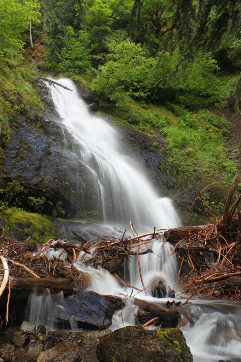
VR - 2 (Small) HR - 6.0 SR - 8/20 TYPE OF APPROACH - Roadside DIFFICULTY - Very Easy LOCATION - Mt. Baker Recreation Area TYPE - Tiered HEIGHT - 140' WIDTH - 5' GPS - N48 40.099 W121 52.535 ELEVATION - 2350' |
|
| DIRECTIONS - Take
the Baker Lake Road to FR 12 signed for Schriebers Meadows and the South Fork Nooksack.
Follow this road for around 6 miles and take the left where the road forks (the
right becomes FR 13). In another few miles take the right road through a seasonal
gate (the left goes up to the Blue Lake Trailhead). Continue along the road for
another few miles. The falls are visible to the right just before reaching FR 1260
to the left. NEARBY WATERFALLS - Bridal Veil Falls, Tamqwilas Falls |
|
ADDITIONAL PHOTOS (CLICK TO ENLARGE) AND VIDEO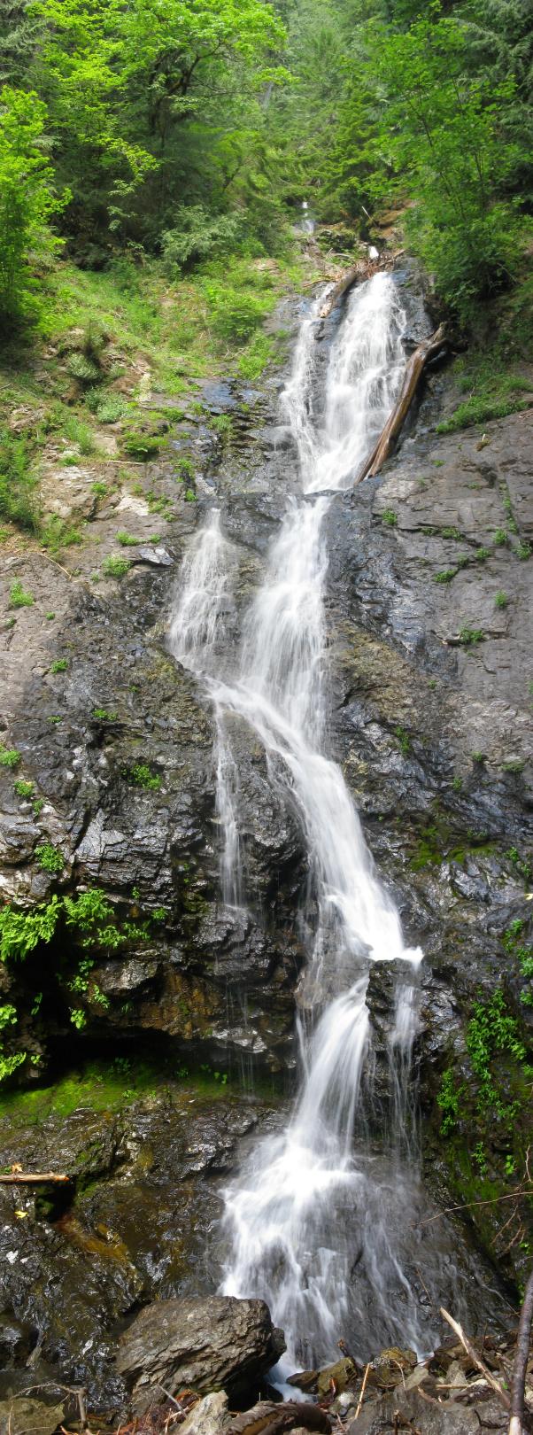
 |
|
HOME WHATCOM COUNTY LINKS BEST IN THE NW WATERFALLS FOR KIDS FLICKR FACEBOOK STORE |
|
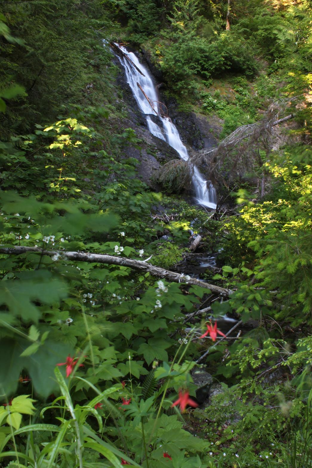 This little creek runs off the west side of
Loomis Mountain and eventually joins the South Fork of the Nooksack. The
bottom tier is a pretty 45' tall horsetail. The creek very likely runs dry
late in the summer. Normally this falls wouldn't be very notable but it's
right on the way to Bridal Veil Falls and is easily viewable from the road.
The road to both Loomis and Bridal Veil Falls is closed until July 1st every
year to protect Elk habitat.
This little creek runs off the west side of
Loomis Mountain and eventually joins the South Fork of the Nooksack. The
bottom tier is a pretty 45' tall horsetail. The creek very likely runs dry
late in the summer. Normally this falls wouldn't be very notable but it's
right on the way to Bridal Veil Falls and is easily viewable from the road.
The road to both Loomis and Bridal Veil Falls is closed until July 1st every
year to protect Elk habitat.