| DIRECTIONS - From Eatonville, follow the signs towards Mt. Rainier National Park which will take you along the Alder Cutoff Road. In a couple of miles the road will go over the railroad tracks. Park at the large turnout just after the tracks and find the trail in the middle of the pullout. The trail drops steeply down to the railroad trestle over the river. Cross the trestle and follow the trail to the right. When it hits the dirt road turn right and follow the road until you see the sign pointing towards "Falls". The trail heads downhill from there and eventually forks. The left fork heads down to "Lower Falls" and the right fork goes to the "Middle Falls". | |
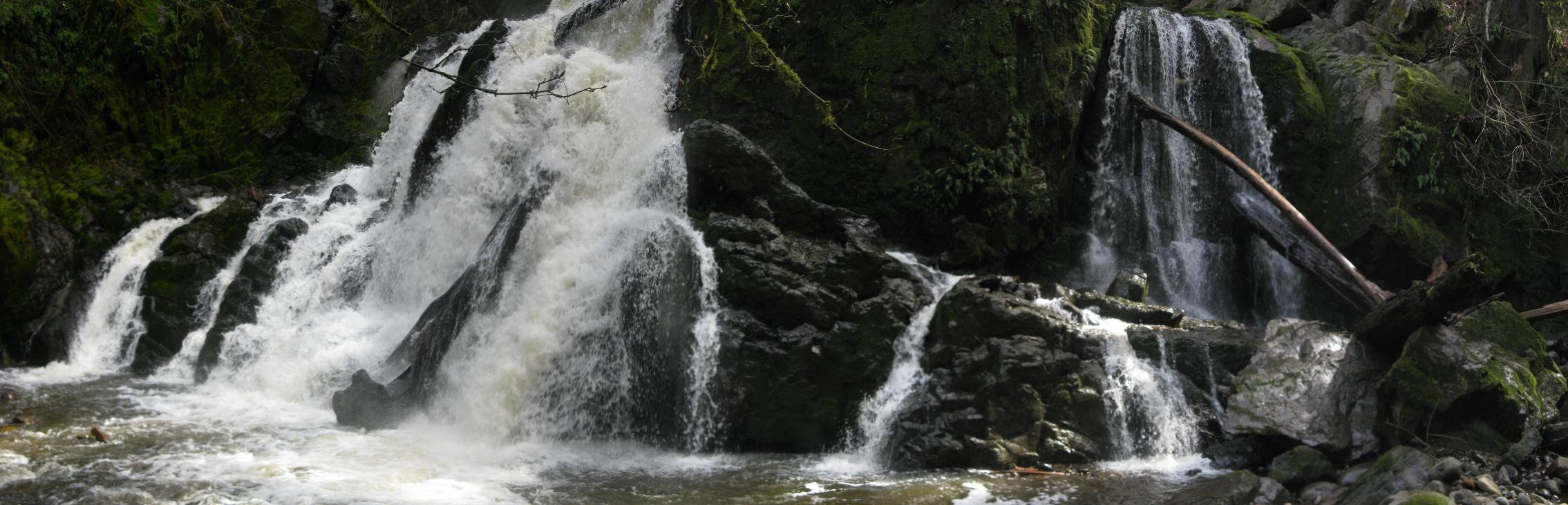
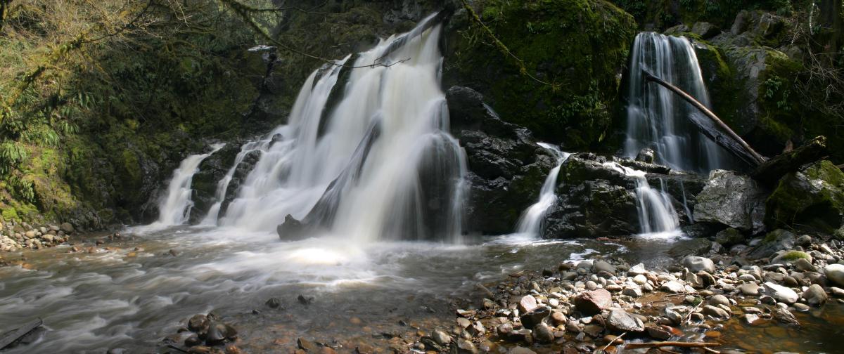
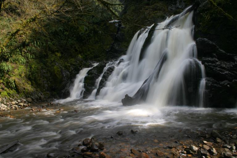
| LOCATION - Eatonville Area TYPE - Segmented HEIGHT - 40' WIDTH - 55' |
RATING -  TYPE OF APPROACH - Trail DIFFICULTY - Medium |
| NEARBY WATERFALLS - Little Mashel Falls | While not as impressive as Little Mashel Falls just upstream, the Lower Falls is more scenic and photogenic. It's a great place to sit back, relax, and enjoy the view. The trail down to the falls is fairly steep and very muddy so be prepared to get dirty. |
 |
|
 |
|
|
|