![]()
MIDDLE SANDY CREEK FALLS |
|
|
RATING -
38.0
VR - 6 (Med) HR - 4.0 SR - 14/20 TYPE OF APPROACH - Bushwhack DIFFICULTY - Extremely Difficult LOCATION - Mt. Baker Recreation Area TYPE - Tiered HEIGHT - 50' WIDTH - 10' ELEVATION - 4175' GPS - N 48 44.042', W 121 47.719' |
|
|
DIRECTIONS - Follow the directions to
Upper Sandy Creek Falls. Continue following the North Fork of Sandy
Creek downstream. It's probably easiest just to rockhop downstream at
creek level. About 1/4 of a mile below the upper falls you will have
to head into the brushy woods on the south side of the creek to get a clear
view. If you've made it this far the short climb won't bother you. NEARBY WATERFALLS - Andesite Falls, Double Falls, Kathryn Falls, South Squak Glacier Falls, Squak Glacier Falls, Upper Sandy Creek Falls |
|
AADDITIONAL PICTURES (CLICK TO ENLARGE) AND
VIDEO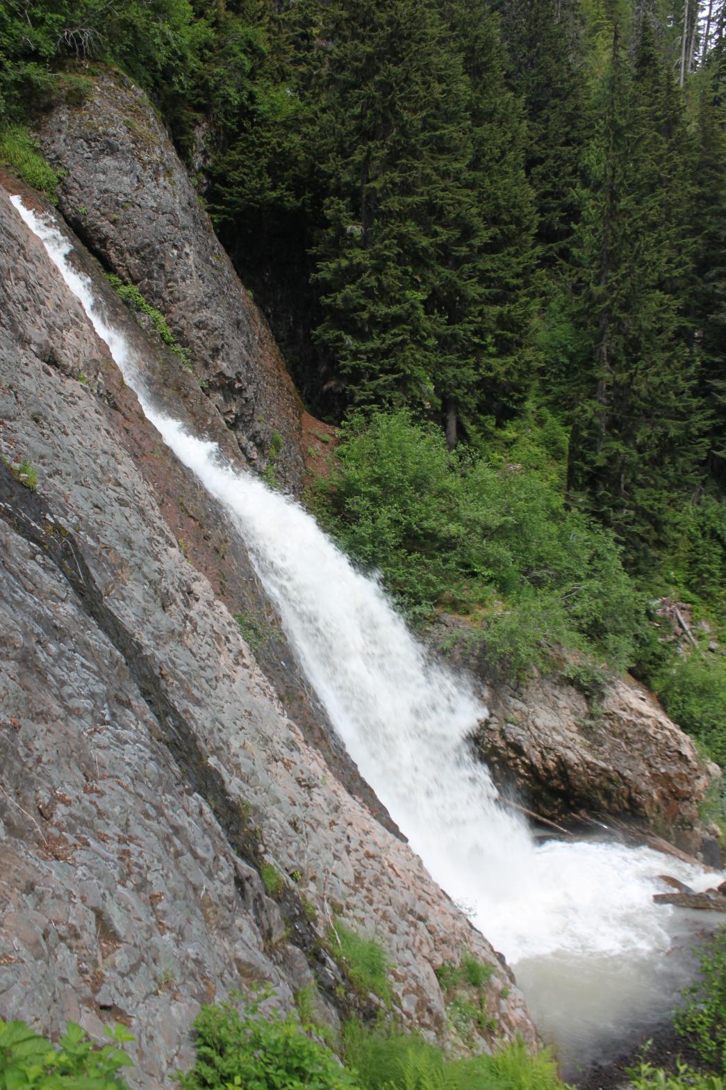 |
|
HOME/a> WHATCOM COUNTY LINKS BEST IN THE NW WATERFALLS FOR KIDS FLICKR FACEBOOK STORE |
|
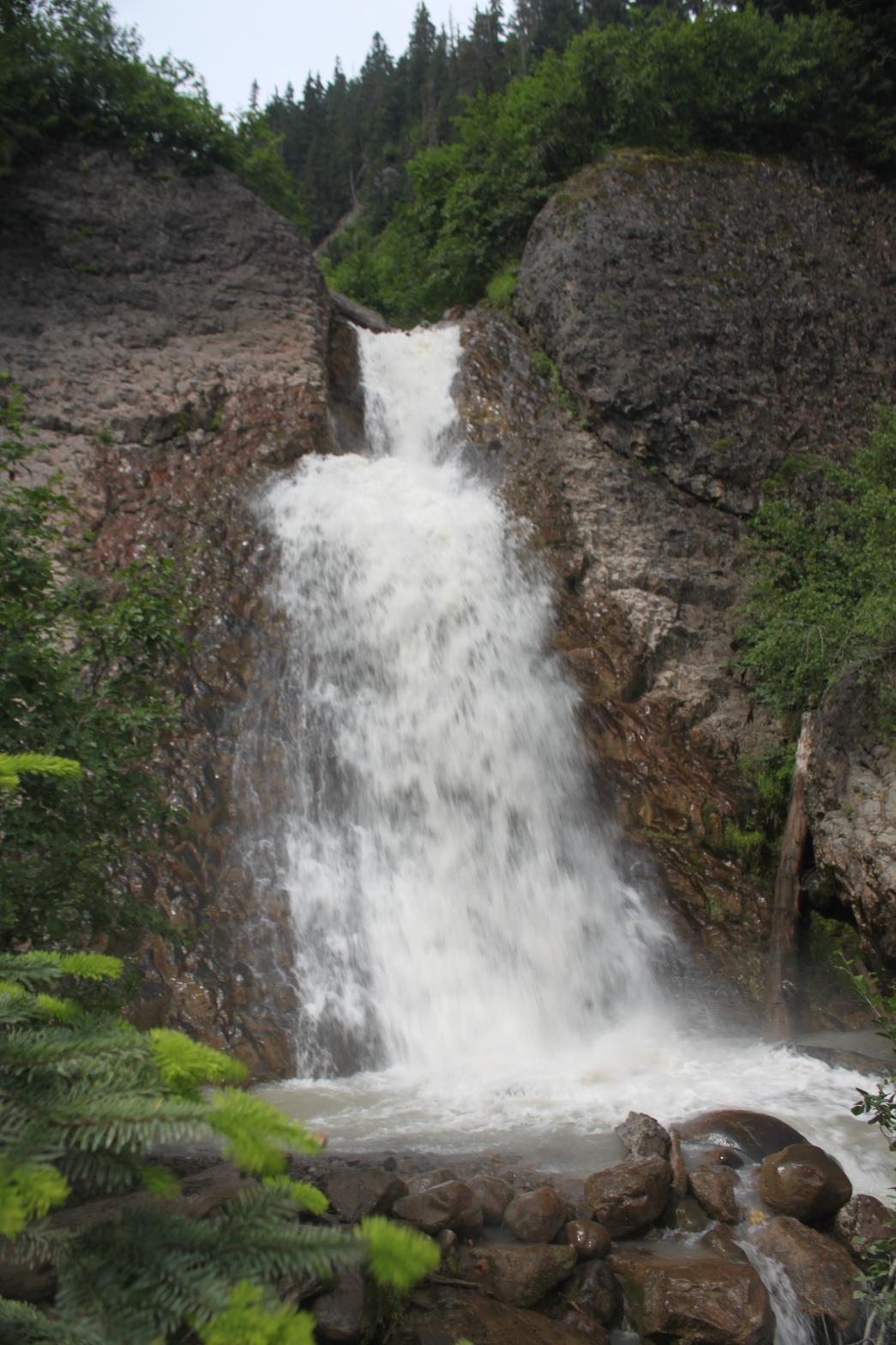 This
is the smallest of the three waterfall on the upper reaches of Sandy Creek
proper. It's still a very impressive waterfall though. The large
volume of Sandy Creek is funnelled into a narrow gap in the bedrock and
launched out in a massive spray of thundering water. Unlike the other
waterfalls in the area, this one is fairly well surrounded by brush, making
it a little difficult to get a clear view. While it's not necessarily
a pretty waterfall, this one is very powerful and it is certainly worthy of
your investigation if you're in the immediate area. I was actually
slightly disappointed that this waterfall wasn't a little taller, but it's
still a great one.
This
is the smallest of the three waterfall on the upper reaches of Sandy Creek
proper. It's still a very impressive waterfall though. The large
volume of Sandy Creek is funnelled into a narrow gap in the bedrock and
launched out in a massive spray of thundering water. Unlike the other
waterfalls in the area, this one is fairly well surrounded by brush, making
it a little difficult to get a clear view. While it's not necessarily
a pretty waterfall, this one is very powerful and it is certainly worthy of
your investigation if you're in the immediate area. I was actually
slightly disappointed that this waterfall wasn't a little taller, but it's
still a great one.