![]()
SKYLINE FALLS |
|
|
RATING -
48.0
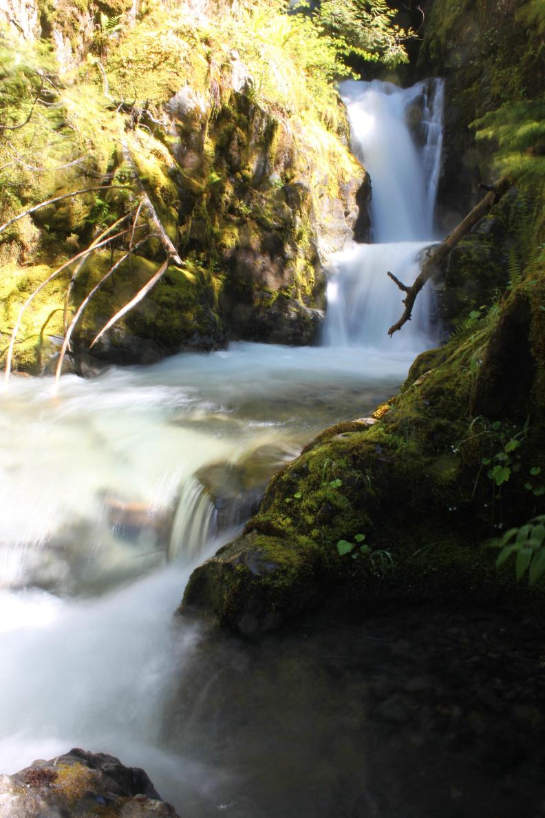
VR - 6.0 (Med) HR - 6.0 SR - 12/20 TYPE - Tiered HEIGHT - 150' WIDTH - 10' TYPE OF APPROACH - Bushwhack DIFFICULTY - Fairly Difficult LOCATION - Glacier Creek Road COORDINATES - 48° 50' 41" N, 121° 53' 35" W ELEVATION - 2722' |
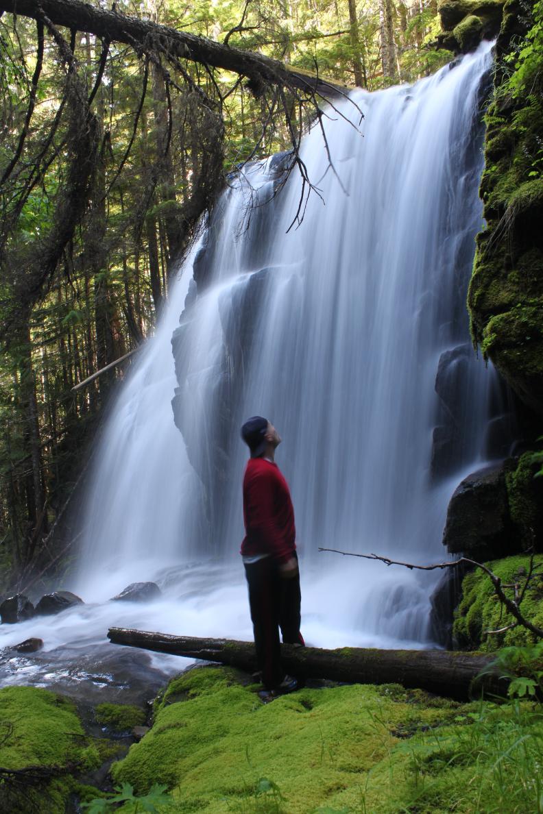 The
creek where Skyline Falls occurs begins high on Chowder Ridge and Skyline
Divide. The falls begin
with a stunning 20' tall, 30' wide convex, u-shaped drop that is among the
most beautiful waterfalls I've ever seen. Below this it drops over a couple
more small tiers before plunging again in a series of small drops running
right through the middle of the old road. This section totals around 50' in
height and is easy to view. Below here, the creek drops over two
back-to-back drops that total around 80' tall. This section is
virtually impossible to view clearly so I wouldn't even try. I
previously thought there was another larger tier below those two, but I have
since learned that was incorrect. This waterfall is really only worth
the trouble for the uppermost tier, which is among the prettiest anywhere. The
creek where Skyline Falls occurs begins high on Chowder Ridge and Skyline
Divide. The falls begin
with a stunning 20' tall, 30' wide convex, u-shaped drop that is among the
most beautiful waterfalls I've ever seen. Below this it drops over a couple
more small tiers before plunging again in a series of small drops running
right through the middle of the old road. This section totals around 50' in
height and is easy to view. Below here, the creek drops over two
back-to-back drops that total around 80' tall. This section is
virtually impossible to view clearly so I wouldn't even try. I
previously thought there was another larger tier below those two, but I have
since learned that was incorrect. This waterfall is really only worth
the trouble for the uppermost tier, which is among the prettiest anywhere. |
|
DIRECTIONS - Drive up Glacier Creek Road and cross the bridge over Glacier
Creek after a few miles. Just before the road starts climbing up
towards the Heliotrope Ridge Trail, you should see an overgrown road heading
left towards the creek. Park at the pullout just before it and start
walking down it. The road is fairly brushy in places but is still easy
enough to follow. Take a right at the first fork (first switchback)
and a left at the second fork (third switchback). The creek is just
after this second fork and some of the upper sections of the falls can be plainly
seen from the road. Getting to the beautiful upper most section will
require climbing up the 20' cliff next to the road and then scrambling
through the woods. |
|
MORE PICTURES (CLICK TO ENLARGE) AND VIDEOS 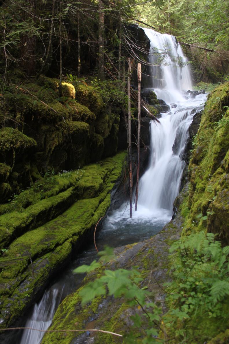
 |
|
HOME WHATCOM COUNTY LINKS BEST IN THE NW WATERFALLS FOR KIDS FLICKR FACEBOOK STORE |
|