![]()
THUNDER CREEK FALLS |
|
|
RATING -
36.0
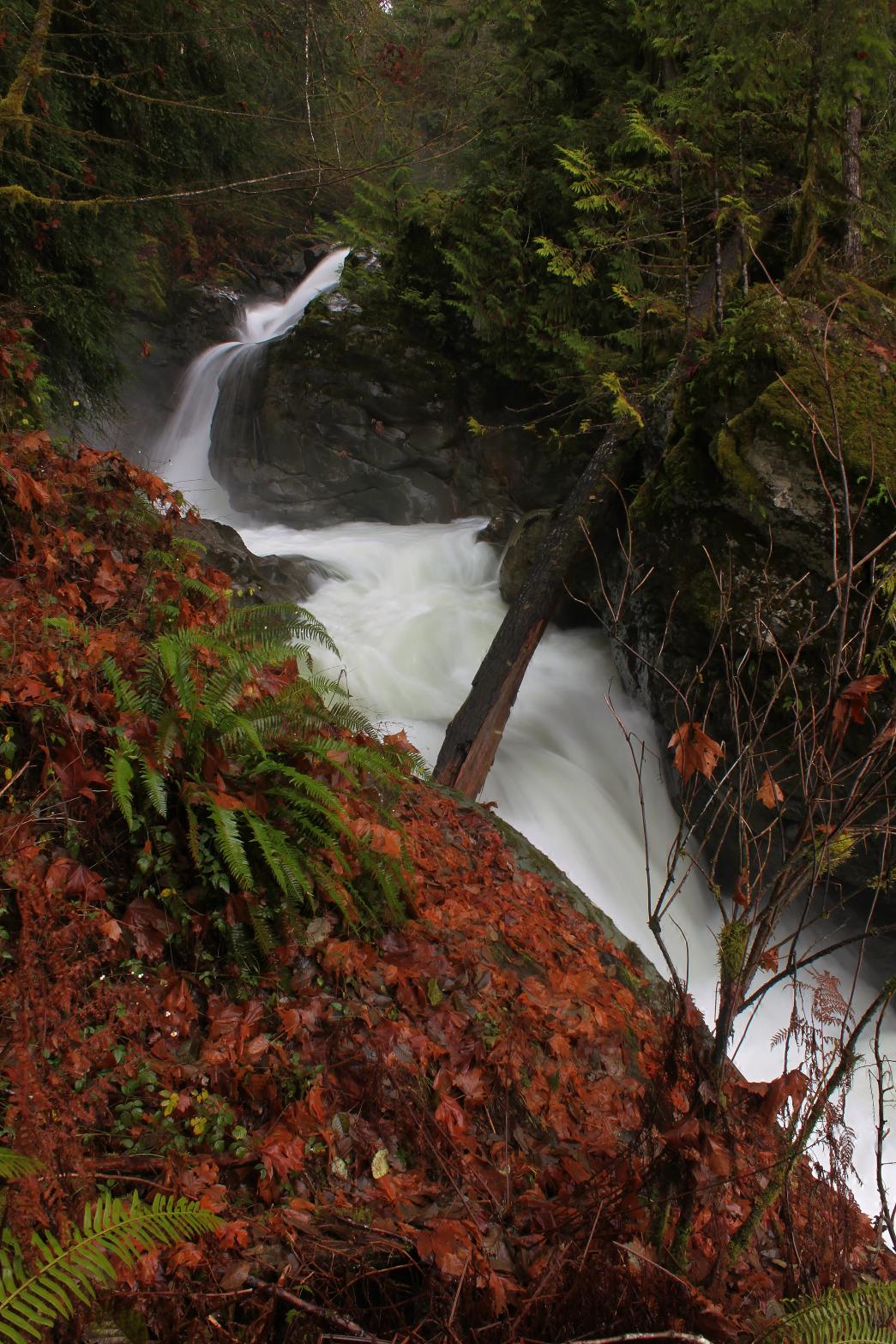
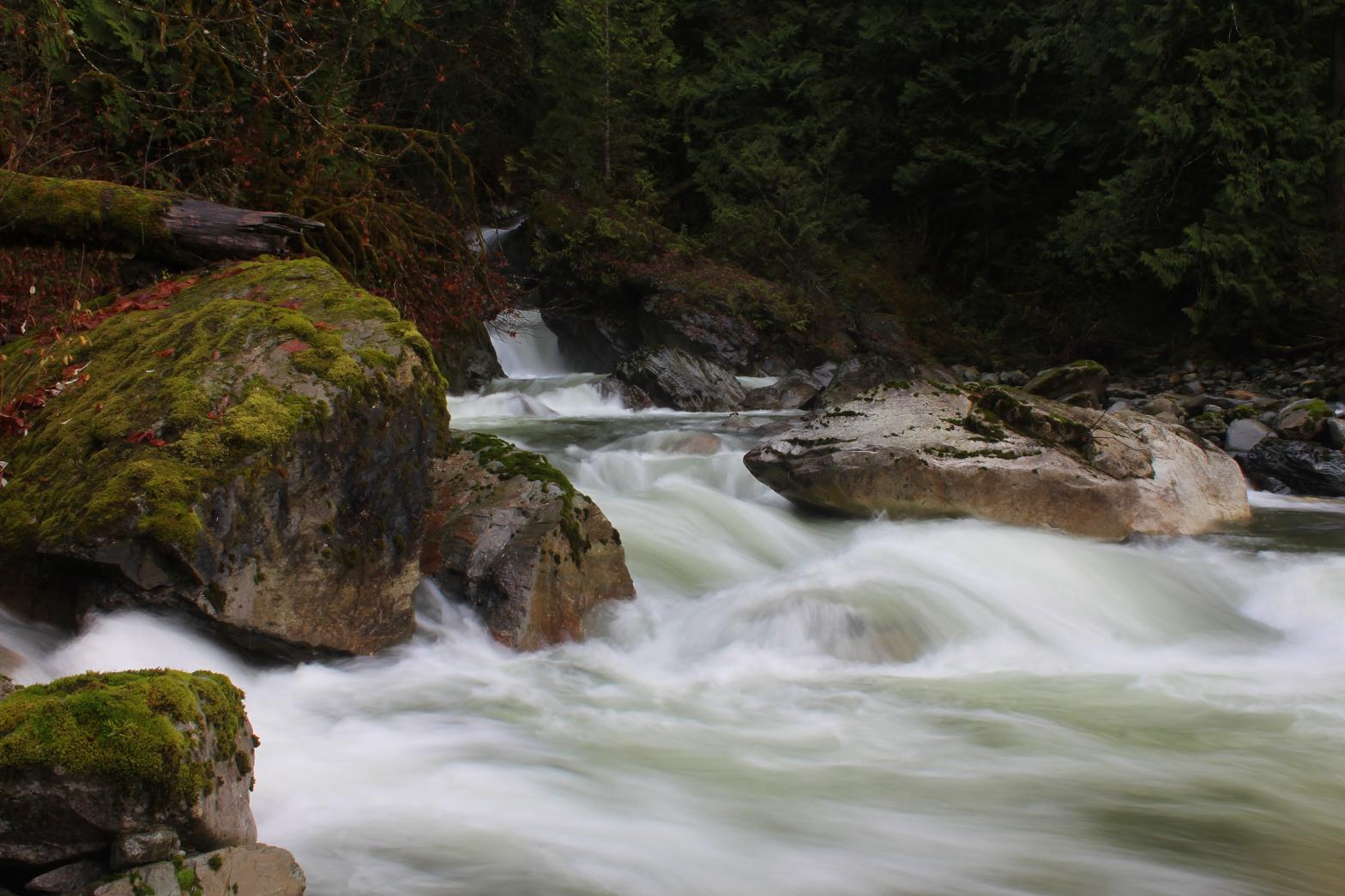
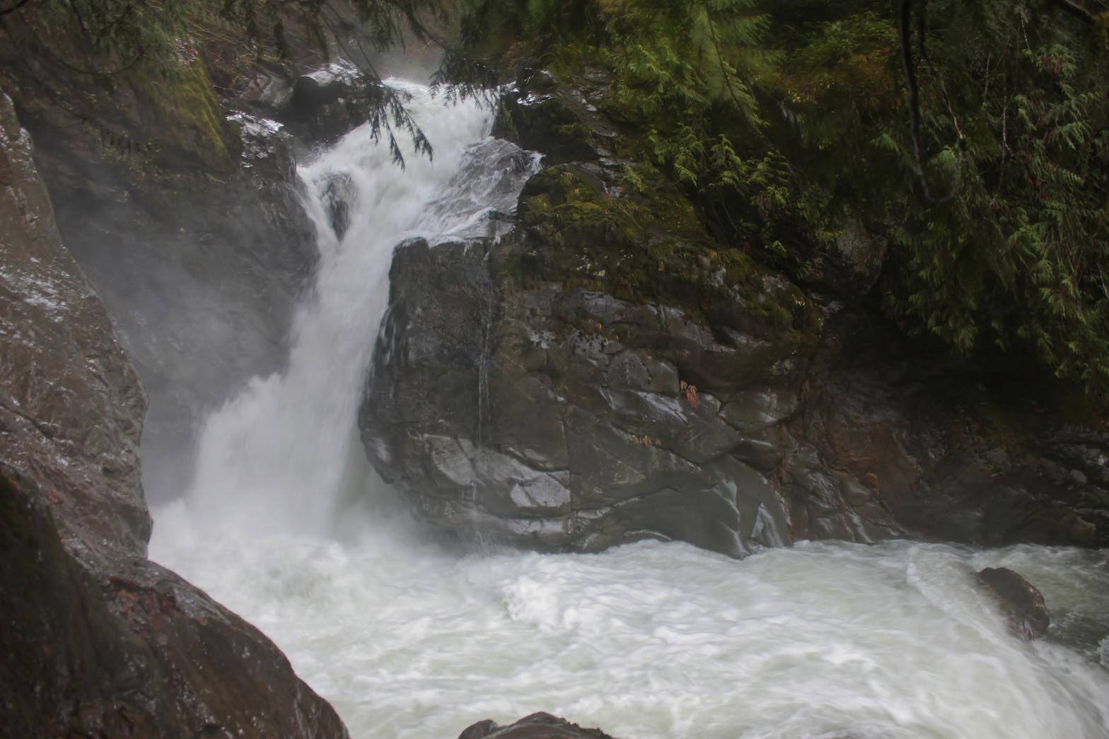
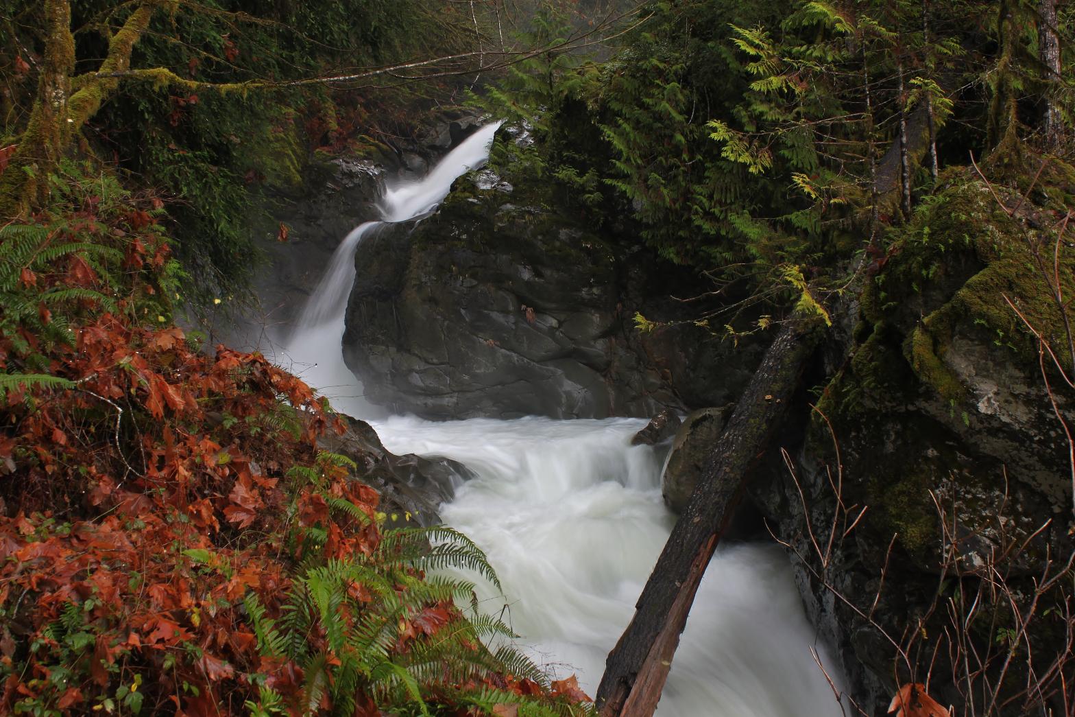
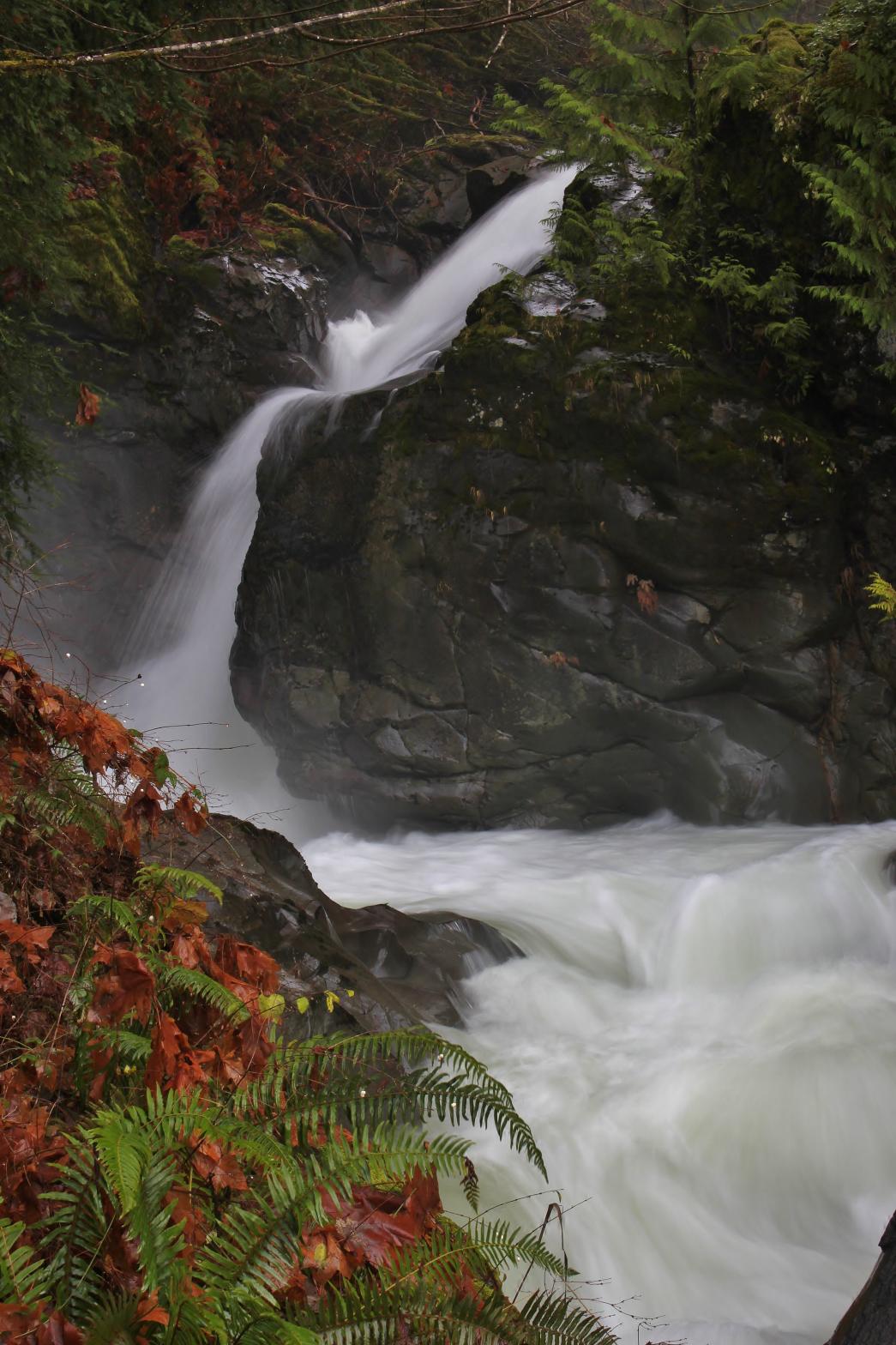
VR - 8.0 (Big) HR - 3.0 SR - 12/20 TYPE OF APPROACH - Roadwalk + Bushwhack DIFFICULTY - Very Difficult LOCATION - Baker Lake Area TYPE - Tiered HEIGHT - 50' WIDTH - 10' GPS - N48 36.162 W121 42.304 ELEVATION - 551' |
My route to the falls is pretty tiring. The road is very flat so it's a pretty easy bike ride, but the climb down to the creek and then back up is exhausting so save some energy. An alternative route to the falls would be to take a boat to the mouth of Thunder Creek and then rockhop upstream. I even found what appeared to be a trail of sorts running along the north side of the creek. Whether this is man-made or animal-made, I know not.
|
| DIRECTIONS -
Drive up Baker Lake Road and turn right onto Baker Dam Road. Shortly
after driving over the dam, part at the gated logging road that heads
straight where the main road turns left. Walk or bike up this road (I
recommend a bike). Just before reaching Thunder Creek, turn right on
another dirt road. You will soon cross under the power lines (this is
a good spot to ditch the bike). Take a left at both forks you come to.
Just after the second fork in about a mile you should hear the creek
roaring below you. Leave the road and start climbing down the hill.
You'll reach the creek in about 220 vertical feet. Follow it upstream
to the falls. NEARBY WATERFALLS - Upper Thunder Creek Falls |
|
OTHER PICTURES (CLICK TO ENLARGE) AND VIDEOS
|
|
| HOME SKAGIT COUNTY LINKS BEST IN THE NW WATERFALLS FOR KIDS FLICKR FACEBOOK STORE | |