![]()
SQUAK GLACIER FALLS |
|
|
RATING -
62.0
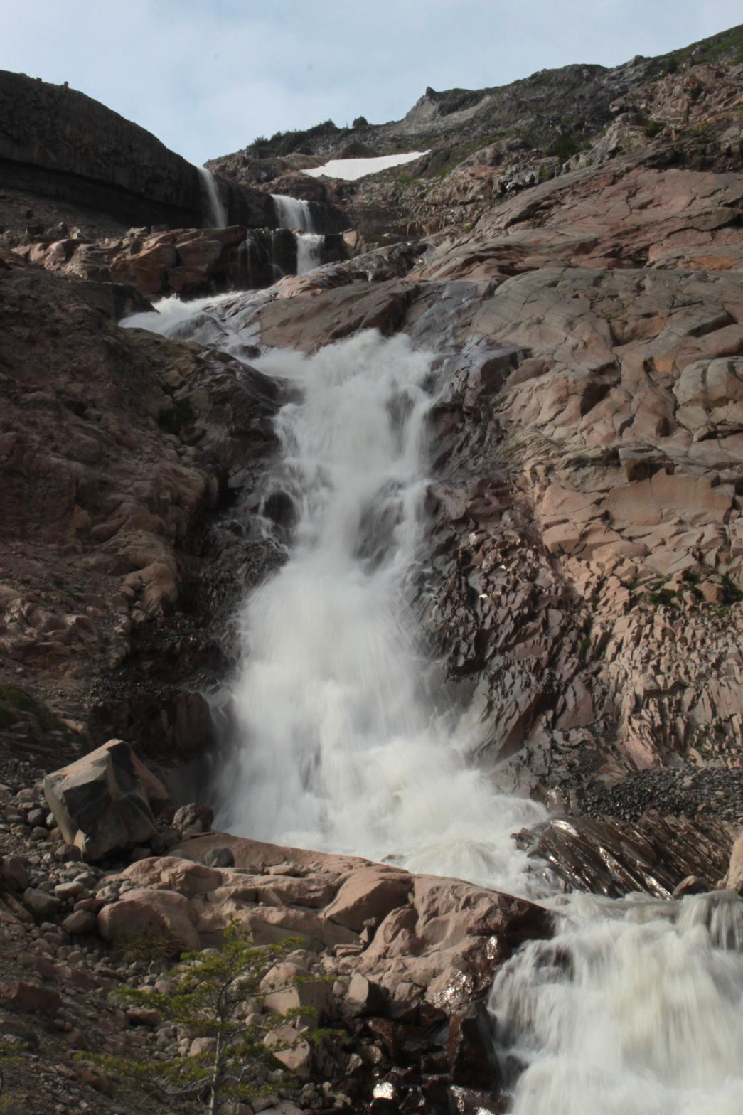
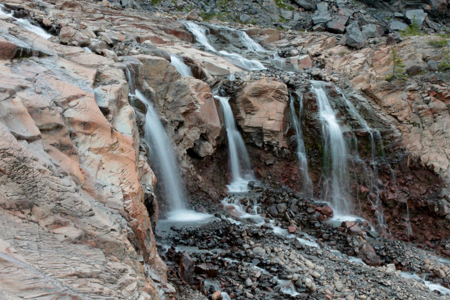
VR - 6.0 (Med) HR - 8.0 SR - 14/20 TYPE OF APPROACH - Trail DIFFICULTY - Medium LOCATION - Mt. Baker Recreation Area TYPE - Cascades HEIGHT - 367' WIDTH - 20' ELEVATION - 5114' GPS - N 48 44.253', W 121 48.180' |
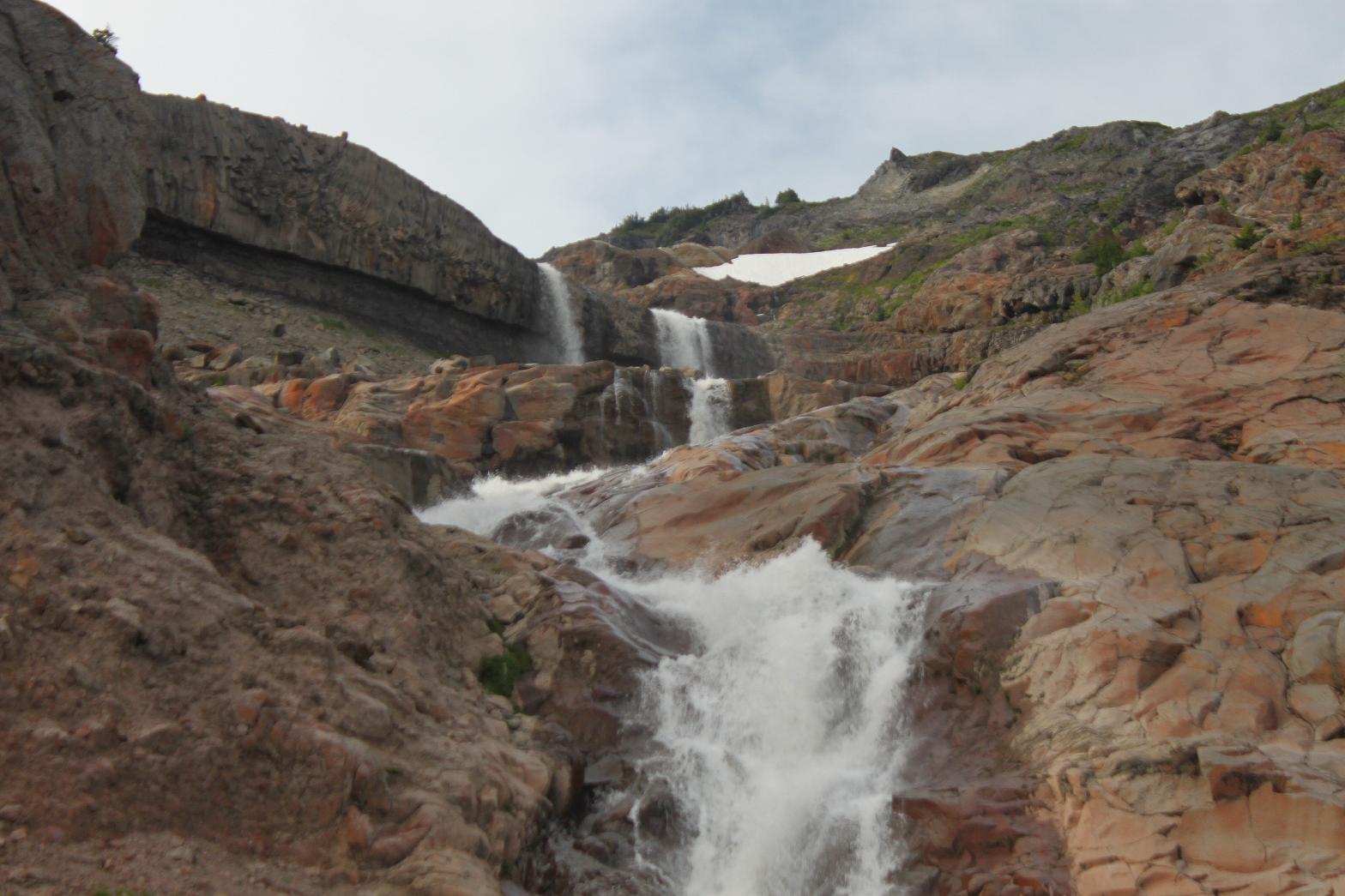
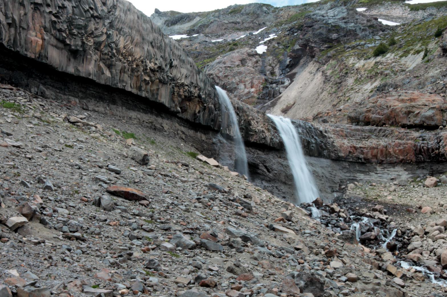
The Sandy Creek Basin is one of the most desolate, rugged, and most difficult to access locations on all of Mt. Baker. However, the area is also home to a plethora of waterfalls and some of the most unique and amazing geology on the entire mountain. Three major streams flow out of the Squak Glacier in the area and each one contains multiple waterfalls along their courses. The upper reaches of Sandy Creek contain a number of waterfalls, many of which are extremely impressive. Squak Glacier Falls occurs just downstream from the terminus of the Squak Glacier. The newly formed Sandy Creek skips, slides, and plunges down the bare rock for 367'. The waterfall begins with a 44' plunge over an amazing bedrock wall that I have named the "Wall of Jericho". The undercut wall stretches for hundreds of feet and is so amazingly uniform that it almost looks man-made. Below there the creek cascades before dropping another 30' in several segments. The waterfall finishes with a 110' tall sliding drop. I measured the waterfall from the bottom and came up with the height of 367' but it still seems a little high to me. If I return I will double check the height. From the Scott Paul Trail, this waterfall is sort of an accent to the view of Baker and the glacier, but from up close, the true power of the waterfall can be plainly seen. There are a ton of smaller volume waterfalls in the immediate area as well that add a lot to the scene. If you happen to work your way over to this waterfall, do yourself a huge favor and work your way down to Upper Sandy Creek Falls as well. It is one of the truly great waterfalls around Mt. Baker. |
|
DIRECTIONS - Drive out Baker Lake Road, turn left onto FR 12, take a right
onto FR 13, and follow it to the Schreibers Meadows Trailhead. A
couple hundred feet down the trail, take a right onto the Scott Paul Trail.
The trail climbs steadily uphill through beautiful forest for about 2 miles
until it finally enters a small meadow with a view of Mt. Shuksan.
Wander through the meadow to the edge and look over to see the falls in the
distance. Don't fall off! NEARBY WATERFALLS - Andesite Falls, Double Falls, Easton Falls, Kathryn Falls, Middle Andesite Falls, Middle Sandy Creek Falls, Skaleek Falls, South Squak Glacier Falls, Upper Andesite Falls, Upper Sandy Creek Falls |
|
ADDITIONAL PICTURES (CLICK TO ENLARGE)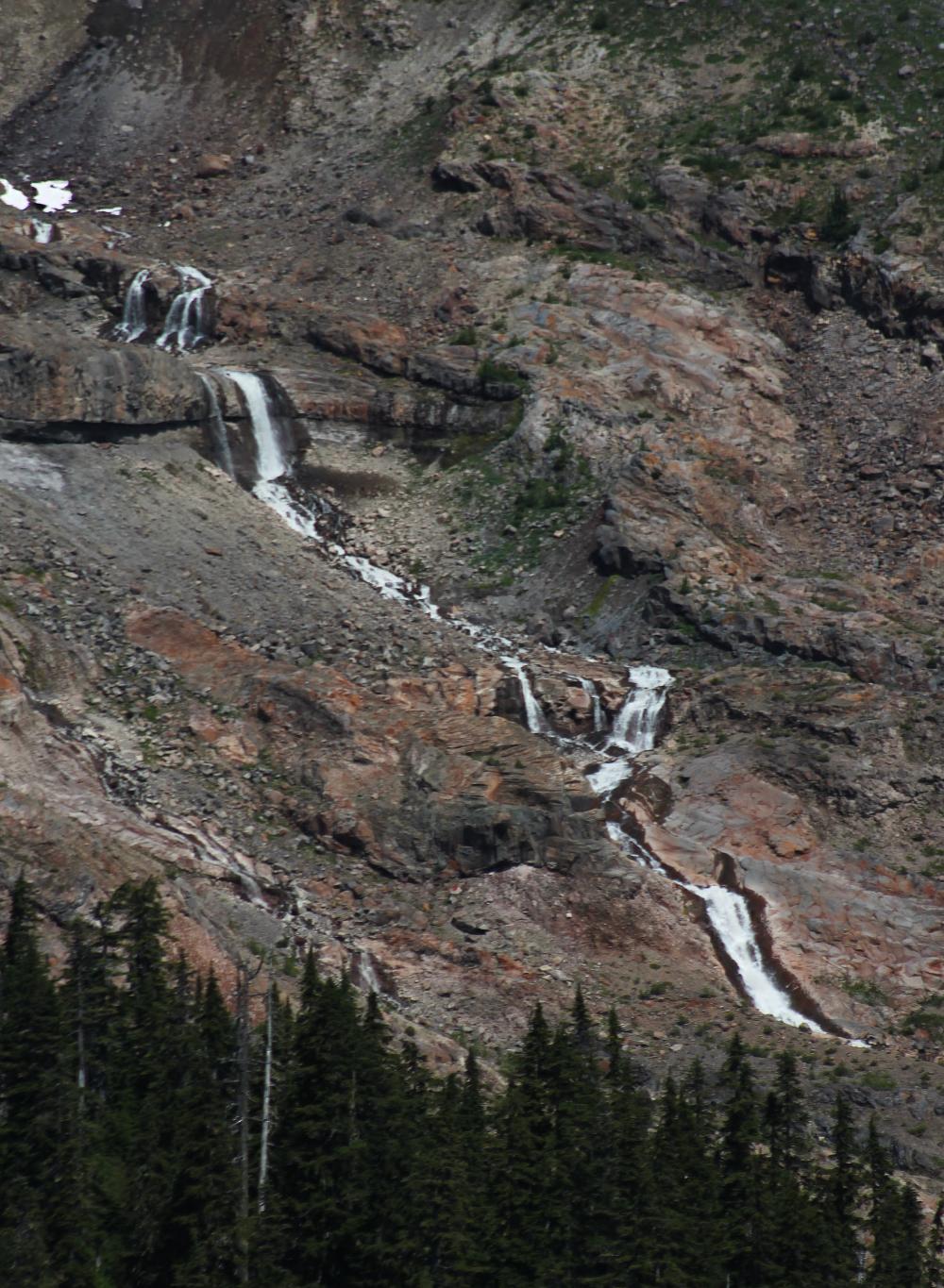
  |
|
HOME WHATCOM COUNTY LINKS BEST IN THE NW WATERFALLS FOR KIDS FLICKR FACEBOOK STORE |
|