![]()
BAGLEY LAKES FALLS |
|
|
RATING - 20.0
VR - 4.0 (M/S) HR - 4 SR - 4/20 TYPE OF APPROACH - Bushwhack DIFFICULTY - Difficult LOCATION - Heather Meadows Area TYPE - Tiered HEIGHT - 60' WIDTH - 10' GPS - N48 51.890 W121 41.091 ELEVATION - 4000' |
|
|
DIRECTIONS -
Drive up Mt. Baker Highway to the lower trailhead for the Chain Lakes Loop.
Just down from the parking lot, the trail crosses a small dam on Bagley
Creek. The falls occurs a short distance downstream from here but it
is difficult to get to, especially if you want to keep your feet dry. NEARBY WATERFALLS - Heather Meadows Falls |
|
HOME WHATCOM COUNTY LINKS BEST IN THE NW WATERFALLS FOR KIDS FLICKR FACEBOOK STORE |
|
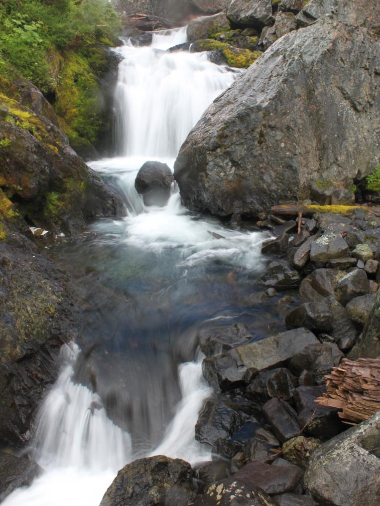 Bagley Creek flows out of the Bagley Lakes and drops over a long
series of 10-15' tall tiers. The area around the creek is covered with
huge boulders and lots of wildflowers so it's a gorgeous locale. The
falls aren't worth the effort it took to get down there, although it looked
like a larger tier may have been just downhill. I'll try to get a view
of the main section of this waterfall in future. It was pouring down
rain on my one trip in here.
Bagley Creek flows out of the Bagley Lakes and drops over a long
series of 10-15' tall tiers. The area around the creek is covered with
huge boulders and lots of wildflowers so it's a gorgeous locale. The
falls aren't worth the effort it took to get down there, although it looked
like a larger tier may have been just downhill. I'll try to get a view
of the main section of this waterfall in future. It was pouring down
rain on my one trip in here.