![]()
BOYD CREEK FALLS |
|
|
RATING - 10.0
VR - 4.0 (M/S) HR - 2 SR - 2/20 TYPE OF APPROACH - Trail DIFFICULTY - Easy LOCATION - Deadhorse Creek Road TYPE - Cascades HEIGHT - 45' WIDTH - 10' GPS - N48 53.947 W121 51.800 ELEVATION - 1300' |
|
| DIRECTIONS - From
Mt. Baker Highway, turn south onto Glacier Creek Road and make an immediate left onto
Deadhorse Creek Road (signed for the Skyline Divide Trail). In 3 miles, park at the
turnout for the Boyd Creek Interpretive Trail. The falls can be heard from the
parking lot and seen a few hundred feet up the trail. Getting a closer view is
possible with a short bushwhack but it's probably not worth the effort. NEARBY WATERFALLS - Cascade Creek Falls, Deadhorse Falls, Lower Deadhorse Falls |
|
ADDITIONAL PICTURES (CLICK TO ENLARGE)
|
|
HOME WHATCOM COUNTY LINKS BEST IN THE NW WATERFALLS FOR KIDS FLICKR FACEBOOK STORE |
|
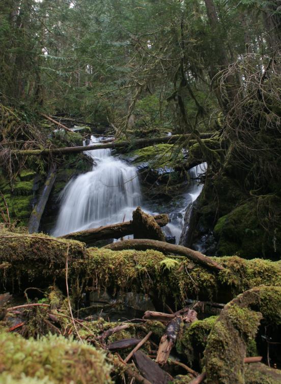
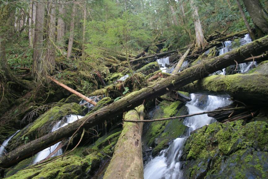
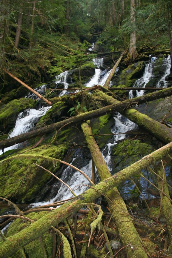 Boyd Creek Falls is sort
of a smaller, uglier version of nearby Cascade Creek Falls. Boyd Creek runs over a
series of small drops that is absolutely choked with logs. If the creek ever floods
and clears the logs out, this could be a nice little waterfall. Until then, it's
quite a let down. I'm not sure how high up the hill the cascades go but I will check
it out more closely on my next trip to the area.
Boyd Creek Falls is sort
of a smaller, uglier version of nearby Cascade Creek Falls. Boyd Creek runs over a
series of small drops that is absolutely choked with logs. If the creek ever floods
and clears the logs out, this could be a nice little waterfall. Until then, it's
quite a let down. I'm not sure how high up the hill the cascades go but I will check
it out more closely on my next trip to the area.