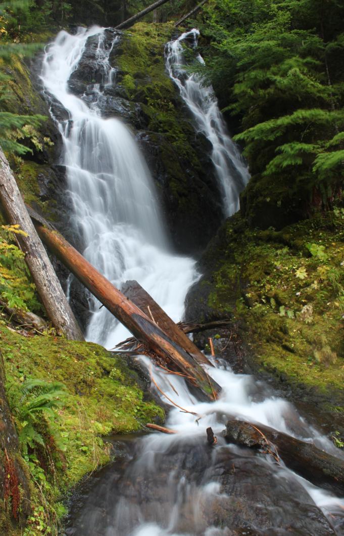
logo.jpg (20892 bytes)


CHOCWICH FALLS

RATING - 20.0

VR - 4 (Med/Sm)               HR - 2                  SR - 12/20

TYPE OF APPROACH - Trail

DIFFICULTY - Medium

LOCATION - Mountain Loop Highway

TYPE - Segmented

HEIGHT - 45'

WIDTH - 15'

GPS - N48 04.168 W121 23.621

ELEVATION - 2329'

Chocwich Creek horsetails down a moss covered rock face for about 45' right next to the trail in two side-by-side segments.  It's not a spectacular waterfall, but it is quite pretty.  There appears to be another waterfall a short distance downstream but I didn't have time to investigate on my trip in.  It will be a very steep scramble to get a view of that one.  There's some discrepancy in how to spell Chocwich, but I'll stick with this one because it seems to be the most common.

The hike is 4 miles round trip but it's a pretty easy 4 miles with very little elevation gain.  Towards the beginning of the hike, some great views of
Fletcher Falls can be had across the valley, dropping 1000' off the Twin Peaks. 

DIRECTIONS - Chocwich Falls is accessed from the Goat Lake Trailhead off the Mountain Loop Highway.  Park and follow the trail.  In 1/4 mile take the left fork signed for "Upper".  At one mile from the trailhead, take another left signed for "Chokwich" and follow the trail for another mile to the falls.

NEARBY WATERFALLS - Bridal Veil Falls, Lower Chocwich Falls, Mackintosh Falls

HOME     SNOHOMISH COUNTY     LINKS     BEST IN THE NW     WATERFALLS FOR KIDS     FLICKR     FACEBOOK      STORE