![]()
LOWER CHOCWICH FALLS |
|
|
RATING - 40.0
VR - 4 (M/Sm) HR - 6.0 SR - 16/20 TYPE OF APPROACH - Trail DIFFICULTY - Fairly Easy LOCATION - Mountain Loop Highway TYPE - Tiered HEIGHT - 132' * WIDTH - 75' GPS - N48 04.346 W121 23.903 ELEVATION - 1524' |
Just above this waterfall are two more waterfalls: Middle Chocwich Falls and Wishbone Falls. If someone wanted to call all three waterfalls one multi-tiered waterfall, I would have a hard time arguing against them. I chose to split the series up into three waterfalls because there is no way to see the three together and there are short, flat spaces between each. |
| DIRECTIONS - The
falls are located just off the Mountain Loop Highway. Drive north of the Elliott
Creek Bridge for about 1.5 miles to where the road crosses over Chocwich Creek
(unsigned). The falls can be seen from the road, but a short, but fairly steep climb
along a well-worn boot path is required to reach a clear view of the falls. NEARBY WATERFALLS - Middle Chocwich Falls, Wishbone Falls |
|
HOME SNOHOMISH COUNTY LINKS BEST IN THE NW WATERFALLS FOR KIDS FLICKR FACEBOOK STORE |
|
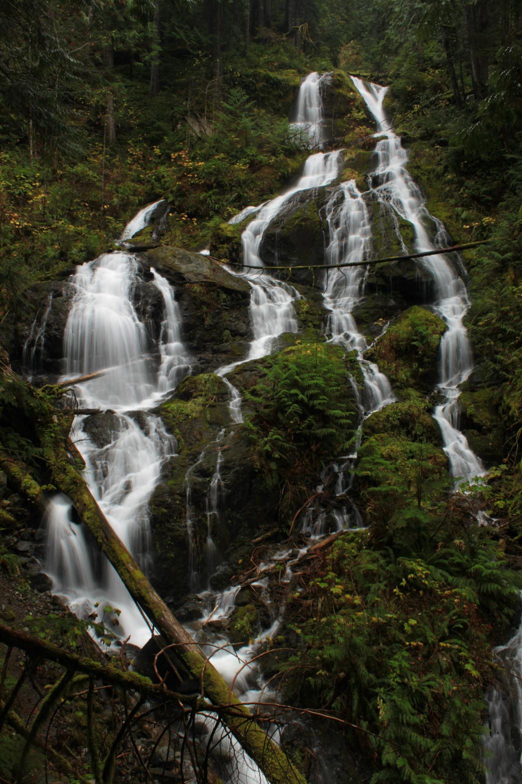 Chocwich
Creek drops over several waterfalls on its way to joining the Sauk River. This is
the only one that can be seen easily. The falls drop around 130' in a series of
small steps. The entire falls is surrounded by lush greenery creating a gorgeous
spot. Given its close proximity to the Mountain Loop Highway, this is a falls that
most people should visit when in the area.
Chocwich
Creek drops over several waterfalls on its way to joining the Sauk River. This is
the only one that can be seen easily. The falls drop around 130' in a series of
small steps. The entire falls is surrounded by lush greenery creating a gorgeous
spot. Given its close proximity to the Mountain Loop Highway, this is a falls that
most people should visit when in the area.