![]()
CORNELL CREEK FALLS |
|
|
RATING - 32.0
VR - 4 (Med/Sm) HR - 5 SR - 12/20 TYPE OF APPROACH - Bushwhack DIFFICULTY - Very Difficult LOCATION - Mt. Baker Highway TYPE - Tiered HEIGHT - 118' WIDTH - 32' GPS - N48 52.536 W121 58.362 ELEVATION - 2001' |
 The
waterfalls of Cornell Creek are found on the West Fork of the creek in the
middle of a very deep, very steep, and very dangerous to navigate canyon.
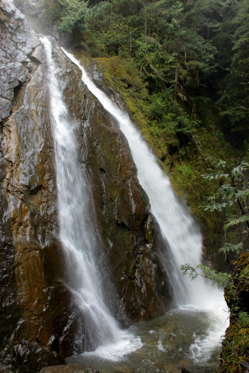
Cornell Creek Falls drops 118' in a series of three drops. The first
two drops around 20' tall, 15' wide cascades. The creek then splits in
two and drops 72' in side-by-side drops that are somewhat reminiscent of
Feature Show Falls near Darrington.
Immediately upon hitting the bottom, the creek makes a wide U-turn around
the promontory before dropping over the middle and lower falls. The
view of the waterfall is really close so it's difficult to fit the whole
falls in a picture without a wide angle. Spray will be a problem at
high water as well and when I visited it was raining. The
waterfalls of Cornell Creek are found on the West Fork of the creek in the
middle of a very deep, very steep, and very dangerous to navigate canyon.
Cornell Creek Falls drops 118' in a series of three drops. The first
two drops around 20' tall, 15' wide cascades. The creek then splits in
two and drops 72' in side-by-side drops that are somewhat reminiscent of
Feature Show Falls near Darrington.
Immediately upon hitting the bottom, the creek makes a wide U-turn around
the promontory before dropping over the middle and lower falls. The
view of the waterfall is really close so it's difficult to fit the whole
falls in a picture without a wide angle. Spray will be a problem at
high water as well and when I visited it was raining.While the waterfall is very impressive, the difficulty and danger of viewing this waterfall make it inaccessible for most people. I would highly recommend against visiting this waterfall unless you have canyoneering skills. It's just too dangerous without it. |
|
DIRECTIONS - Follow the directions to
Middle Cornell Creek Falls. After crossing the tributary stream,
head uphill above the creek. You'll encounter a massive maze of logs
in an open section of the hill. Cross near the bottom here and you'll
be near the top of the falls. In order to get to the promentory where
I took my pictures, you'll need a rope and a lot of nerves. You'll
have to climb down a nearly vertical cliff and then scoot over to the top of
the viewing rock. Don't falls or you're dead. NEARBY WATERFALLS - Lower Cornell Creek Falls, Middle Cornell Creek Falls |
|
ADDITIONAL PICTURES (CLICK TO ENLARGE) AND VIDEO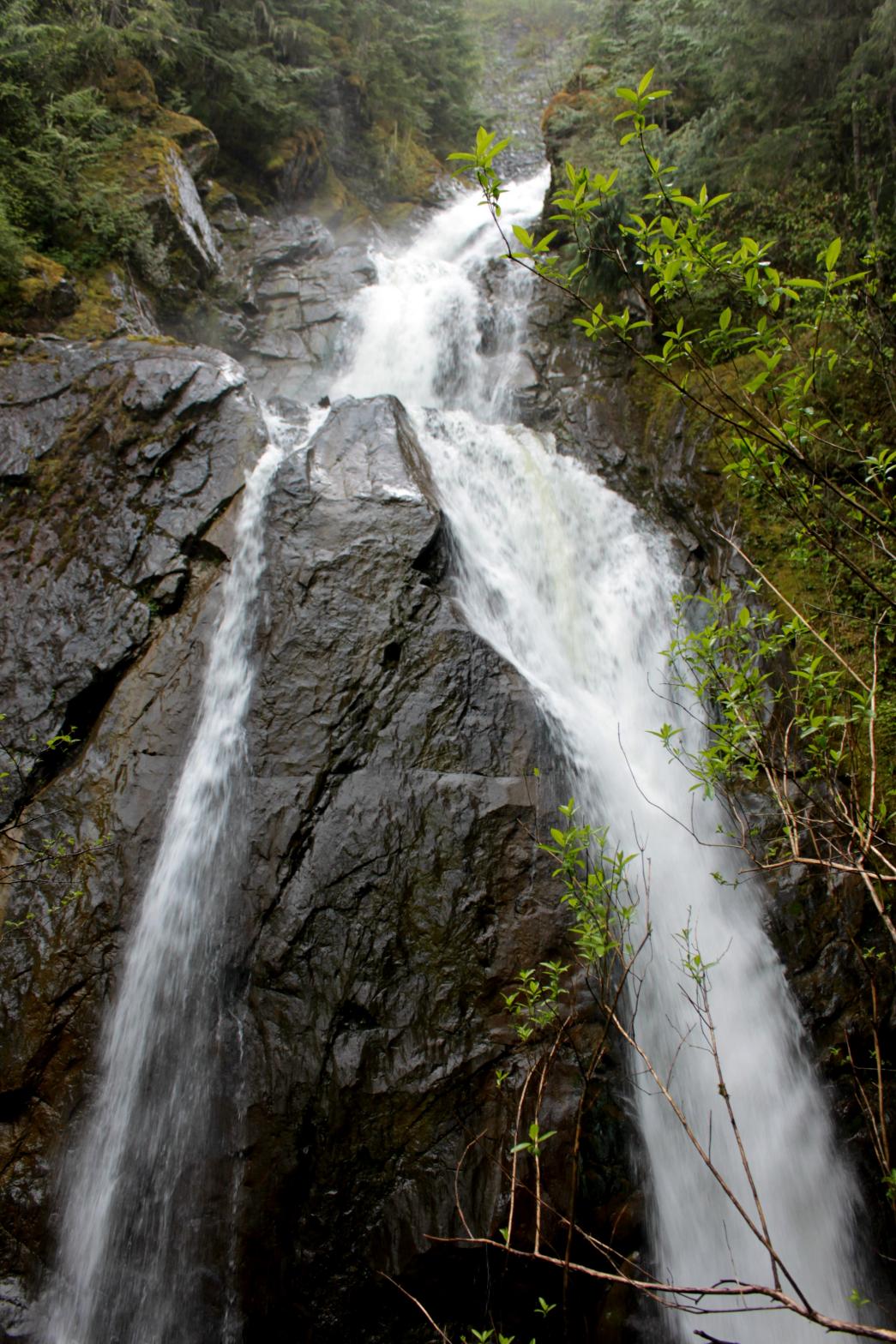 |
|
HOME WHATCOM COUNTY LINKS BEST IN THE NW WATERFALLS FOR KIDS FLICKR FACEBOOK STORE |
|