![]()
EAST IRON FALLS |
|
|
RATING - 30.0
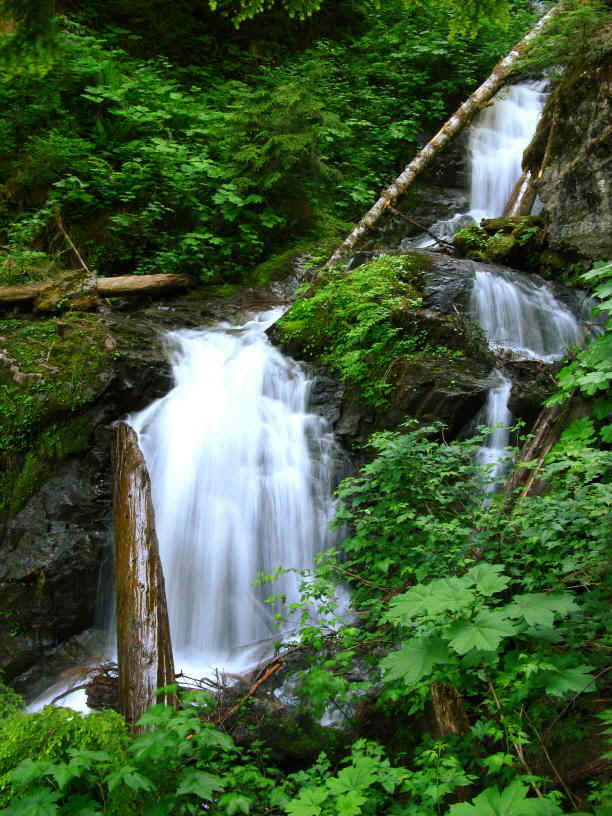
VR - 4 (Med/Sm) HR - 6.5 SR - 4/20 TYPE OF APPROACH - Bushwhack DIFFICULTY - Extremely Difficult LOCATION - Illabot Creek Road (FR 16) TYPE - Tiered HEIGHT - 202' WIDTH - 10' |
|
| DIRECTIONS - Follow
the directions to Iron Creek Falls, which can be seen
from the road. Just upstream from the road, Iron Creek splits in two with the
right-hand segment going up to Iron Creek Falls. The left-hand fork runs through the
brushy terrain for around 1/2 a mile to East Iron Falls. The trip is very
difficult. To see the upper sections of the falls, climb up the hillside along the
creek and through the brush. NEARBY WATERFALLS - Iron Creek Falls, Upper Hilt Creek Falls |
|
OTHER PICTURES (CLICK TO ENLARGE)
|
|
HOME SKAGIT COUNTY LINKS BEST IN THE NW WATERFALLS FOR KIDS FLICKR FACEBOOK STORE |
|
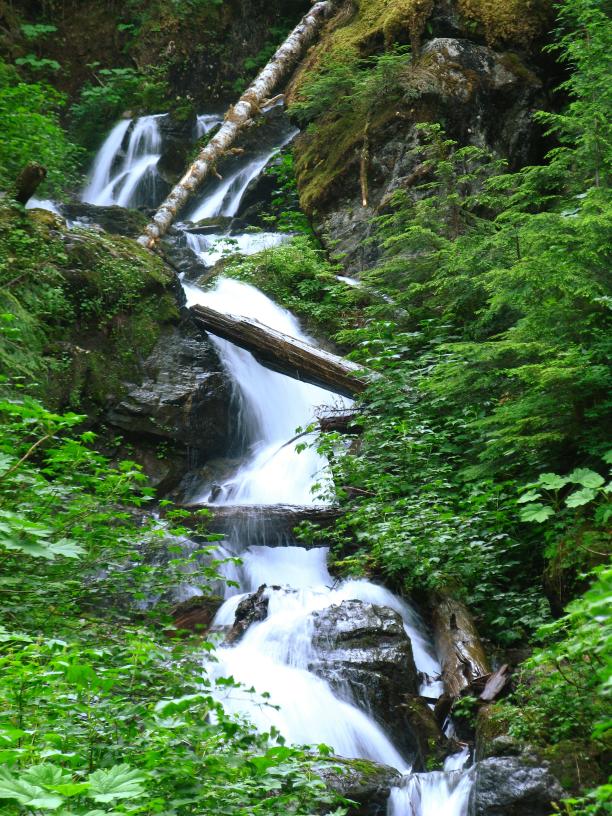 After getting a view
of Iron Creek Falls in November 2007, I took a good look at the Topo map and realized Iron
Creek probably had two separate falls on it. In 2008, I finally had a chance to find
my way into both of them. What I found on the East Fork was a series of drops
totaling around 200' tall. The falls begin with a straight plunge of about 25'
feet followed immediately by another 35' drop. From there it turns a corner
and runs over a long series of cascades before leveling out and joining the West Fork of
Iron Creek. Getting to this falls is very difficult and not recommended for most
people.
After getting a view
of Iron Creek Falls in November 2007, I took a good look at the Topo map and realized Iron
Creek probably had two separate falls on it. In 2008, I finally had a chance to find
my way into both of them. What I found on the East Fork was a series of drops
totaling around 200' tall. The falls begin with a straight plunge of about 25'
feet followed immediately by another 35' drop. From there it turns a corner
and runs over a long series of cascades before leveling out and joining the West Fork of
Iron Creek. Getting to this falls is very difficult and not recommended for most
people.