![]()
GOLD MOUNTAIN FALLS |
|
|
RATING - 28.0
VR - 3.6 (Med/Sm) HR - 5.0 SR - 10/20 TYPE OF APPROACH - Bushwhack DIFFICULTY - Medium LOCATION - Old Mountain Loop Highway TYPE - Tiered HEIGHT - 100' WIDTH - 10' GPS - N48 13.461' W121 33.485' ELEVATION - 945' |
The way the creek zigzags down the hillside and the encroaching brush make it very difficult to see falls. In fact, the photo at the left was taken while sitting atop a 3' wide ledge with an 80' drop right behind me. I wouldn't recommend climbing up the steep hillside for the fleeting glimpses you get of this waterfall, but it's certainly worth the effort to get to Upper Gold Mountain Falls just a bit upstream. |
|
DIRECTIONS - Follow the directions to
Lower Gold Mountain Falls. This waterfall is located a short
distance upstream. It's not horribly difficult to get partial views of
the various parts of the waterfall, but the views are always blocked by some
trees and shrubbery. NEARBY WATERFALLS - Cougar Hollow Falls, Lower Cougar Mountain Falls, Upper Gold Mountain Falls |
|
ADDITIONAL PICTURES (CLICK TO ENLARGE) AND
VIDEO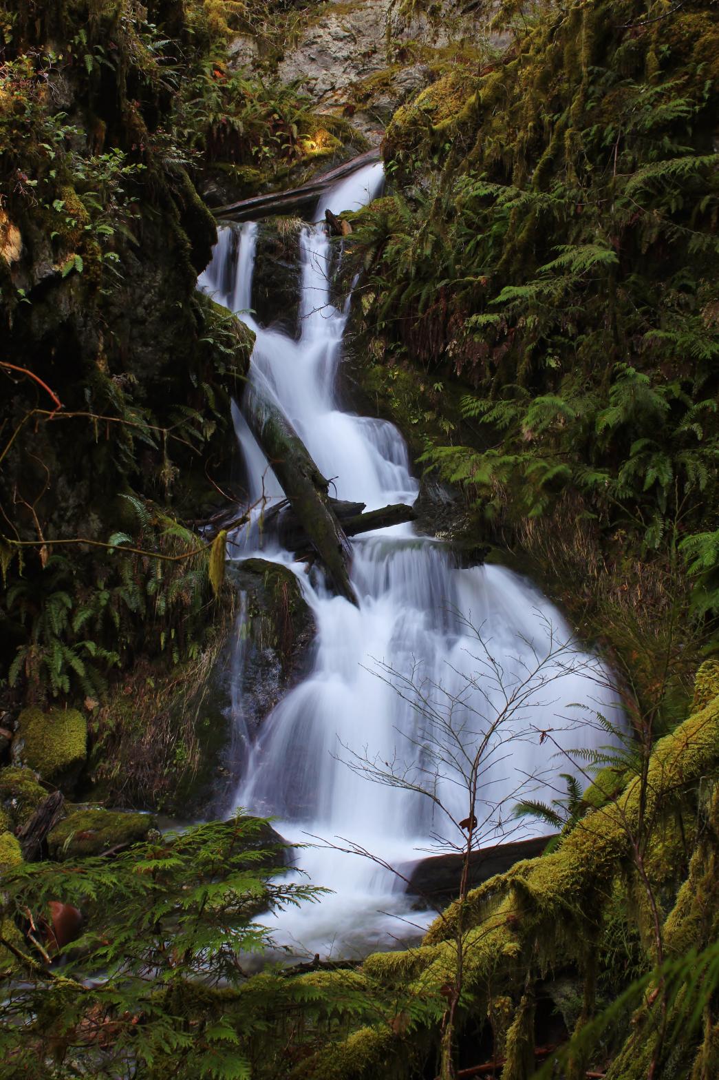 |
|
HOME SNOHOMISH COUNTY LINKS BEST IN THE NW WATERFALLS FOR KIDS FLICKR FACEBOOK STORE |
|
 Gold
Mountain Falls is a tall, but difficult to see, multi-tiered waterfall on
the east side of the Sauk River. The falls begin with the pretty 20'
tall plunge seen on the left. From there the creek drops down a 35'
tall bow-tie shaped drop that is difficult to see without some trees
blocking the view. A 10' plunge follows immediately below that and the
waterfall finishes with a 35' tall cascade (see Additional Pictures below).
Below that, the creek runs through a really pretty set of mossy boulder
cascades that would make some great pictures with the right lighting.
Gold
Mountain Falls is a tall, but difficult to see, multi-tiered waterfall on
the east side of the Sauk River. The falls begin with the pretty 20'
tall plunge seen on the left. From there the creek drops down a 35'
tall bow-tie shaped drop that is difficult to see without some trees
blocking the view. A 10' plunge follows immediately below that and the
waterfall finishes with a 35' tall cascade (see Additional Pictures below).
Below that, the creek runs through a really pretty set of mossy boulder
cascades that would make some great pictures with the right lighting.