![]()
HALHOMISH FALLS |
|
|
RATING -
23.2
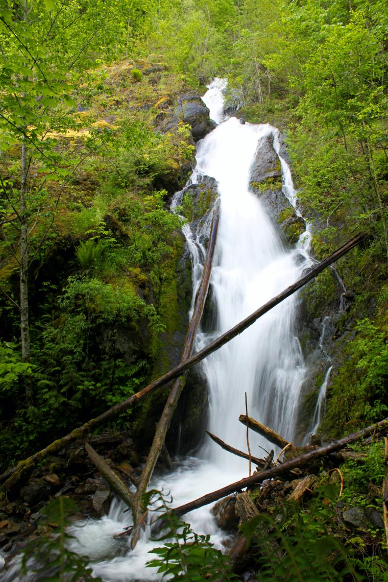
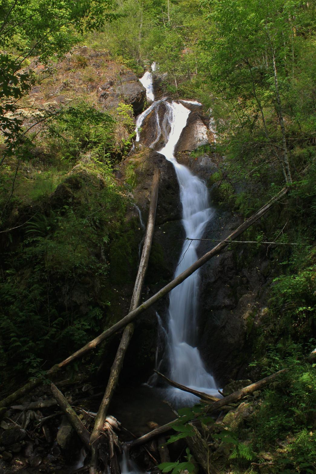
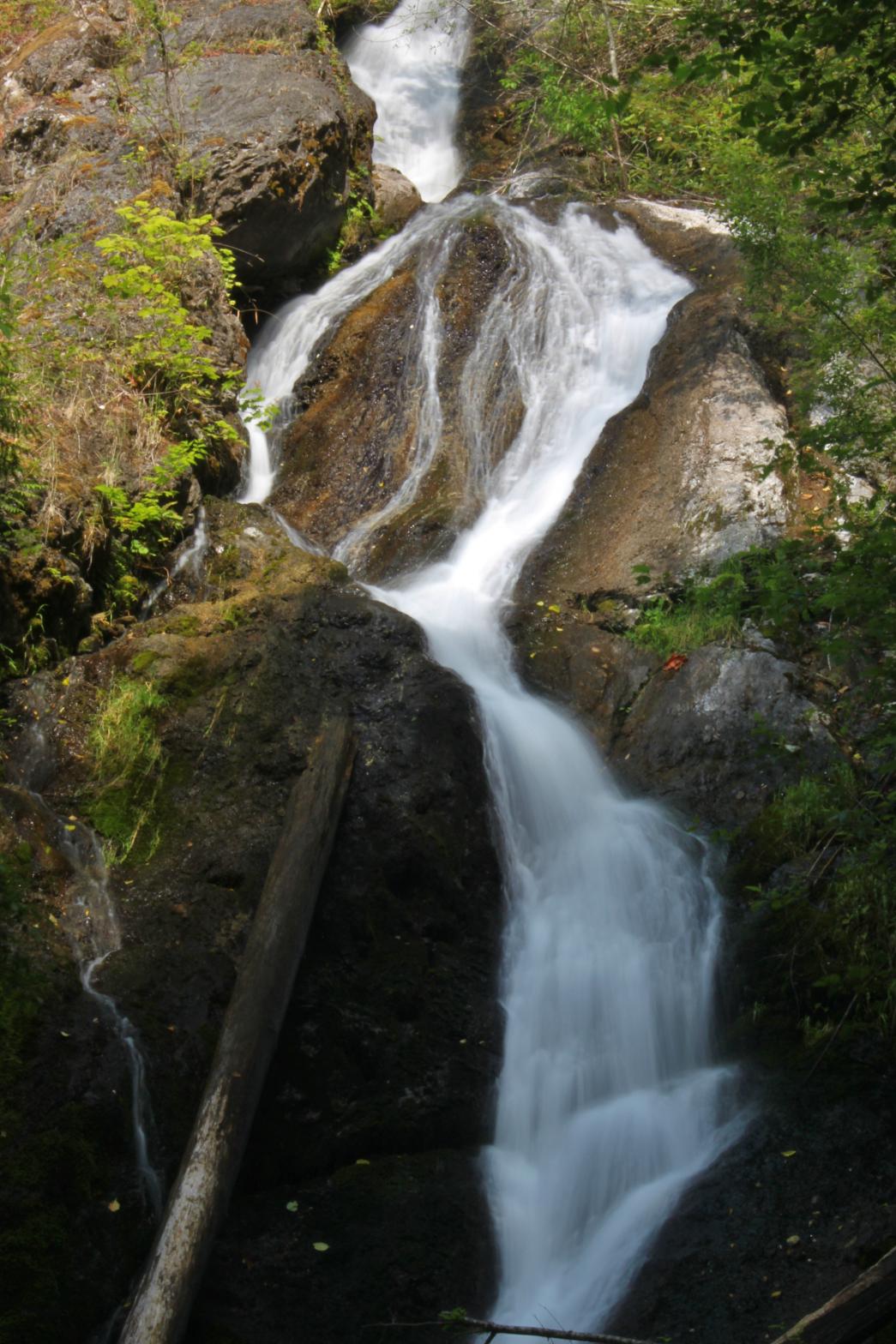
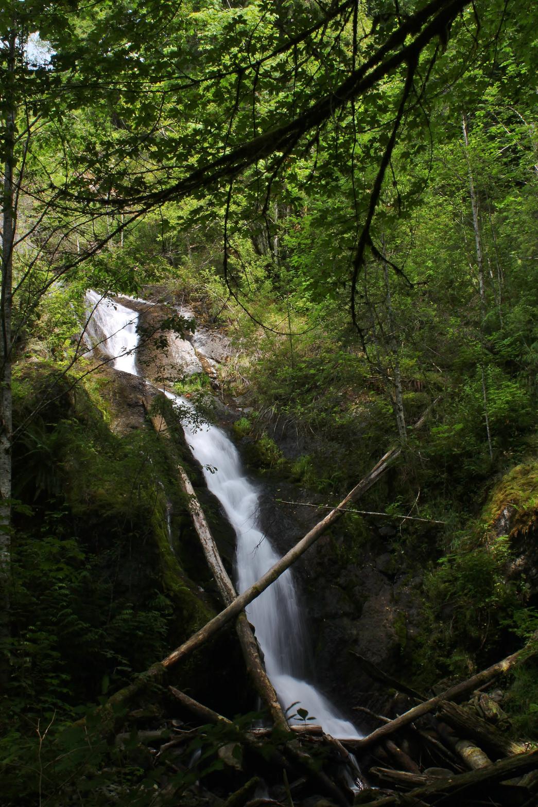
VR - 1.8 (Small) HR - 4.0 SR - 16/20 TYPE OF APPROACH - Bushwhack DIFFICULTY - Difficult LOCATION - Middle Fork Nooksack Road TYPE - Horsetail HEIGHT - 65' WIDTH - 10' GPS - N48 46.339 W122 03.669 ELEVATION - 1090' |
 Any time you have a creek named Falls Creek,
it's a good bet that there is a waterfall on it. I had looked at the
Topo maps of
this area endlessly and made two unsuccessful attempts into areas that looked somewhat
promising but couldn't find a waterfall. It finally occurred to me that the people
who named the creek were probably traveling along the river and that the waterfall would
be close to it. Sure enough, on my third visit, I found the waterfall and it was a
beauty. Halhomish is a Nooksack word meaning "beautiful" or
"handsome". The shape of the falls looks like a woman in a flowing gown so
I thought the name was fitting. Any time you have a creek named Falls Creek,
it's a good bet that there is a waterfall on it. I had looked at the
Topo maps of
this area endlessly and made two unsuccessful attempts into areas that looked somewhat
promising but couldn't find a waterfall. It finally occurred to me that the people
who named the creek were probably traveling along the river and that the waterfall would
be close to it. Sure enough, on my third visit, I found the waterfall and it was a
beauty. Halhomish is a Nooksack word meaning "beautiful" or
"handsome". The shape of the falls looks like a woman in a flowing gown so
I thought the name was fitting.Falls Creek drops over a 65' tall horse tailing drop at about a 50 degree angle. The creek below the falls is covered with bleeding hearts and the rocks on the side of the falls are full of red columbine as well as several other flowers. The falls are difficult to photograph because the top half of the falls is much brighter than the bottom half. Hope for overcast skies and go in the spring when the tiny creek is at its peak volume for the best experience. |
| DIRECTIONS - Head
east on the Mt. Baker Highway and turn south onto Mosquito Lake Road. Soon you will
drive through the community of Happy Valley and turn left
onto Middle Fork Road. At the 3.5 mile mark you will cross little Falls Creek.
Park and follow the ridge to the west of the creek downstream until you hit the
Middle Fork. Follow Falls Creek upstream about 100' to the falls. NEARBY WATERFALLS - Lower Wallace Creek Falls, Warm Creek Falls |
|
ADDITIONAL PICTURES
(CLICK TO ENLARGE) AND VIDEO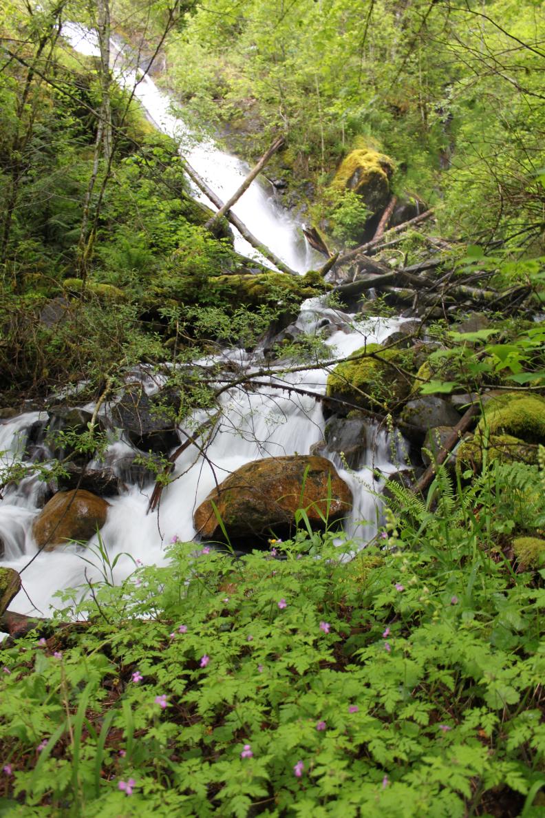
 |
|
HOME WHATCOM COUNTY LINKS BEST IN THE NW WATERFALLS FOR KIDS FLICKR FACEBOOK STORE |
|