![]()
LOWER WALLACE CREEK FALLS |
|
|
RATING -
24.0
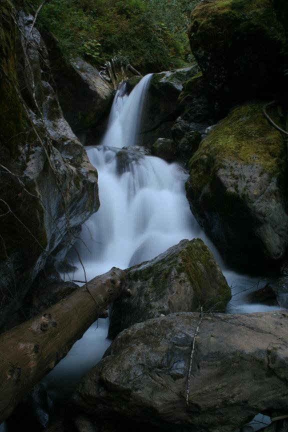
VR - 8 (Big) HR - 2.0 SR - 18/20 TYPE OF APPROACH - Roadside DIFFICULTY - Very Easy LOCATION - Middle Fork Nooksack Road TYPE - Tiered HEIGHT - 20' WIDTH - 10' GPS - N48 44.846 W121 56.706 ELEVATION - 2043' |
 Wallace Creek is a large creek in
the Middle Fork Nooksack Valley. The creek appears to harbor at least three
waterfalls. The uppermost looks like a sheer plunge near the headwaters of the
creek. The middle falls is located about two miles upstream in a steeply walled
canyon that I plan to visit sometime this summer. The lower falls is the smallest of
the three, but the only one that can be accessed with any degree of ease. Wallace Creek is a large creek in
the Middle Fork Nooksack Valley. The creek appears to harbor at least three
waterfalls. The uppermost looks like a sheer plunge near the headwaters of the
creek. The middle falls is located about two miles upstream in a steeply walled
canyon that I plan to visit sometime this summer. The lower falls is the smallest of
the three, but the only one that can be accessed with any degree of ease. Wallace Creek drops a total of about 20' in two back-to-back plunges
as it tears through some massive, mossy boulders. From the bridge over the creek,
you can see the bottom tier of the falls and part of the upper tier. With a ton of
effort I was able to get closer to the falls for some nice pictures. |
| DIRECTIONS - Head
east on the Mt. Baker Highway and turn south onto Mosquito Lake Road. Soon you will
drive through the community of Happy Valley. Just after leaving that area, turn left
onto Middle Fork Road. Around 11 miles down the road you will cross over Wallace
Creek (3rd concrete bridge on the road). The falls can be seen from the bridge, but
a difficult bushwhack down to the creek bed will be required to get a good view. NEARBY WATERFALLS - De Haro Falls, Halhomish Falls, Middle Wallace Creek Falls, Warm Creek Falls |
|
ADDITIONAL PICTURES (CLICK TO ENLARGE)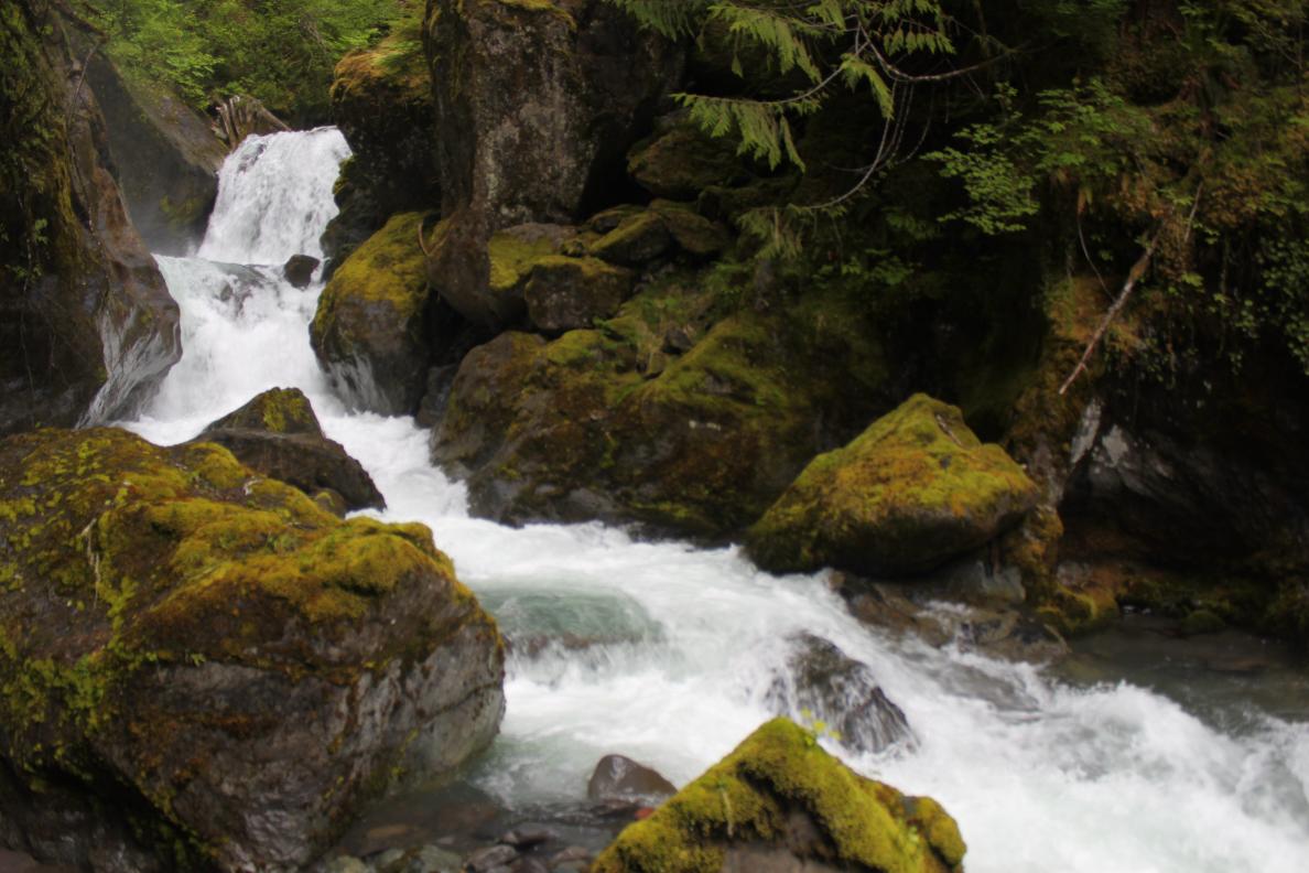 |
|
HOME WHATCOM COUNTY LINKS BEST IN THE NW WATERFALLS FOR KIDS FLICKR FACEBOOK STORE |
|