![]()
| MARIETTA FALLS | |
|
RATING - 48.0 VR - 6.0 (Med) HR - 6.0 SR - 12/20 TYPE OF APPROACH - Bushwhack DIFFICULTY - Medium LOCATION - South Skagit Highway TYPE - Tiered HEIGHT - 141' WIDTH - 15' GPS - N48 30.525 W121 55.156 ELEVATION - 277' |
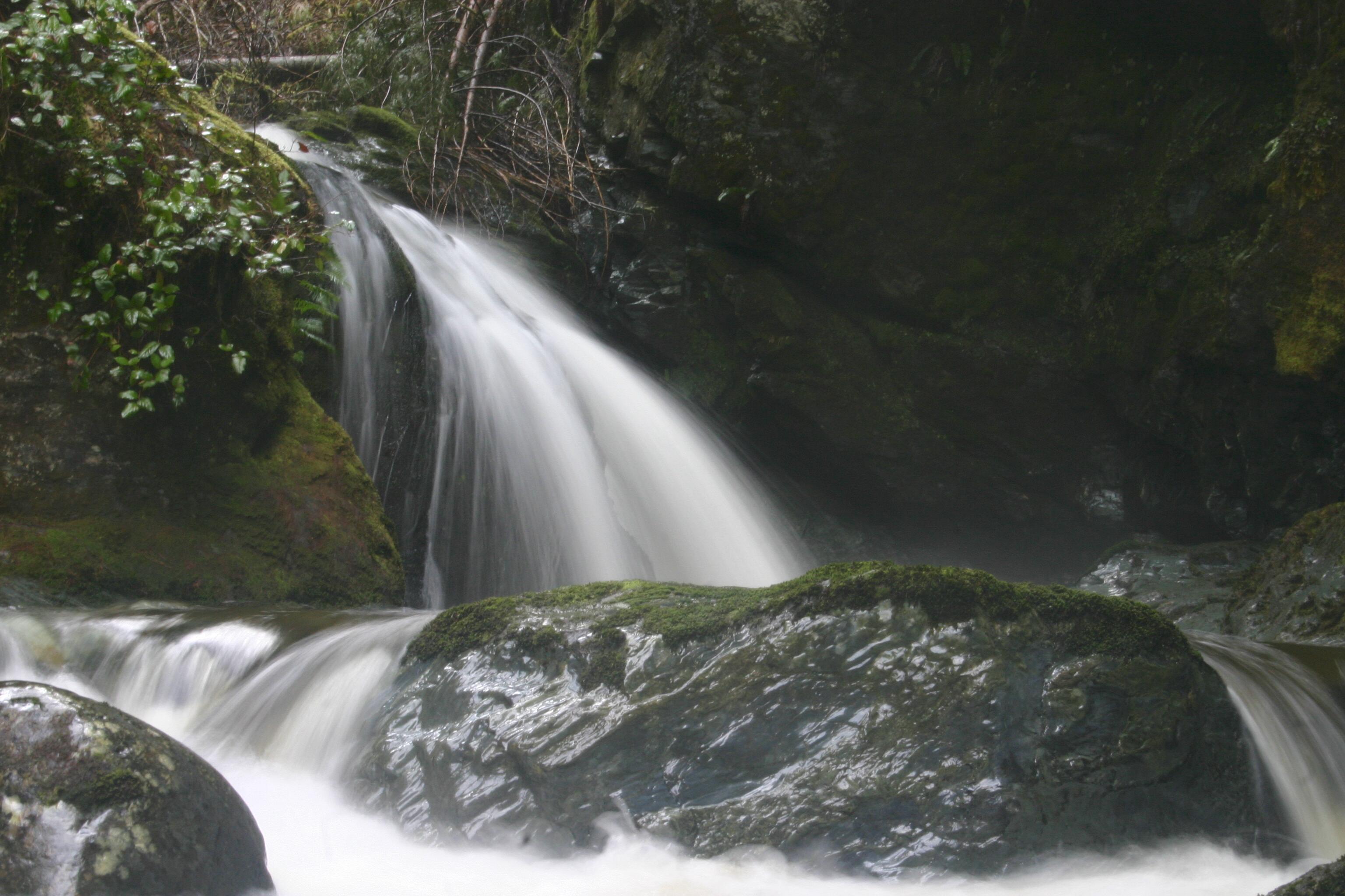
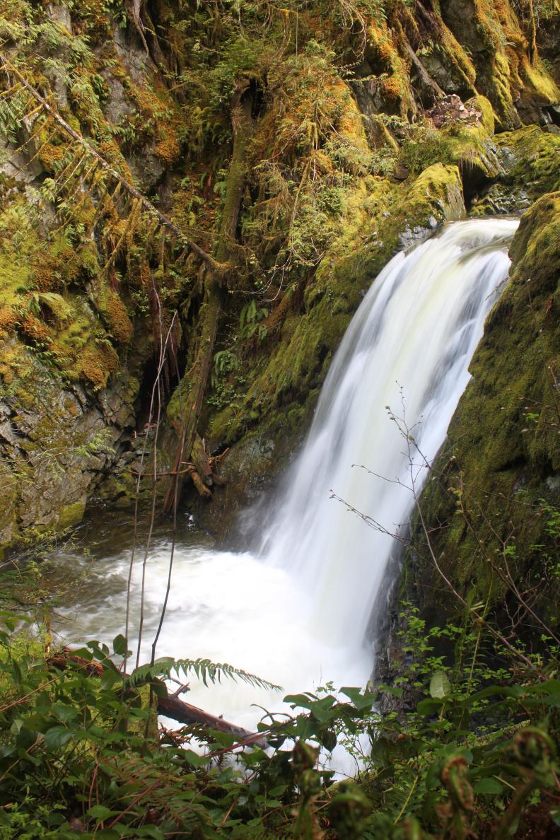
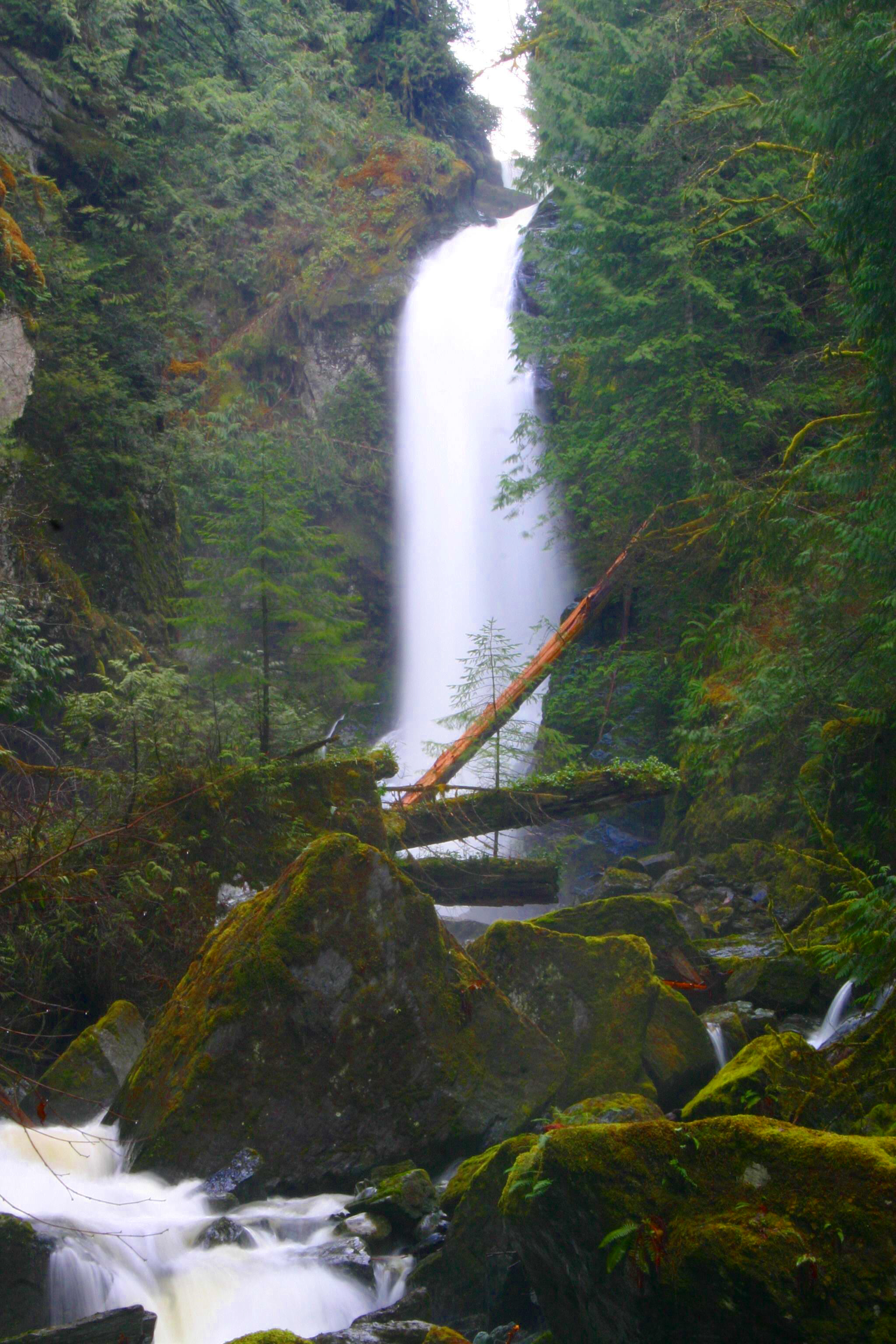
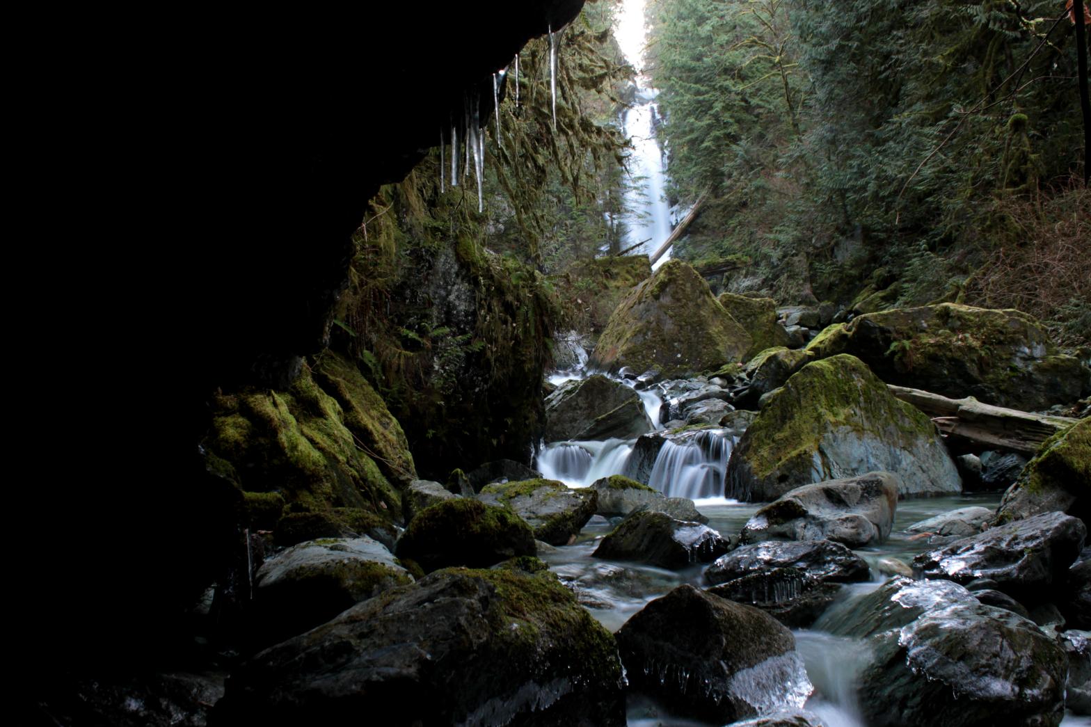
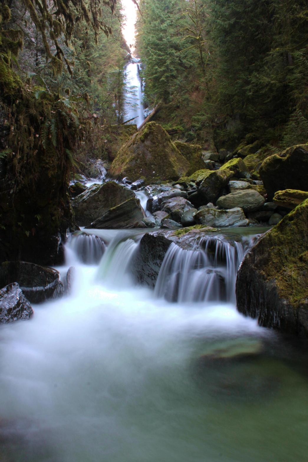 Marietta
Falls is one of the best waterfalls in the lower
part of Skagit Valley. O'Toole Creek drops 141' into
a very steeply walled canyon and runs through a series of huge boulders.
The main tier of the falls is a 102' tall
plunging drop that walls into a pretty pool of
water. Unfortunately, getting up close to
the falls is pretty difficult except in the
summer when the volume is lower. The
39' tall upper tier can be reached from the logging road above the falls
but it's not worth the trouble unless you're doing something else further up
the road. The falls are not too difficult to reach, but do
requiring fording the creek once (not easy in high water) and climbing up a fairly steep
hill (although someone has put a rope there to aid the climb). As you can see from
the pictures below, there's really one common vantage point, but it's good
enough you don't need another one. It is
possible to get closer to the falls if you don't
mind getting really wet. Marietta
Falls is one of the best waterfalls in the lower
part of Skagit Valley. O'Toole Creek drops 141' into
a very steeply walled canyon and runs through a series of huge boulders.
The main tier of the falls is a 102' tall
plunging drop that walls into a pretty pool of
water. Unfortunately, getting up close to
the falls is pretty difficult except in the
summer when the volume is lower. The
39' tall upper tier can be reached from the logging road above the falls
but it's not worth the trouble unless you're doing something else further up
the road. The falls are not too difficult to reach, but do
requiring fording the creek once (not easy in high water) and climbing up a fairly steep
hill (although someone has put a rope there to aid the climb). As you can see from
the pictures below, there's really one common vantage point, but it's good
enough you don't need another one. It is
possible to get closer to the falls if you don't
mind getting really wet. |
| DIRECTIONS - Drive
along the South Skagit Highway to the point where it crosses over O'Toole Creek.
Just west of the creek is a logging road. Turn into it and immediately park at the
gate. A small trail leads along the creek for a little ways. When it ends,
cross the creek (which will require you getting wet) and climb up the 15' tall hill/cliff
on the far side. Someone has graciously left a rope to assist the climb. From
there just follow the hillside around to a nice rock with a good view. It is
possible to get closer to the falls but you will get wet and in high water it would be
very dangerous. NEARBY WATERFALLS - Mill Creek Falls |
|
|
VIDEOS |
|
ADDITIONAL PICTURES
(CLICK TO ENLARGE)


 |
|
| HOME SKAGIT COUNTY LINKS BEST IN THE NW WATERFALLS FOR KIDS FLICKR FACEBOOK STORE | |