![]()
MILL CREEK FALLS |
|
|
RATING -
50.0
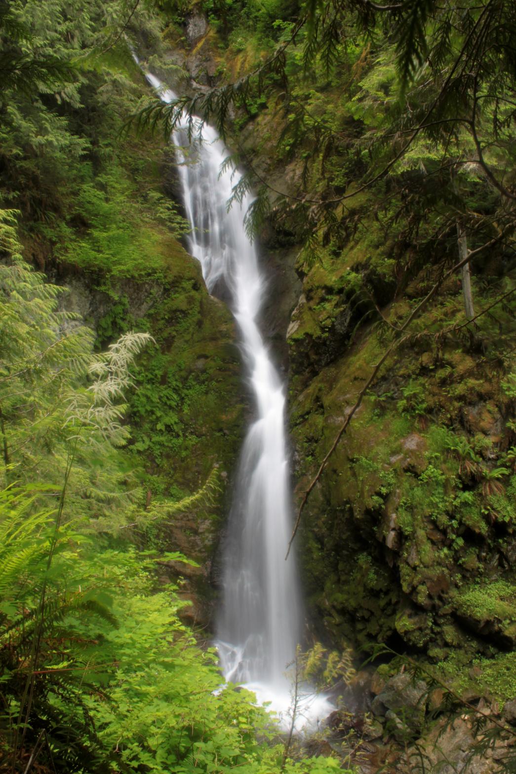
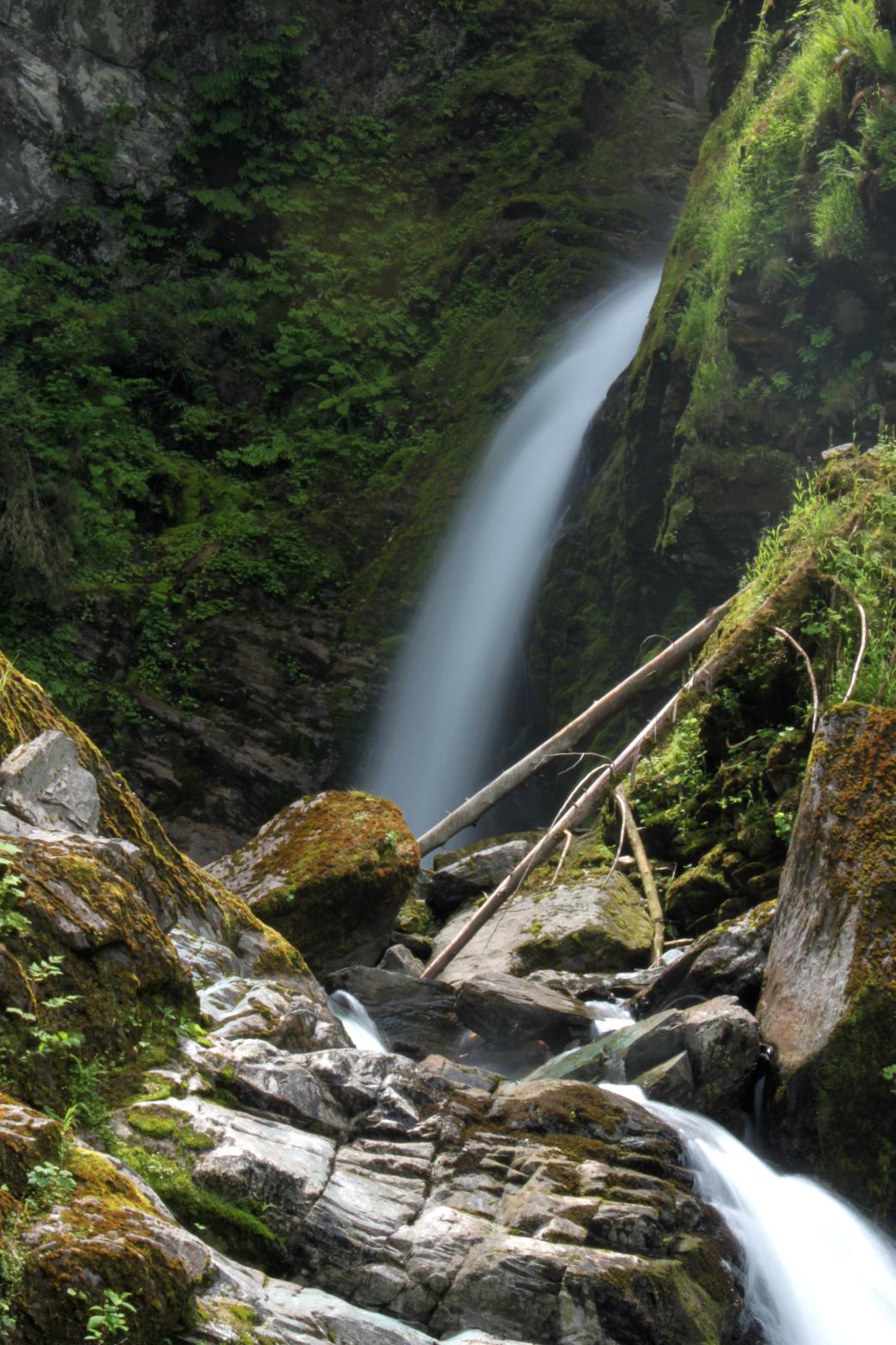
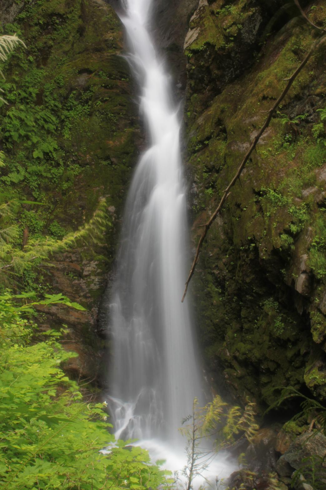
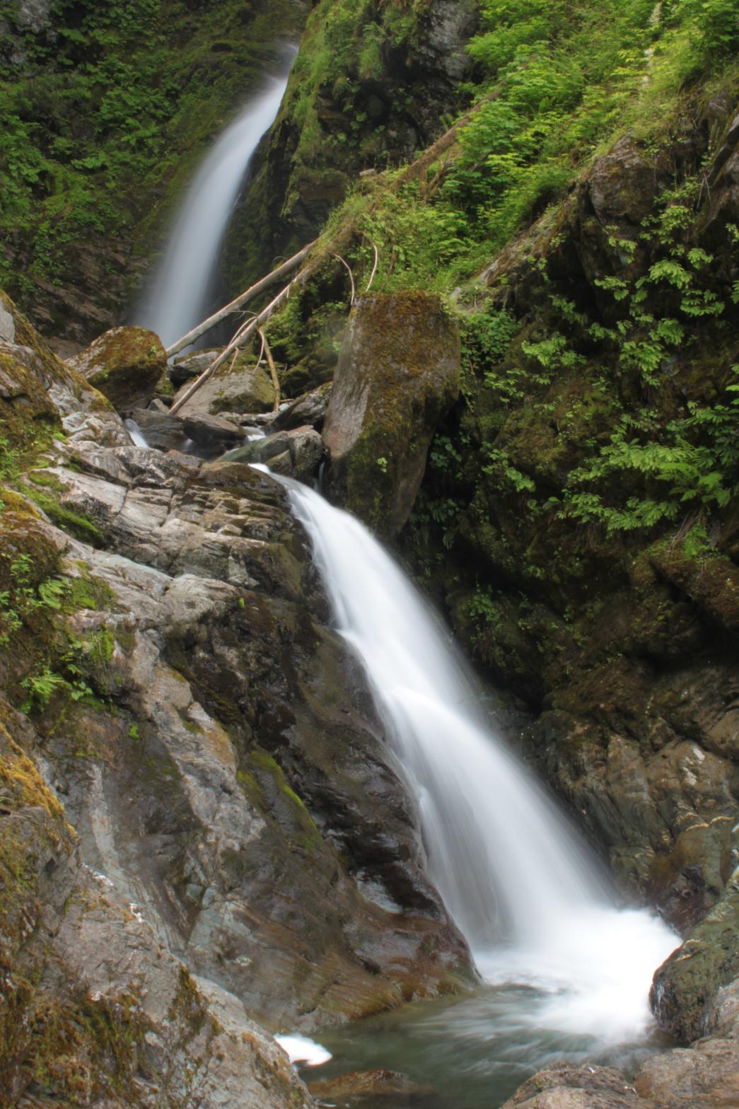
VR - 6 (Med) HR - 6.0 SR - 14/20 TYPE OF APPROACH - Bushwhack DIFFICULTY - Difficult LOCATION - South Skagit Highway TYPE - Tiered HEIGHT - 190' WIDTH - 10' |
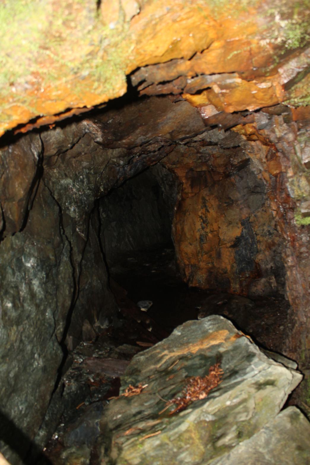
Located at the base of the falls on the left is an old mine of some sort. I haven't been able to find any information about this mine, but I have a friend of mine researching the matter. I walked about 100' into the mine before it got too dark to continue. If I go back to the waterfall, I'll be sure to take a flashlight so I can investigate further. As cool as the area is, it takes a long time to get in there. The round trip was about five hours. There are only a couple of difficult spots on the journey; it's just long. If you attempt the trip upstream from the highway, make sure you have shoes with good ankle support and plan on getting wet. |
|
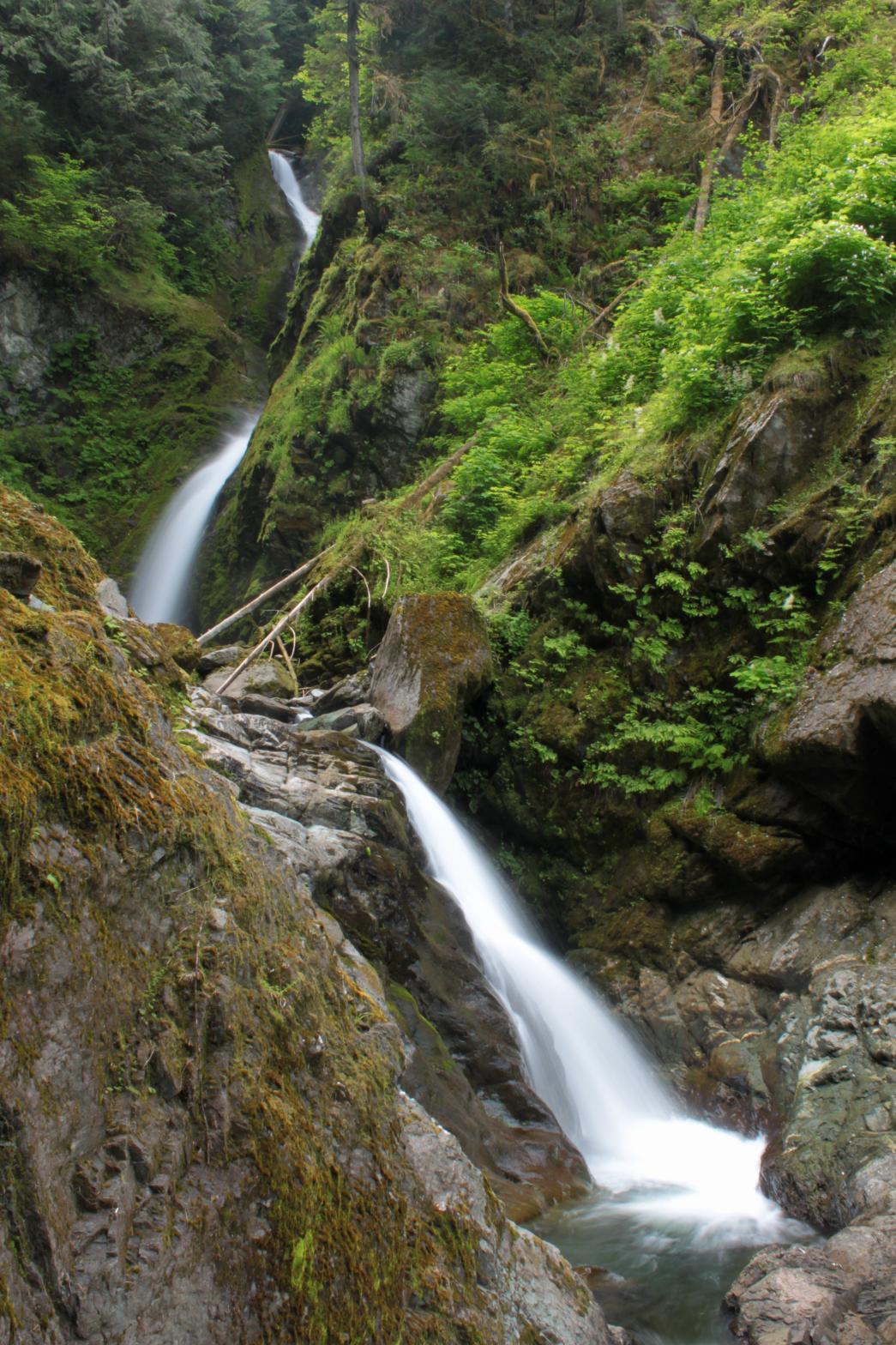
DIRECTIONS - Mill Creek is located along the South Skagit Highway about a
mile east of O'Toole Creek. Park at the creek and begin the long
journey upstream. The falls are about two miles upstream. The
journey is not horribly difficult, but it's long and time consuming.
You'll have to climb over or around a couple small lower falls and wade
through a couple waist deep pools. It's probably possible to save some
of the bushwhack by walking up a logging road on the west side of the creek
and climbing into the canyon but I haven't done it that way yet. NEARBY WATERFALLS - Marietta Falls |
|
|
ADDITIONAL PICTURES (CLICK TO ENLARGE) AND VIDEO
 |
|
HOME SKAGIT COUNTY LINKS BEST IN THE NW WATERFALLS FOR KIDS FLICKR FACEBOOK STORE |
|