![]()
McGILLICUDDYS FALLS |
|
|
RATING -
24.4
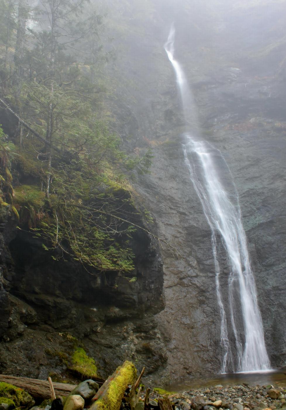
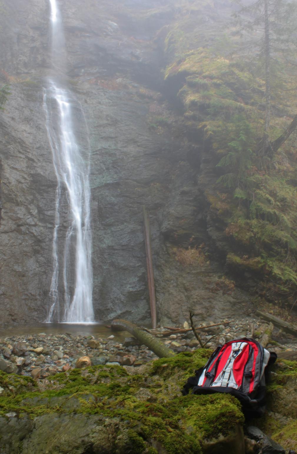
VR - 3.6 (Med/Sm) HR - 4.0 SR - 12/20 TYPE OF APPROACH - Bushwhack DIFFICULTY - Medium LOCATION - Lake Cavanaugh Area TYPE - Segmented HEIGHT - 80' WIDTH - 100' GPS - N48 19.624 W121 56.436 ELEVATION - 1649' |
There's nothing too difficult about getting to the falls but it does require scrambling down a somewhat steep slope (around 35 degree angle). I would imagine the right segment dries out in the summer but there should always be some water in the left half. I named the falls after McGillicuddys Peak from which the streams originate. |
| DIRECTIONS - Drive
East from I-5 through Arlington on Highway 530. About 16.5 miles from
the freeway, turn left onto E Brooks Creek Road. There are a mess of
roads leading off from here but if you stay on the main road after the first
fork you should be OK. Take the following forks: left, right,
right, left, left. Just after this final left you will go over the
creek on a bridge. Keep driving up the road, taking a sharp right at
the next fork and then parking at a small pullout just before the next
junction. There should be a small stream just off the road on the
downhill side. Follow this down, staying on the right side of the
creek for about 800' (300' vertical drop) until you come out at the falls. NEARBY WATERFALLS - Dicks Creek Falls |
|
ADDITIONAL PICTURES (CLICK TO ENLARGE) AND
VIDEO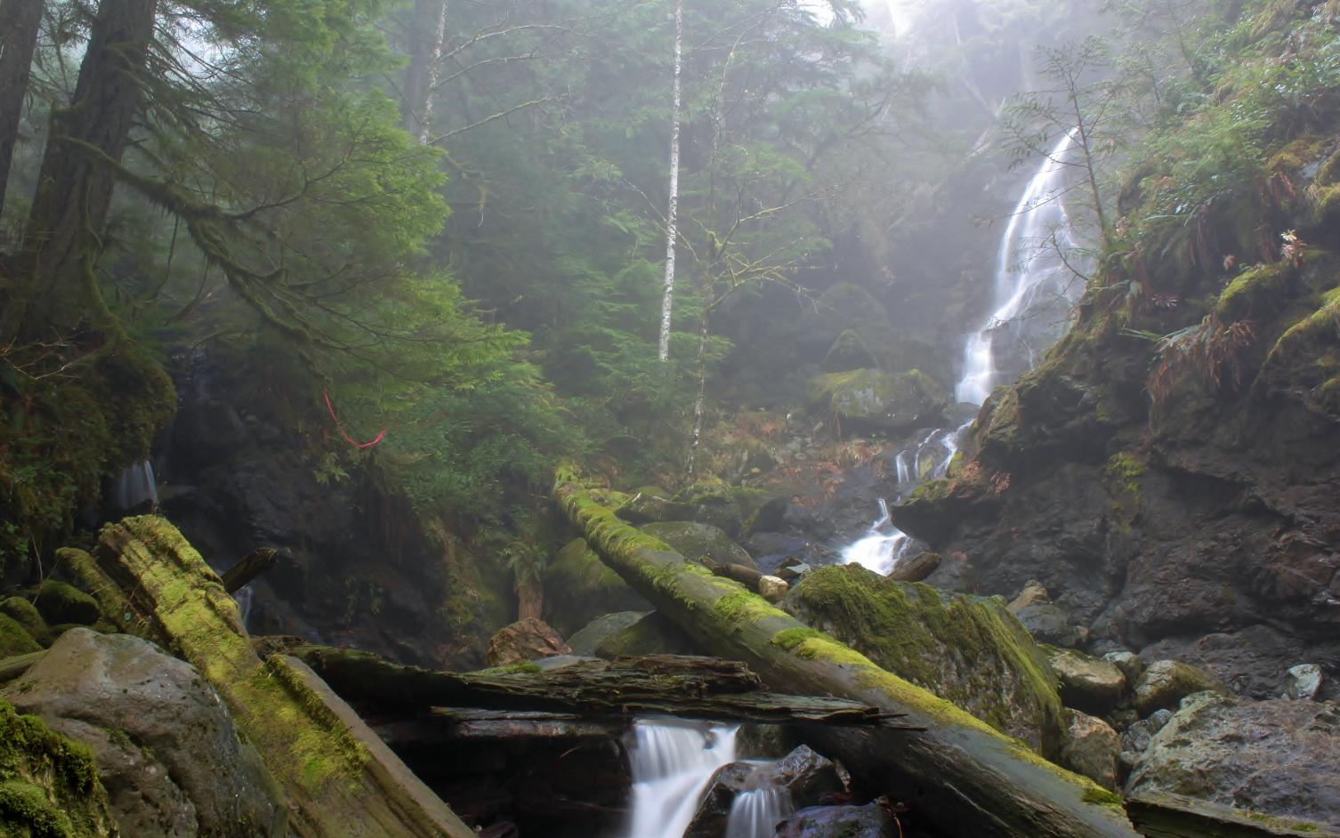
|
|
HOME SKAGIT COUNTY LINKS BEST IN THE NW WATERFALLS FOR KIDS FLICKR FACEBOOK STORE |
|
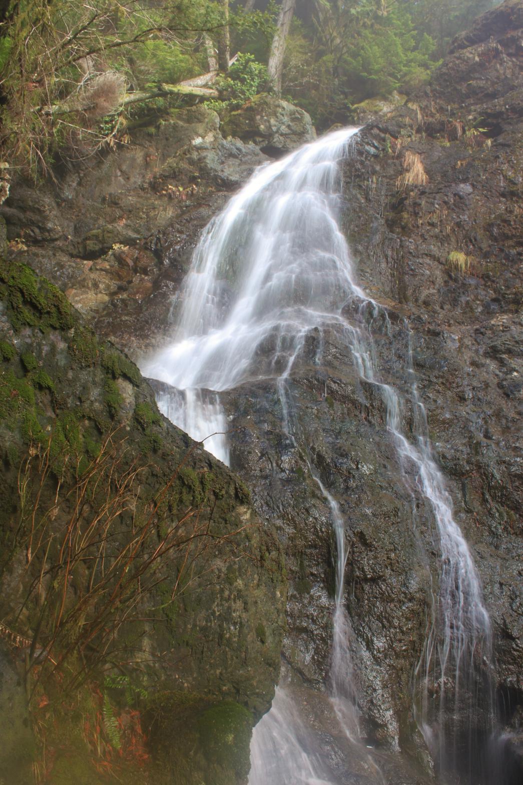 This nice pair of falls occurs where two branches of a small, unnamed creek
join together in side-by-side waterfalls. The left side is the larger
volume of the two, dropping about 25' in a pretty fan, before curtaining
another 20' and finishing by cascading another 15' or so.
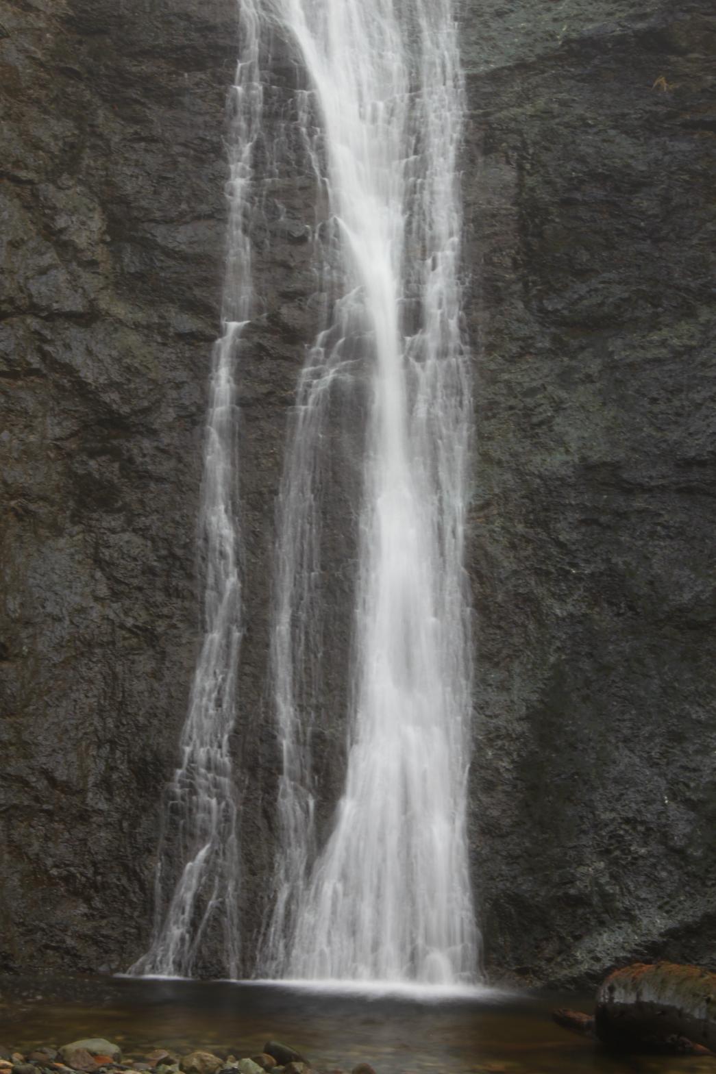
The right segment is a plunge of about 80' tall, but on a smaller stream.
When I first scouted the area a couple weeks before I found the falls, the
creek had easily three times as much water so it looks like this could be
really impressive in the right conditions.
This nice pair of falls occurs where two branches of a small, unnamed creek
join together in side-by-side waterfalls. The left side is the larger
volume of the two, dropping about 25' in a pretty fan, before curtaining
another 20' and finishing by cascading another 15' or so.
The right segment is a plunge of about 80' tall, but on a smaller stream.
When I first scouted the area a couple weeks before I found the falls, the
creek had easily three times as much water so it looks like this could be
really impressive in the right conditions.