![]()
MIDDLE DAVIS CREEK FALLS |
|
|
RATING -
15.0
VR - 1.8 (Small) HR - 4.0 SR - 6/20 TYPE OF APPROACH - Bushwhack DIFFICULTY - Medium LOCATION - Mt. Baker Highway TYPE - Cascades HEIGHT - 64' WIDTH - 5' GPS - N48 52' 38.70", W121 55' 48.01" ELEVATION - 1380' |
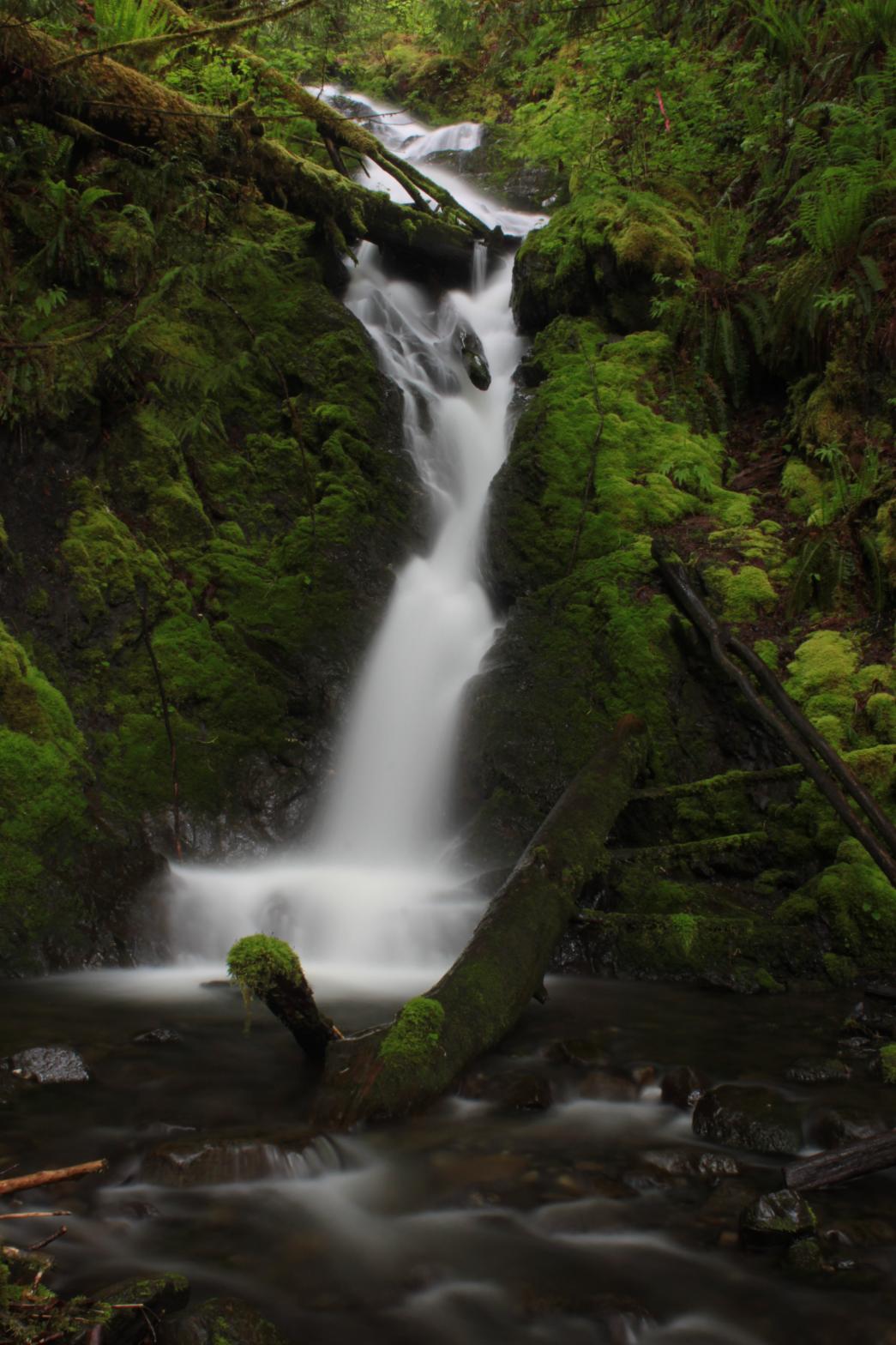 Davis
Creek near Glacier is chock full of waterfalls. There are at least
four major waterfalls on the creek. Middle Davis Creek Falls occurs just upstream from the road and
can actually be seen from the car. Here the creek drops 64' over a
series of cascades, culminating in a plunging final drop. It's not a
spectacular waterfall, but there are certainly worse ones around. A clear view can be attained with a
short bushwhack up the right side of the creek. Stay on top of the
ridge until the last second and you will make the journey a lot easier on
yourself. The first time I visited the falls I thought they were
really ugly and hardly worth the effort to view. My second trip took
place in the spring and the waterfall is much more worthy than I previously
thought. There is a lot of gorgeous moss lining the creek, making it a
pretty scene, even if the waterfall itself is a little lacking. Davis
Creek near Glacier is chock full of waterfalls. There are at least
four major waterfalls on the creek. Middle Davis Creek Falls occurs just upstream from the road and
can actually be seen from the car. Here the creek drops 64' over a
series of cascades, culminating in a plunging final drop. It's not a
spectacular waterfall, but there are certainly worse ones around. A clear view can be attained with a
short bushwhack up the right side of the creek. Stay on top of the
ridge until the last second and you will make the journey a lot easier on
yourself. The first time I visited the falls I thought they were
really ugly and hardly worth the effort to view. My second trip took
place in the spring and the waterfall is much more worthy than I previously
thought. There is a lot of gorgeous moss lining the creek, making it a
pretty scene, even if the waterfall itself is a little lacking. |
|
DIRECTIONS - Drive east on the Mt Baker Highway to the town of Glacier.
Just past the little store in town, turn right onto Coal Creek Road (before
crossing Gallop Creek). Take the middle road in a few feet at a weird
intersection and follow the road for a little over a mile to the creek.
The falls can be seen from the road. A short bushwhack up the right
side of the creek will get you a good view from the base. NEARBY WATERFALLS - Davis Creek Falls, Lower Davis Creek Falls |
|
ADDITIONAL PICTURES (CLICK TO ENLARGE) AND VIDEO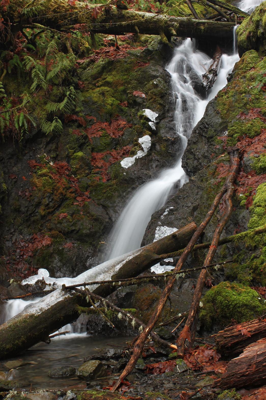
 |
|
HOME WHATCOM COUNTY LINKS BEST IN THE NW WATERFALLS FOR KIDS FLICKR FACEBOOK STORE |
|