![]()
OYSTER CREEK FALLS |
|
|
RATING - 38.0
VR - 4 (Med/Sm) HR - 6.0 SR - 14/20 TYPE OF APPROACH - Trail + Bushwhack DIFFICULTY - Very Difficult LOCATION - Chuckanut Mountain TYPE - Tiered HEIGHT - 130' WIDTH - 15' GPS - N48 38.430 W122 26.380 ELEVATION - 600' |
|
| DIRECTIONS - Follow
the directions to Lost Lake Falls. At the first
fork, take the right hand trail and follow it very steeply downhill and past a small, log
choked pond. Soon after you will run into a logging road. Follow that for
around 1/2 a mile until it makes a sharp turn to the right with another road heading off
from the corner. Follow this new road for a few hundred feet. Keep your eyes
open for pink ribbons on the right. If you enter the woods in the right spot you
will find an obscure boot path. Either way, follow the small tributary downstream to
where it joins Oyster Creek at the base of the falls (maybe 1/4 mile from the road). NEARBY WATERFALLS - Chuckanut Mountain Falls, Clayton Beach Falls, Lost Lake Falls, Upper Oyster Creek Falls |
|
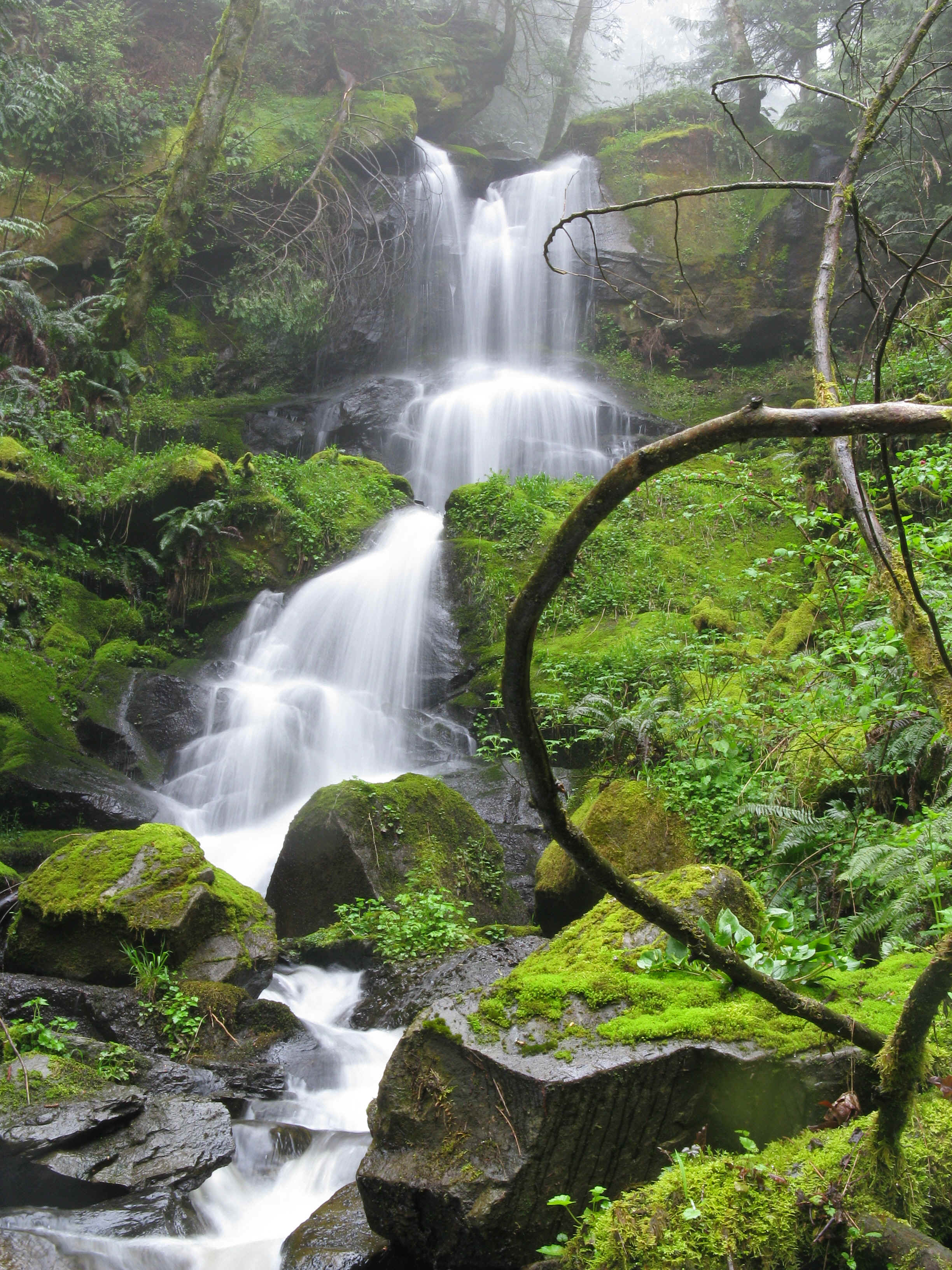
ADDITIONAL PICTURES (CLICK TO ENLARGE)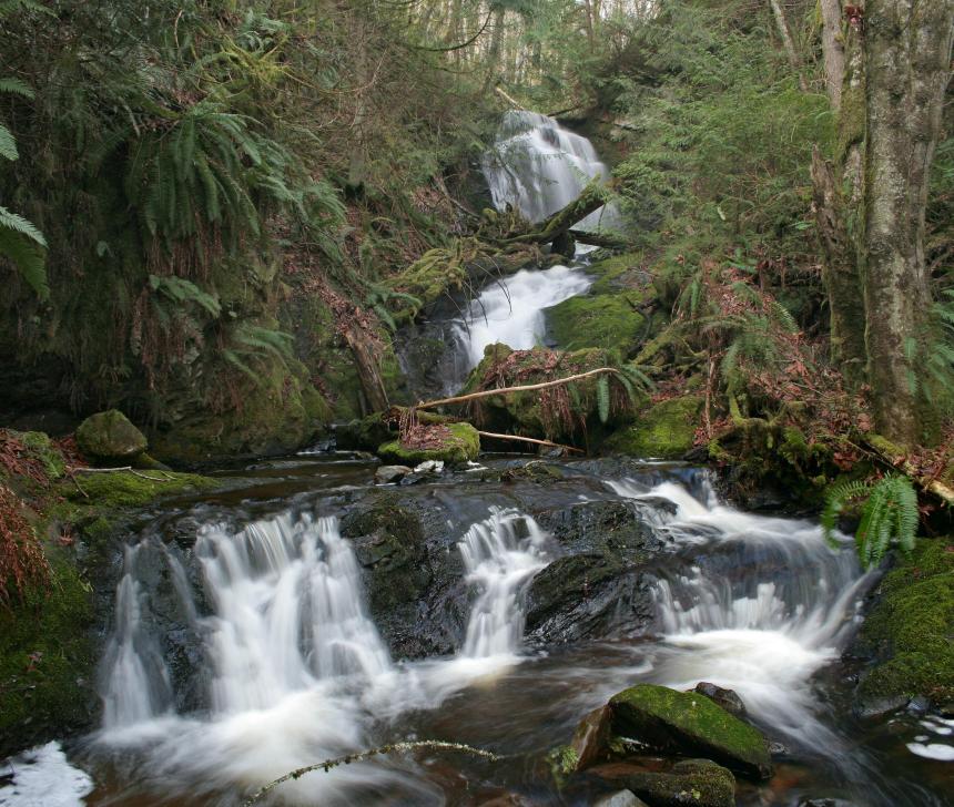

 |
|
HOME SKAGIT COUNTY LINKS BEST IN THE NW WATERFALLS FOR KIDS FLICKR FACEBOOK STORE |
|
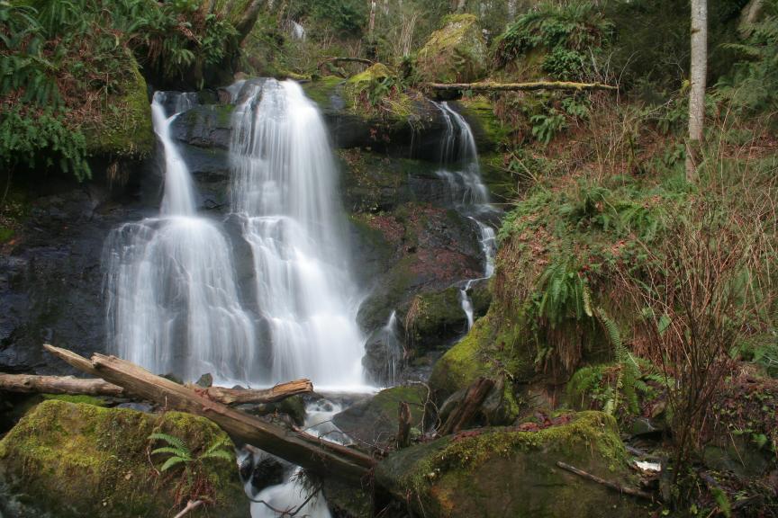
 Oyster
Creek Falls had been plaguing me for quite a while. I had looked at the
Topo maps
and I was pretty sure there was a falls there. Then, I read in Bob Mooers book that
he had found it so I knew it existed. I tried to get there the day after Christmas
2007, but got turned around by snow. Brett and I tried one day in February by going
upstream from Chuckanut Drive and didn't make it. When I finally made it, I was
thrilled by the beautiful falls. It's a tough trip in, but well worth it for a
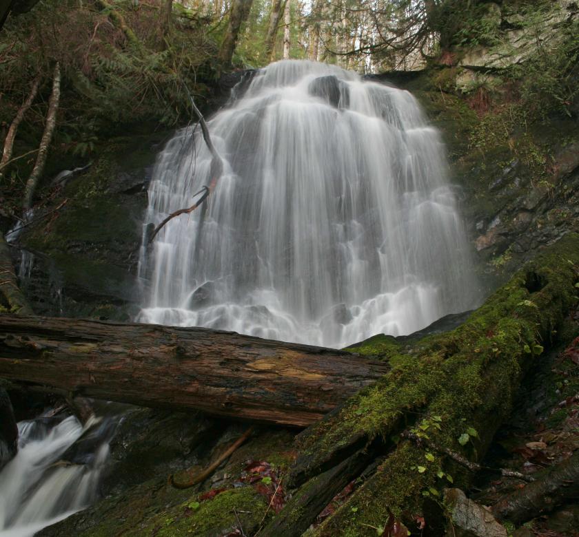
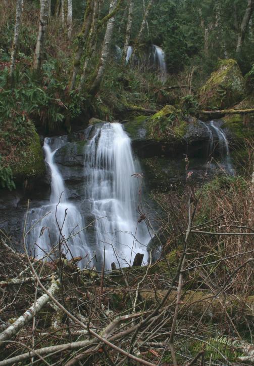
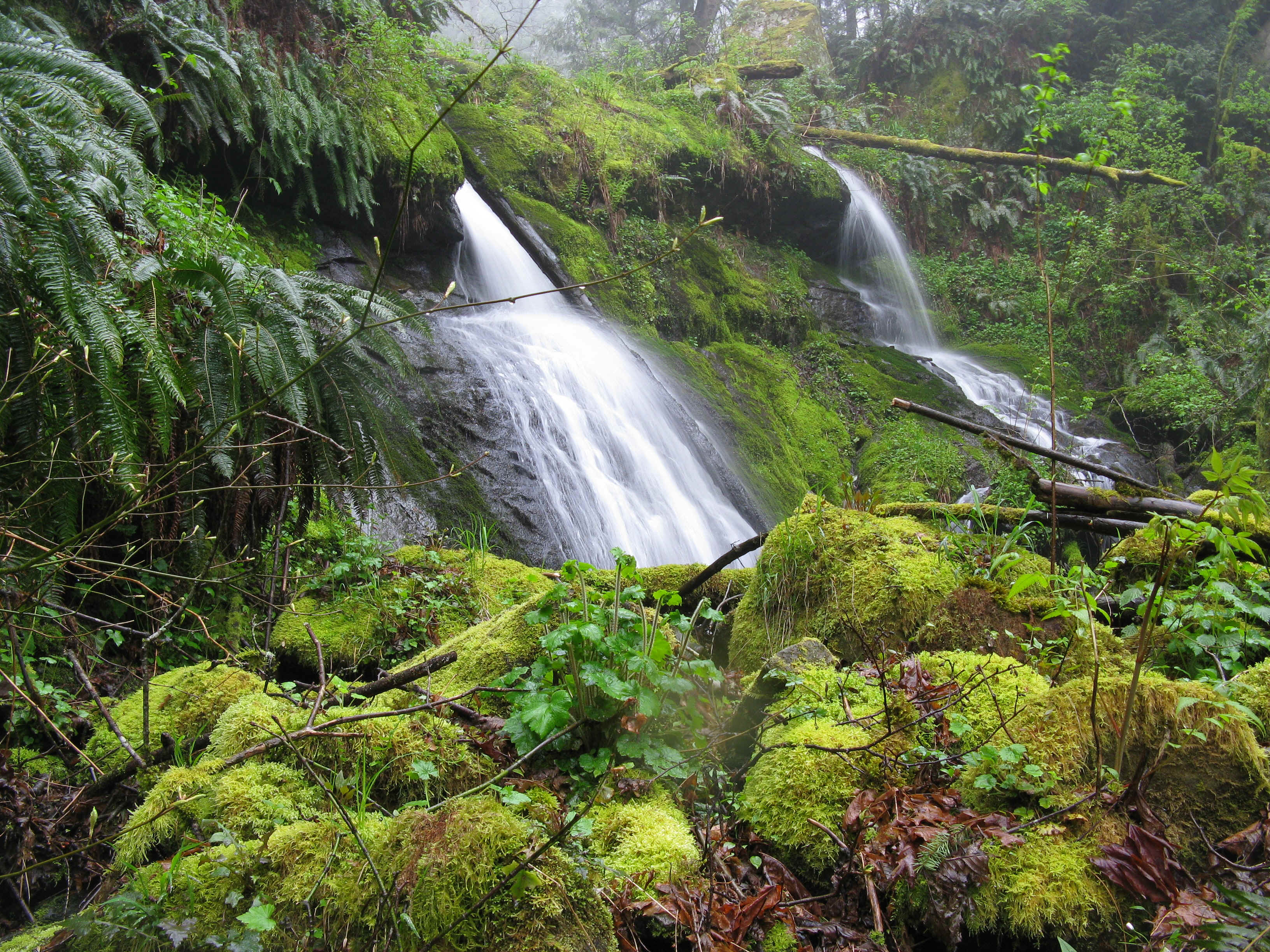
serious waterfall hunter. The
falls have three major sections. The top section consists of a really pretty 25'
tall fan shaped drop, followed by about 20' worth of cascades. The middle section
has a very nice 50' tall, 3 tiered drop with about 10' of cascades below. The final
drop is a nice segmented, 20' tall drop.
Oyster
Creek Falls had been plaguing me for quite a while. I had looked at the
Topo maps
and I was pretty sure there was a falls there. Then, I read in Bob Mooers book that
he had found it so I knew it existed. I tried to get there the day after Christmas
2007, but got turned around by snow. Brett and I tried one day in February by going
upstream from Chuckanut Drive and didn't make it. When I finally made it, I was
thrilled by the beautiful falls. It's a tough trip in, but well worth it for a
serious waterfall hunter. The
falls have three major sections. The top section consists of a really pretty 25'
tall fan shaped drop, followed by about 20' worth of cascades. The middle section
has a very nice 50' tall, 3 tiered drop with about 10' of cascades below. The final
drop is a nice segmented, 20' tall drop.