| DIRECTIONS - From North Bend, turn north onto Ballarat Ave, which changes to 428th Ave, and then North Fork Rd. Two miles after crossing the river, take the left at a Y in the road. In a few miles the road will turn from paved to gravel. Just past this point, the road takes a sharp left turn with a gated dirt road going off to the right. Park and walk down this road taking a left at the first fork and then right at every other fork. Eventually you will see the falls on the opposite side of the river. The falls can also be seen by traveling past Lower SMC Falls to the Black Creek Powerhouse and following the creek to the edge of the cliff. I know of two guys who made their way down to the North Fork from there and photographed the falls from the base, but there were trees in the way so the pictures were so-so. | |
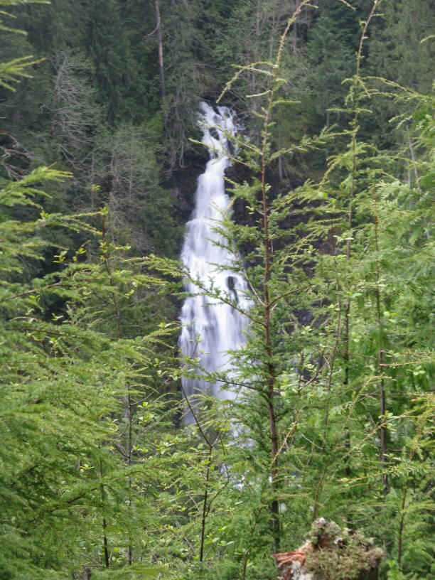
| LOCATION - Snoqualmie Tree Farm TYPE - Plunge HEIGHT - 100' WIDTH - 15' |
RATING -  TYPE OF APPROACH - Trail DIFFICULTY - Fairly Easy |
| NEARBY WATERFALLS - Crater Creek Falls, Fantastic Falls, Lower SMC Falls, Luna Falls, Old Spur Falls, Rachor Falls, SMC Falls | A small stream runs down from the Moon Wall and right past the Black Creek Powerhouse. There it is joined by the tailrace from the powerhouse and runs about 100' before dropping over this 100' plunge into the North Fork. The easy view is from across the river but it is possible to get to the base with a lot of work. This falls is also called Discovery Falls by Tony who first photographed it and Tailrace Falls by Bryan Swan. Take your pick. |
The cool logo on the powerhouse |
Powerhouse Falls from across the North Fork |