![]()
BLUEBERRY FALLS |
|
|
RATING -
32.0
VR - 8.0 (Big) HR - 3 SR - 8/20 TYPE - Tiered HEIGHT - 50' WIDTH - 15' TYPE OF APPROACH - Bushwhack DIFFICULTY - Very Difficult LOCATION - Baker Lake Area GPS - N48 44.453 W121 41.138 ELEVATION - 1077' |
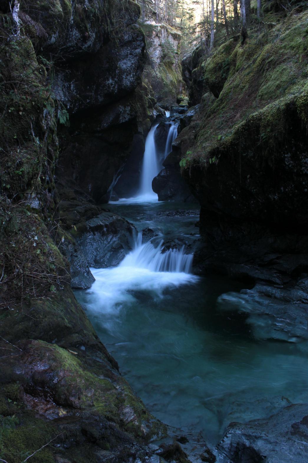 Park Creek runs
through a narrow canyon that contains at least five small waterfalls. The main
section of the falls consists of a plunge of about 20' followed almost immediately by the
30-35' drop in my picture. Above these two there are two 5-10' drops and another
small drop downstream from the main section. Getting the view I did requires a
difficult and steep scramble down the side of the canyon. Getting an over-the-top
view of the falls is not real difficult but also not real rewarding. I named the
falls for the massive amounts of delicious wild blueberries around the falls. Watch
out for bees. I got stung 3 times on the way in. Park Creek runs
through a narrow canyon that contains at least five small waterfalls. The main
section of the falls consists of a plunge of about 20' followed almost immediately by the
30-35' drop in my picture. Above these two there are two 5-10' drops and another
small drop downstream from the main section. Getting the view I did requires a
difficult and steep scramble down the side of the canyon. Getting an over-the-top
view of the falls is not real difficult but also not real rewarding. I named the
falls for the massive amounts of delicious wild blueberries around the falls. Watch
out for bees. I got stung 3 times on the way in.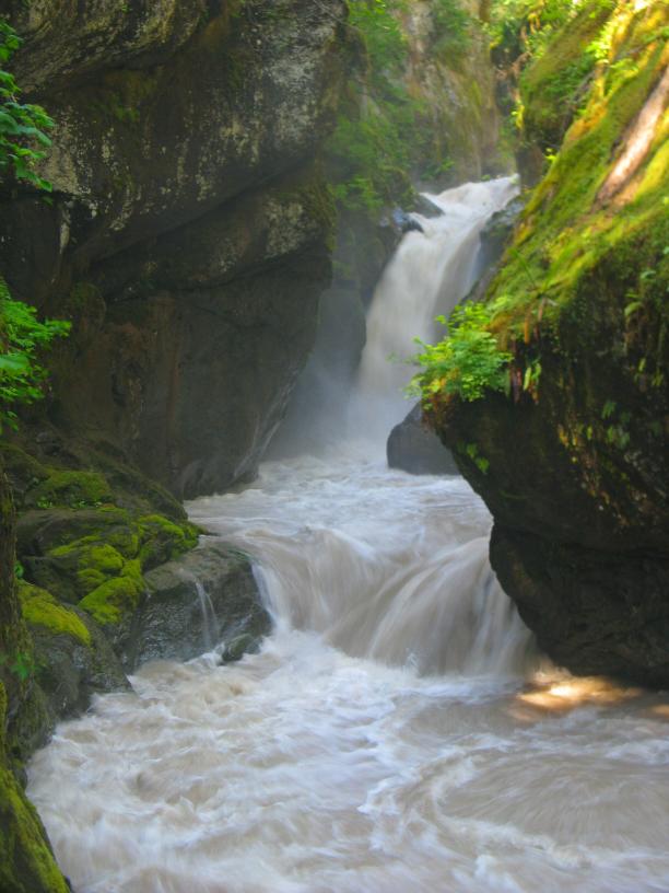 |
| DIRECTIONS - Drive
east on HWY 20 and turn left onto Baker Lake Road. In around 14 miles, you'll cross
over Boulder Creek. Turn left onto FR 1130 just after the creek. Take the
right at the first fork. In around 3 miles the road goes over Park Creek. The
falls are located maybe 1/4 of a mile downstream from the bridge. I parked at the
corner about 800' before the bridge and headed into the woods from there. NEARBY WATERFALLS - Boulder Camp Falls, Lava Divide Falls, Lower Morowitz Falls, Rainbow Falls, Upper Morowitz Falls |
|
HOME WHATCOM COUNTY LINKS BEST IN THE NW WATERFALLS FOR KIDS FLICKR FACEBOOK STORE |
|