![]()
LOWER FURLAND FALLS |
|
|
RATING - 14.0
VR - 4 (M/Sm) HR - 2.0 SR - 6/20 TYPE OF APPROACH - Trail + Bushwhack DIFFICULTY - Medium LOCATION - Darrington area TYPE - Tiered HEIGHT - 45' WIDTH - 10' GPS - N48 14.740 W121 42.384 ELEVATION - 1132' |
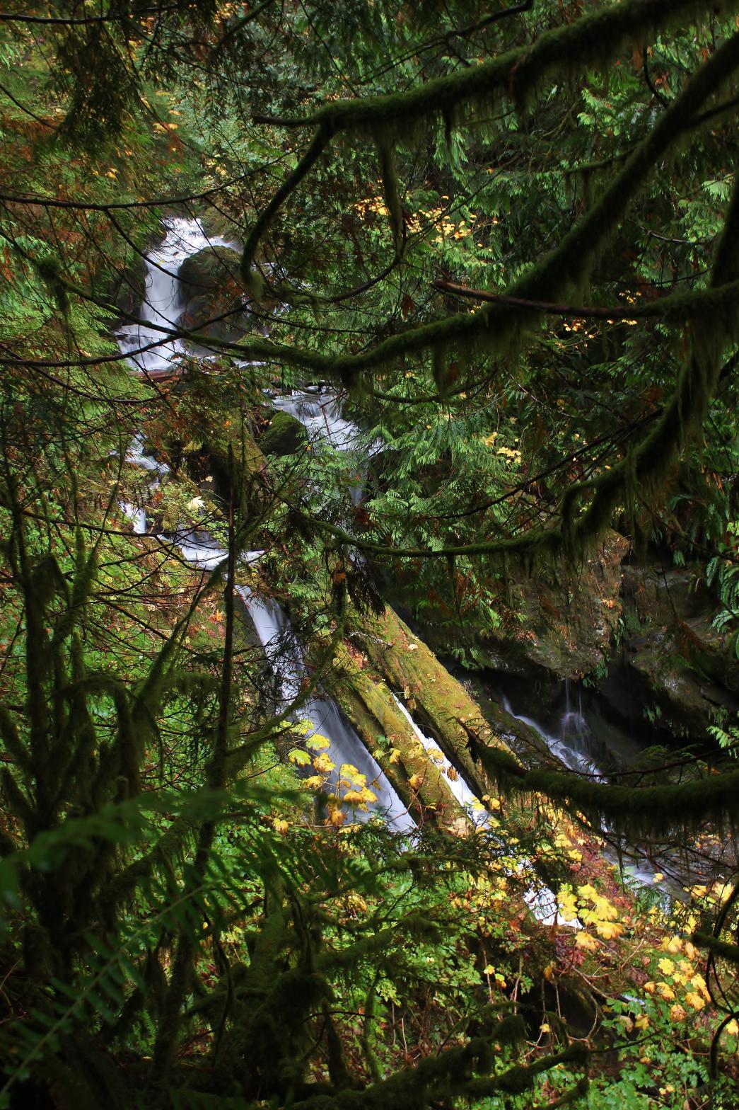 This
is the lowest, and smallest, of the three major waterfalls on Furland Creek.
The falls occur where the creek drops over a 3-step waterfall totaling about
45' in height. The largest tier is the bottom, which is covered by two
massive logs. Surprisingly, this does not detract from the look of the
waterfall and in some ways adds to it. Just downstream are two more
10' tall drops that could probably be included in the height of the falls.
I took my pictures through the trees from the steep hillside above the
creek. It would certainly be possible to scramble down to the base for
a clear view, but I had bigger fish to fry upstream on the way in and was
too wet, tired, and beat up on the way back. I'll be heading back into
the area in the near future, so I'll get better pictures at that time. This
is the lowest, and smallest, of the three major waterfalls on Furland Creek.
The falls occur where the creek drops over a 3-step waterfall totaling about
45' in height. The largest tier is the bottom, which is covered by two
massive logs. Surprisingly, this does not detract from the look of the
waterfall and in some ways adds to it. Just downstream are two more
10' tall drops that could probably be included in the height of the falls.
I took my pictures through the trees from the steep hillside above the
creek. It would certainly be possible to scramble down to the base for
a clear view, but I had bigger fish to fry upstream on the way in and was
too wet, tired, and beat up on the way back. I'll be heading back into
the area in the near future, so I'll get better pictures at that time. |
|
DIRECTIONS - Drive along Highway 530 between Arlington and Darrington. A
couple miles west of Darrington, turn south onto Mine Rd. Follow it to its
end in about a mile where a gated road heads uphill to the right and FR 2030
heads to the left. Park and start walking up 2030. The road immediately
crosses Moose Creek and then reaches Furland Creek in just under a mile.
Cross the creek and head upstream through the woods on the left side of the
creek. The falls are reached in about 2/3 of a mile. NEARBY WATERFALLS - Furland Falls, Middle Furland Falls, Snow Gulch Falls |
|
ADDITIONAL
PICTURES (CLICK TO ENLARGE)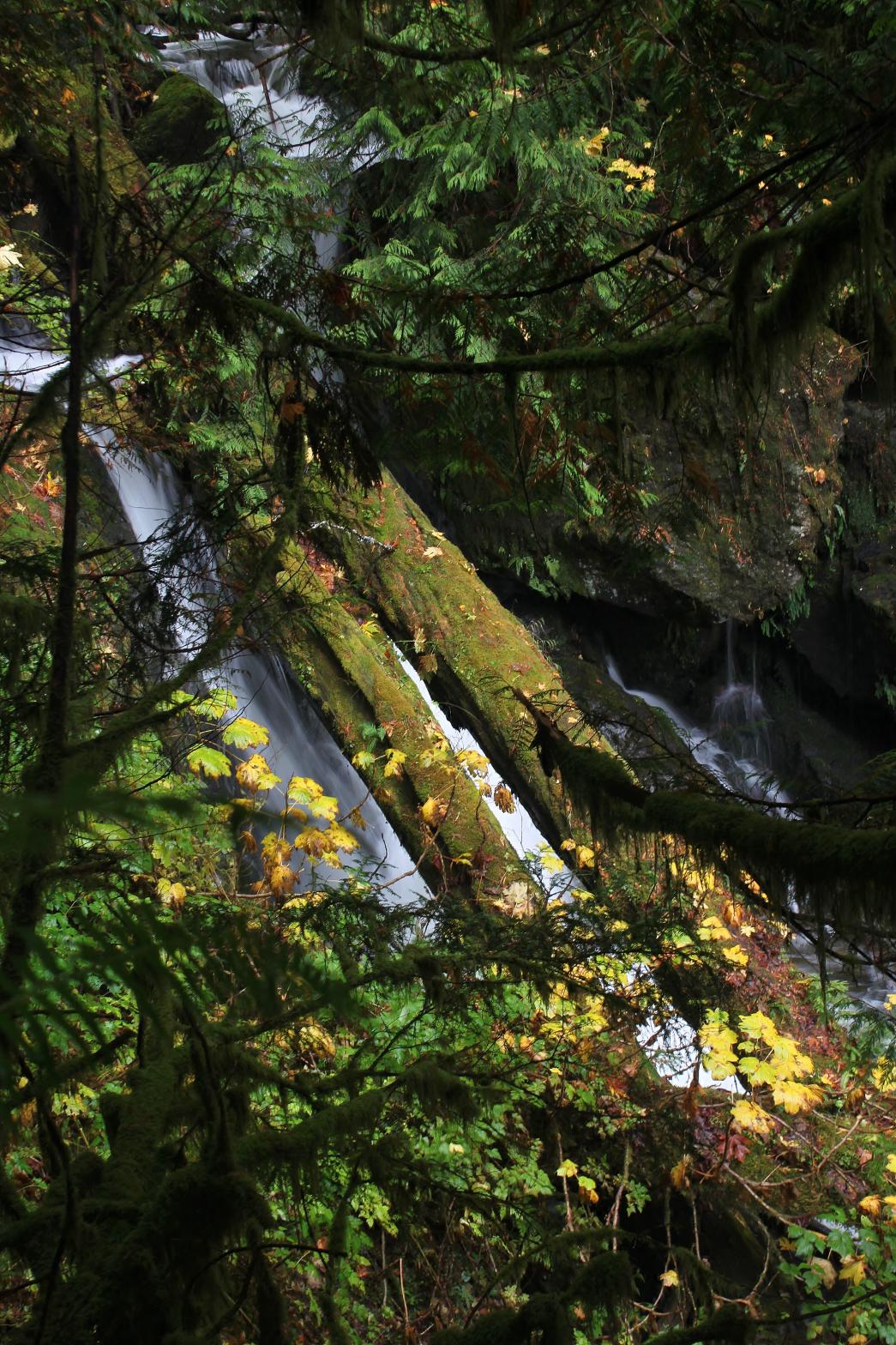 |
|
HOME SNOHOMISH COUNTY LINKS BEST IN THE NW WATERFALLS FOR KIDS FLICKR FACEBOOK STORE |
|