![]()
SNOW GULCH FALLS |
|
|
RATING -
24.4
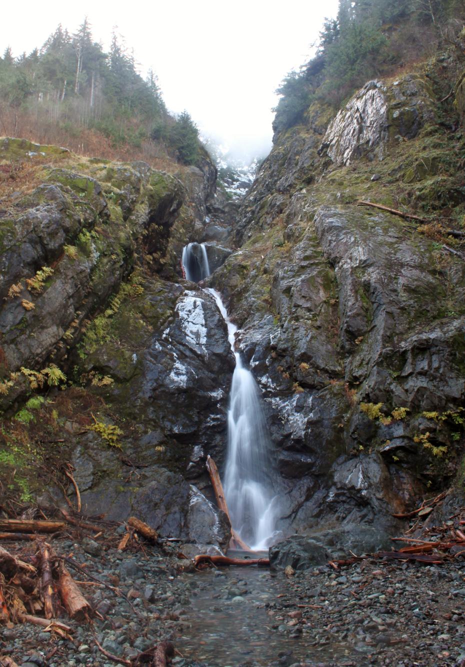
VR - 1.8 (Small) HR - 8.0 SR - 10/20 TYPE OF APPROACH - Road Walk DIFFICULTY - Medium LOCATION - Darrington area TYPE - Tiered HEIGHT - 450' WIDTH - 10' |
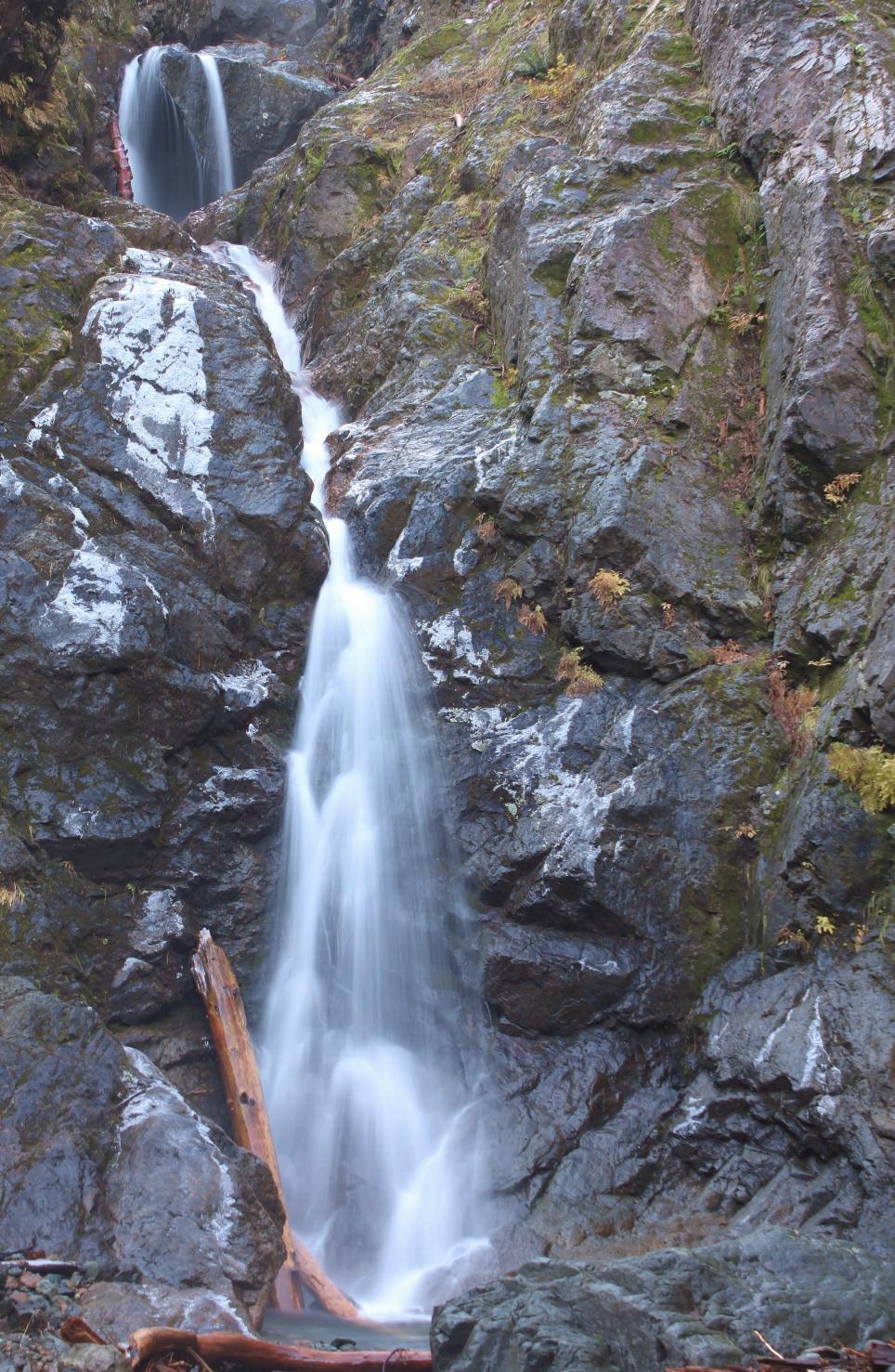 Snow
Gulch Falls occurs where three streams (only two of which are visible) drop
hundreds of feet down the north side of Whitehorse Mountain into Snow Gulch.
From the So-Bahli-Ahli Glacier to the base of the falls is over 2000' of
elevation loss, almost all of which is waterfall. From the base,
"only" about 500' of waterfall is visible. The center segment tumbles
down the cliff in a long series of drops, culminating in a 45' tall
horsetail with a great view of Whitehorse Mountain looming high above the
creek bed. The right side is straighter so more of the falls is
visible from the bottom. These waterfalls are really just an accent to
the amazing views of the mountain. In addition, a mine opening sits
right at the end of the road so this is a very cool area. In the
Spring and Summer, this can be a dangerous locale with massive avalanches
and rock slides pouring into the gulch so be careful. Snow
Gulch Falls occurs where three streams (only two of which are visible) drop
hundreds of feet down the north side of Whitehorse Mountain into Snow Gulch.
From the So-Bahli-Ahli Glacier to the base of the falls is over 2000' of
elevation loss, almost all of which is waterfall. From the base,
"only" about 500' of waterfall is visible. The center segment tumbles
down the cliff in a long series of drops, culminating in a 45' tall
horsetail with a great view of Whitehorse Mountain looming high above the
creek bed. The right side is straighter so more of the falls is
visible from the bottom. These waterfalls are really just an accent to
the amazing views of the mountain. In addition, a mine opening sits
right at the end of the road so this is a very cool area. In the
Spring and Summer, this can be a dangerous locale with massive avalanches
and rock slides pouring into the gulch so be careful. |
| DIRECTIONS -
Drive along Highway 530 between Arlington and Darrington. A couple
miles west of Darrington, turn south onto Mine Rd. Follow it to its
end in about a mile where a gated road heads uphill to the right and FR 2030
heads to the left. Park and start walking up 2030. Stay on the
main road until it ends at about 1.75 miles. Scrambling upstream among
the avalanche debris will get you to the base of the falls. NEARBY WATERFALLS - Furland Falls, Lower Furland Falls, Middle Furland Falls |
|
ADDITIONAL
PICTURES (CLICK TO ENLARGE)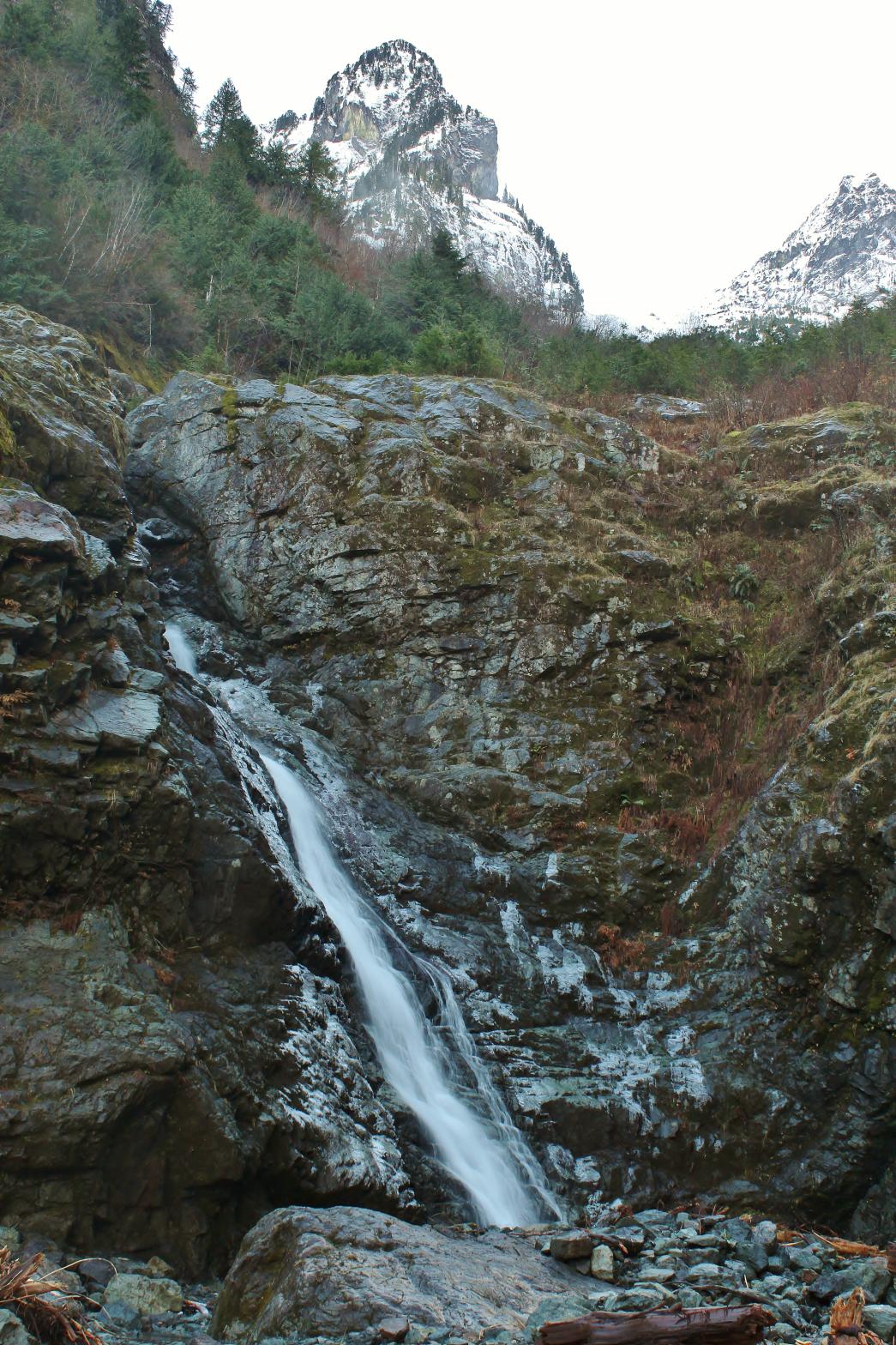
 |
|
HOME SNOHOMISH COUNTY LINKS BEST IN THE NW WATERFALLS FOR KIDS FLICKR FACEBOOK STORE |
|