![]()
LOWER SULPHUR CREEK FALLS |
|
|
RATING - 20.0
VR - 6 (Med) HR - 1.0 SR - 14/20 TYPE OF APPROACH - Bushwhack DIFFICULTY - Fairly Easy LOCATION - Baker Lake Area TYPE - Plunge HEIGHT - 24' WIDTH - 5' GPS - N48 39.552 W121 42.727 ELEVATION - 854' |
|
| DIRECTIONS - Drive
out the Baker Lake Road and turn right onto the road leading to the Upper Baker Dam (FR
1106). Just after turning on this road you will drive over a wooden bridge.
Park at the small pullout just over the bridge. The falls are about 200' downstream
from here. Head downstream through the brush until you find a small path leading
down to the creek below the falls.
(Note: The bridge over Sulphur Creek has
been removed so you will either need to ford the creek or walk up the road
from the other end to get to the pullout now.) NEARBY WATERFALLS - Middle Sulphur Creek Falls, Sulphur Creek Falls, Upper Sulphur Creek Falls |
|
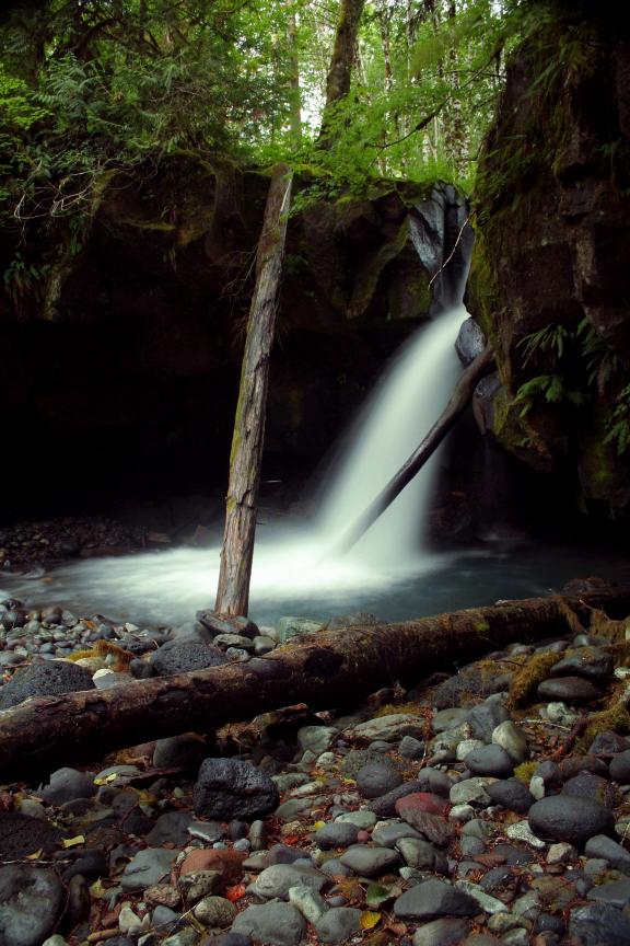
ADDITIONAL PICTURES (CLICK TO ENLARGE)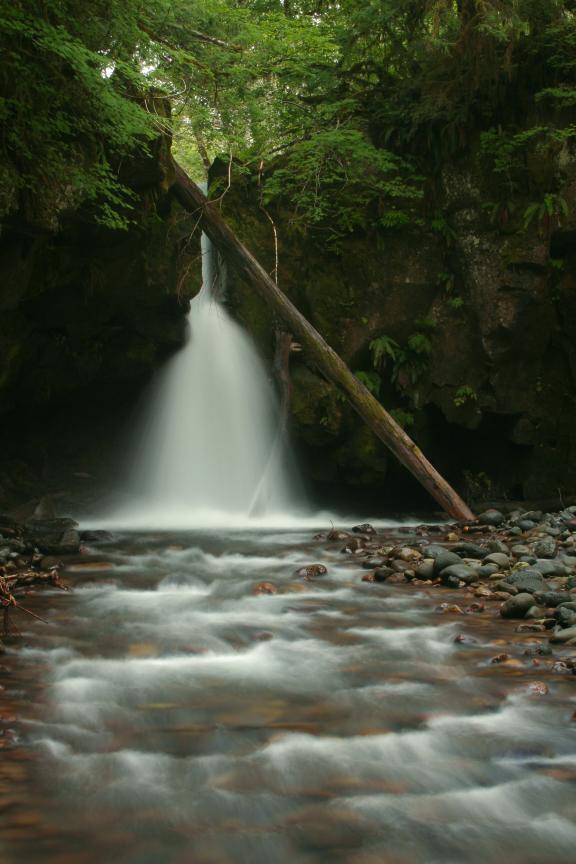 |
|
HOME WHATCOM COUNTY LINKS BEST IN THE NW WATERFALLS FOR KIDS FLICKR FACEBOOK STORE |
|
 Sulphur Creek runs
through a narrow chute before launching itself out into a pool of crystal clear
water. The cliff surrounding the falls is undercut making a little cave
underneath. During the spring and summer there are a lot of bees near where you drop
into the canyon so keep your eyes open. I'd love to come up with a more fitting
name for this one so if you can think of anything,
Sulphur Creek runs
through a narrow chute before launching itself out into a pool of crystal clear
water. The cliff surrounding the falls is undercut making a little cave
underneath. During the spring and summer there are a lot of bees near where you drop
into the canyon so keep your eyes open. I'd love to come up with a more fitting
name for this one so if you can think of anything,