![]()
LOWER THUNDER FALLS |
|
|
RATING -
32.0
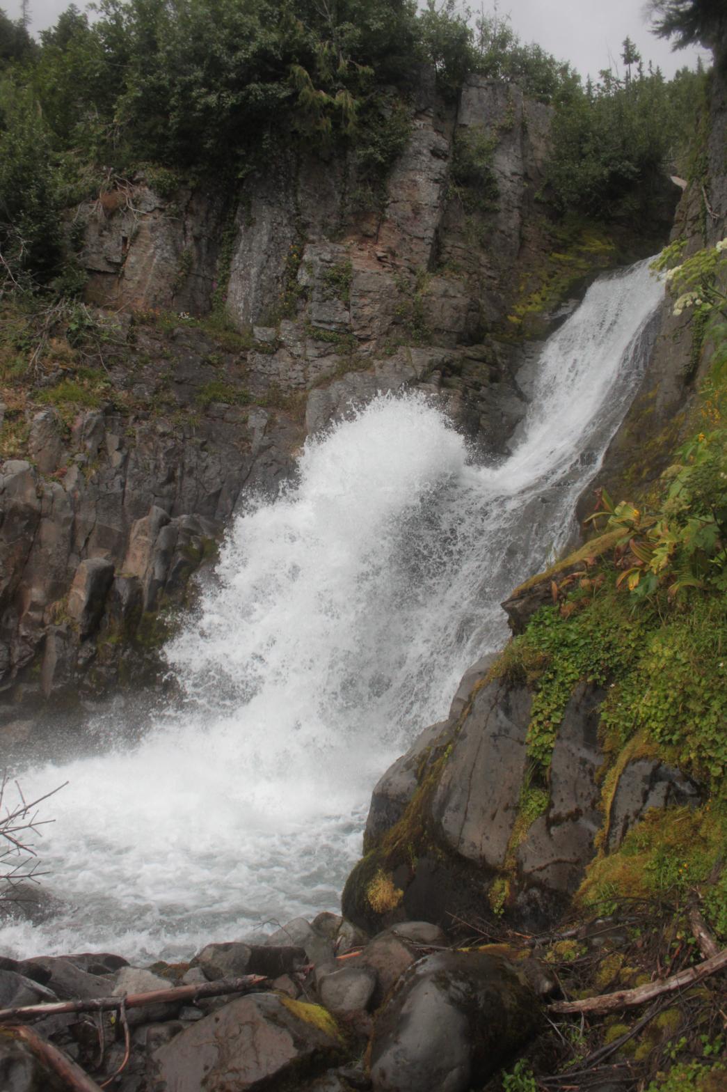
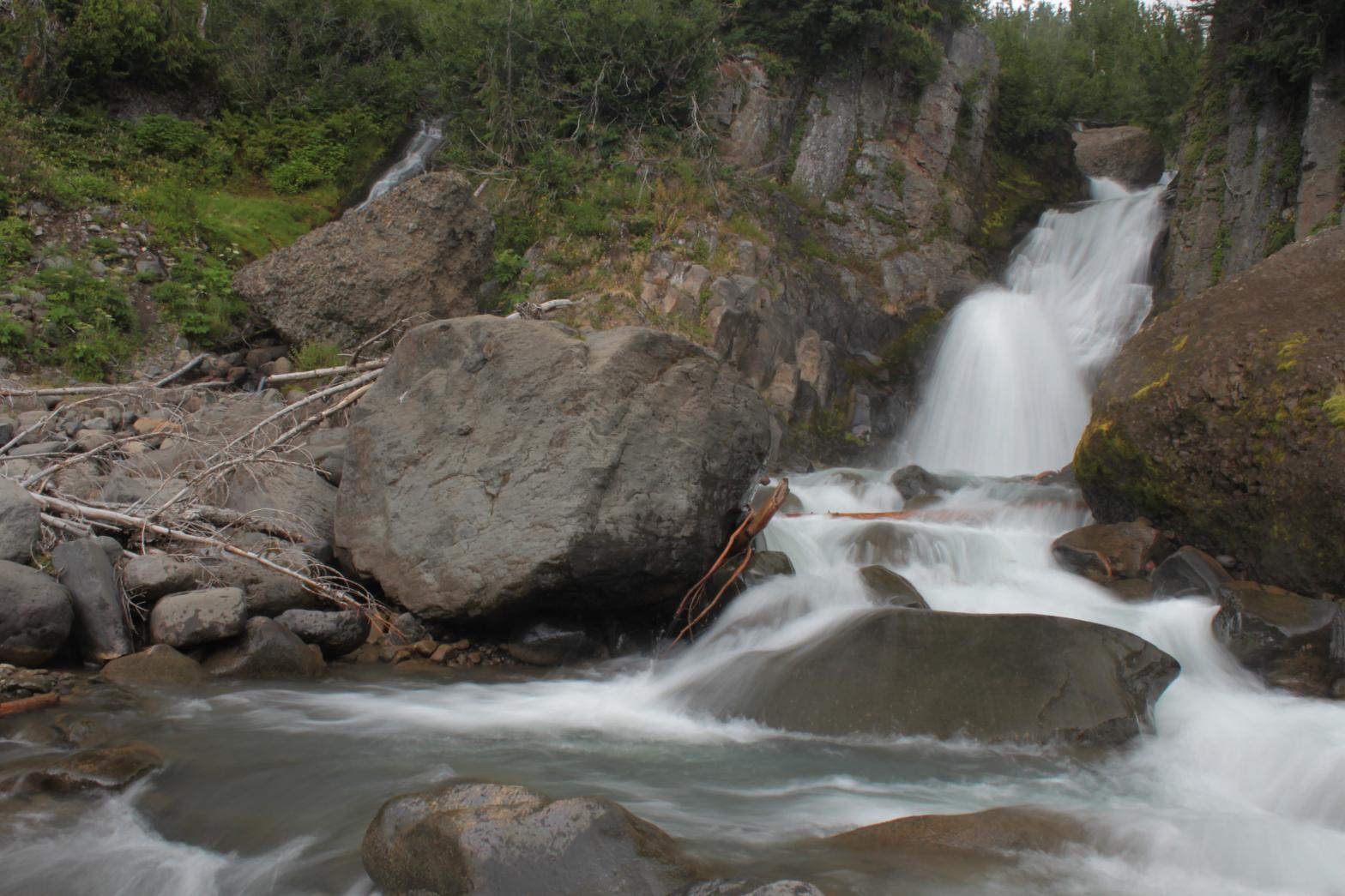
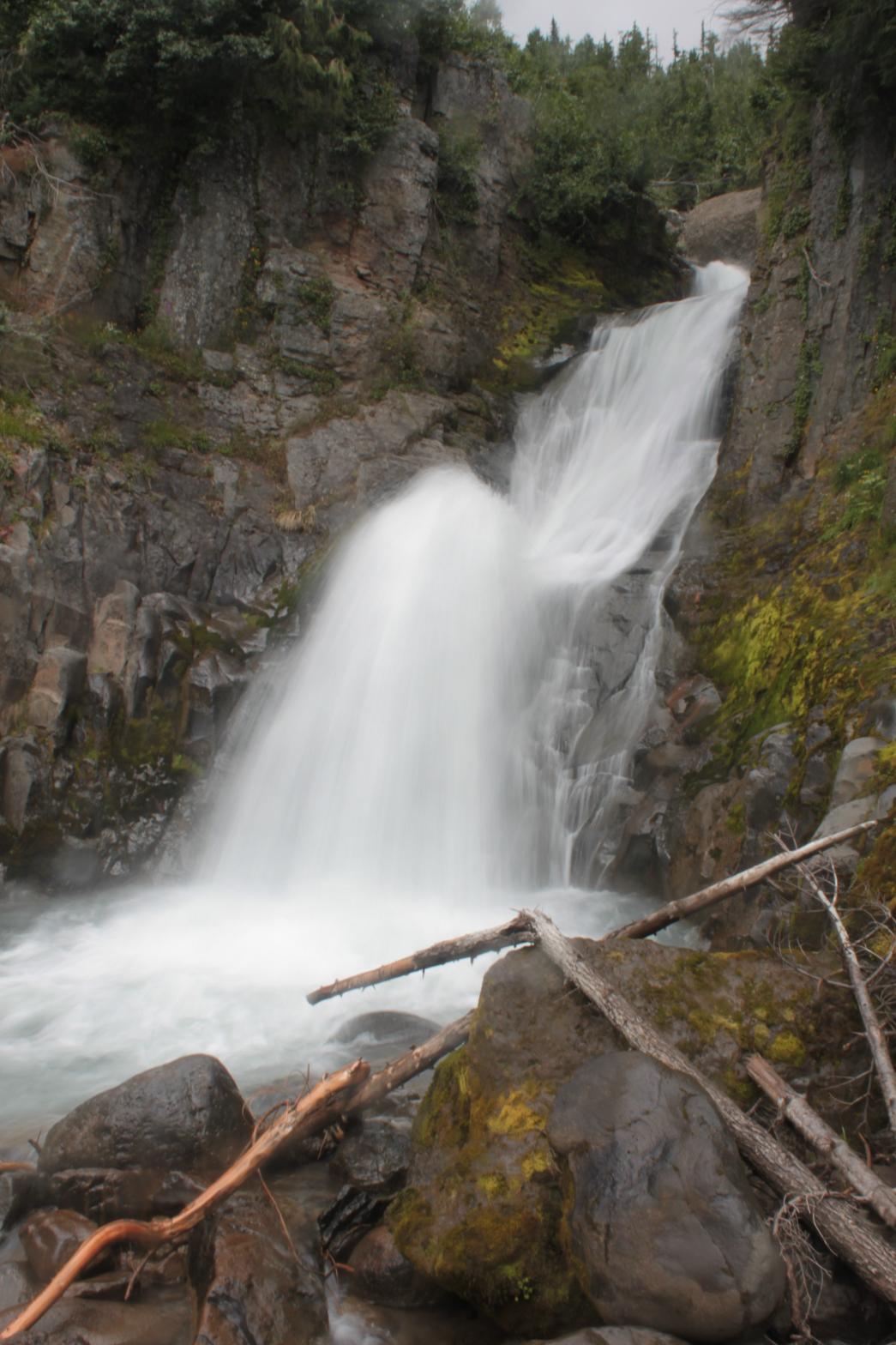
VR - 8 (Big) HR - 2.0 SR - 16/20 TYPE OF APPROACH - "Trail" + Bushwhack DIFFICULTY - Very Difficult LOCATION - Middle Fork Nooksack Road TYPE - Tiered HEIGHT - 43' WIDTH - 10' GPS - N48 45.666 W121 53.428 ELEVATION - 4442' |
 While
not nearly as impressive as Thunder Falls upstream, Lower Thunder Falls is
really unique. The streams from Thunder and Lightning Falls combine
and a short distance downstream drop over this 43' tall waterfall. The
stream cascades for 11' feet and then drops over the main, 32' tall drop
where the creek slides down a bedrock ramp and launches itself up and
outward into a beautiful pool of water. The cliff the waterfall drops
over is really cool, but the area below and around the waterfall is pretty
messy thanks to the tremendous amount of avanlanche debris. The cliff
walls are covered with greenery and flowers as well which adds to the scene. While
not nearly as impressive as Thunder Falls upstream, Lower Thunder Falls is
really unique. The streams from Thunder and Lightning Falls combine
and a short distance downstream drop over this 43' tall waterfall. The
stream cascades for 11' feet and then drops over the main, 32' tall drop
where the creek slides down a bedrock ramp and launches itself up and
outward into a beautiful pool of water. The cliff the waterfall drops
over is really cool, but the area below and around the waterfall is pretty
messy thanks to the tremendous amount of avanlanche debris. The cliff
walls are covered with greenery and flowers as well which adds to the scene.There is a small, seasonal creek that joins Wallace Creek here on the left side. This creek actually has several more small waterfalls upstream that I didn't bother to investigate because of the small size of the creek. |
|
DIRECTIONS - From Lightning Falls, continue
to follow the stream down to where it converges with the main branch of
Wallace Creek. Lower Thunder Falls is about 500' downstream from here.
You can either smash through the brush on the south side of the creek until
you get below, or rockhop downstream until you reach the top, cross the
creek, and then climb down the much easier north side. It's your
choice if you want to get scratched up or wet. NEARBY WATERFALLS - Lightning Falls, Thunder Falls, Upper Lightning Falls |
|
ADDITIONAL PICTURES AND VIDEO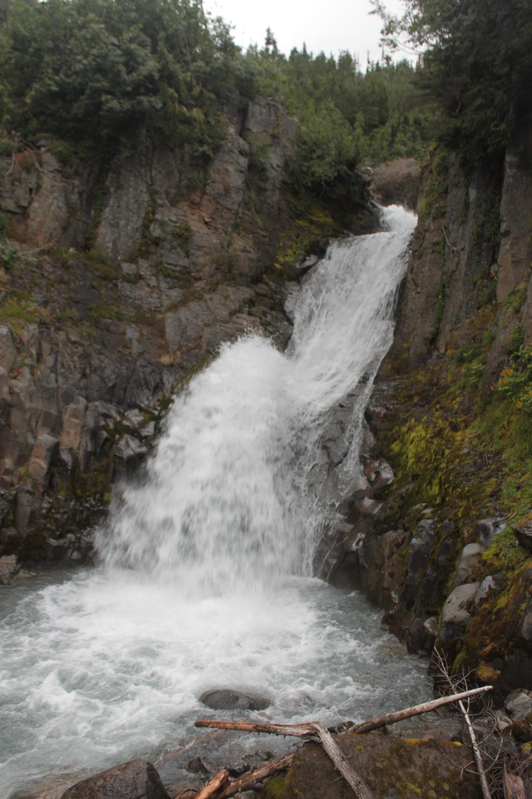
 |
|
HOME WHATCOM COUNTY LINKS BEST IN THE NW WATERFALLS FOR KIDS FLICKR FACEBOOK STORE |
|