![]()
MIDDLE ANDESITE FALLS |
|
|
RATING -
32.0
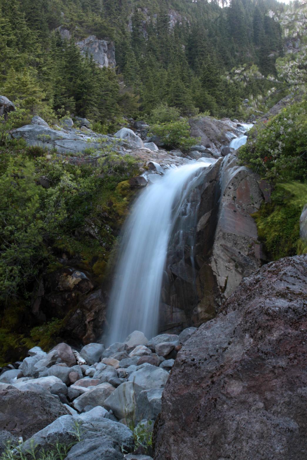
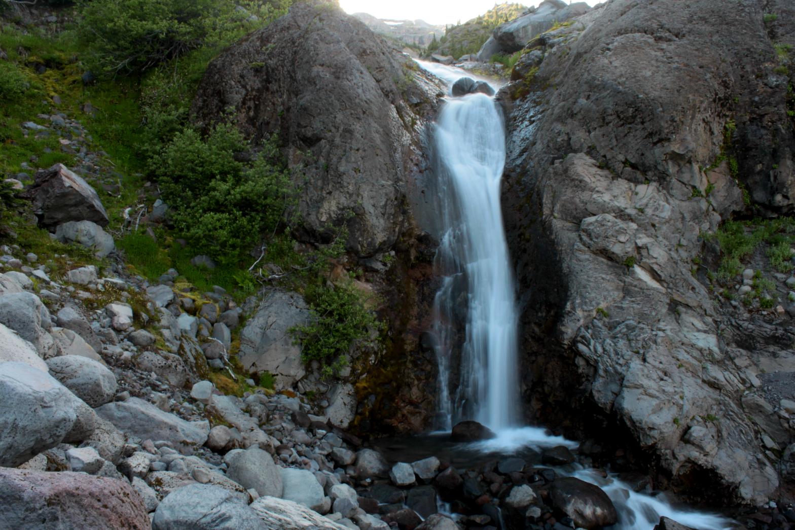
VR - 4 (Med/Sm) HR - 4 SR -16/20 TYPE OF APPROACH - Bushwhack DIFFICULTY - Extremely Difficult LOCATION - Mt. Baker Recreation Area TYPE - Tiered HEIGHT - 53' WIDTH - 5' ELEVATION - 4401' GPS - N 48 44.124', W 121 47.953' |
The Sandy Creek Basin is one of the most desolate, rugged, and most difficult to access locations on all of Mt. Baker. However, the area is also home to a plethora of waterfalls and some of the most unique and amazing geology on the entire mountain. Three major streams flow out of the Squak Glacier in the area and each one contains multiple waterfalls along their courses. Middle Andesite Falls is a pretty set of waterfalls located just upstream from the awesome Andesite Falls. The waterfall consists of a 38' tall upper tier and a 15' tall lower tier. Unlike most of the Sandy Creek Basin, this creek, particularly around this waterfall, is fairly green and lush. There are a lot of flowers and vegetation around the falls that contrast beautifully with the rugged volcanic rocks in the area. |
|
DIRECTIONS - From Upper Andesite Falls,
follow the edge of the canyon downstream for a couple hundred feet to the
upper tier. The lower tier is a little trickier to view but can be
done. The top of 256' tall Andesite Falls is just downstream from the
lower tier so DON'T FALL! NEARBY WATERFALLS - Andesite Falls, Double Falls, Kathryn Falls, Middle Andesite Falls, Middle Sandy Creek Falls, Skaleek Falls, South Squak Glacier Falls, Squak Glacier Falls, Upper Sandy Creek Falls |
|
ADDITIONAL
PICTURES (CLICK TO ENLARGE)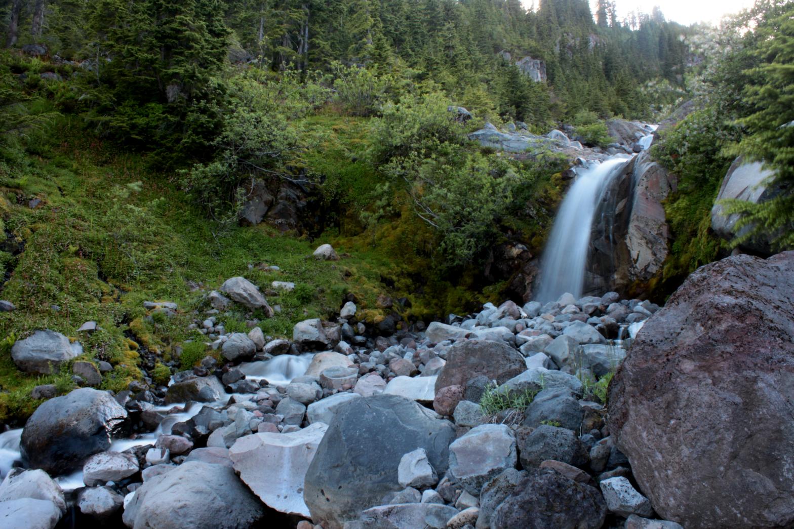
 |
|
HOME/a> WHATCOM COUNTY LINKS BEST IN THE NW WATERFALLS FOR KIDS FLICKR FACEBOOK STORE |
|