![]()
LOWER FOSS RIVER FALLS |
|
|
RATING - 72.0
VR - 10 (Huge) HR - 6.0 SR - 12/20 TYPE OF APPROACH - Trail DIFFICULTY - Difficult LOCATION - Foss River Trail TYPE - Tiered HEIGHT - 160' WIDTH - 80' GPS - N47 35' 56.56" W121 18' 51.62" ELEVATION - 3150' |
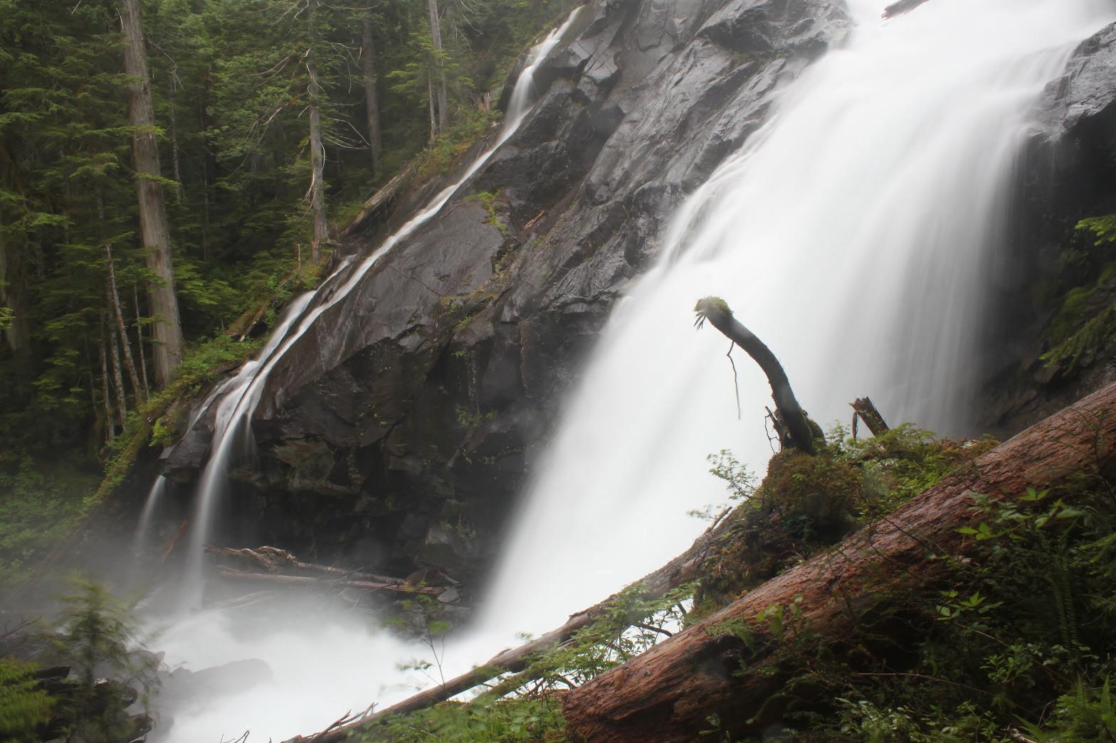
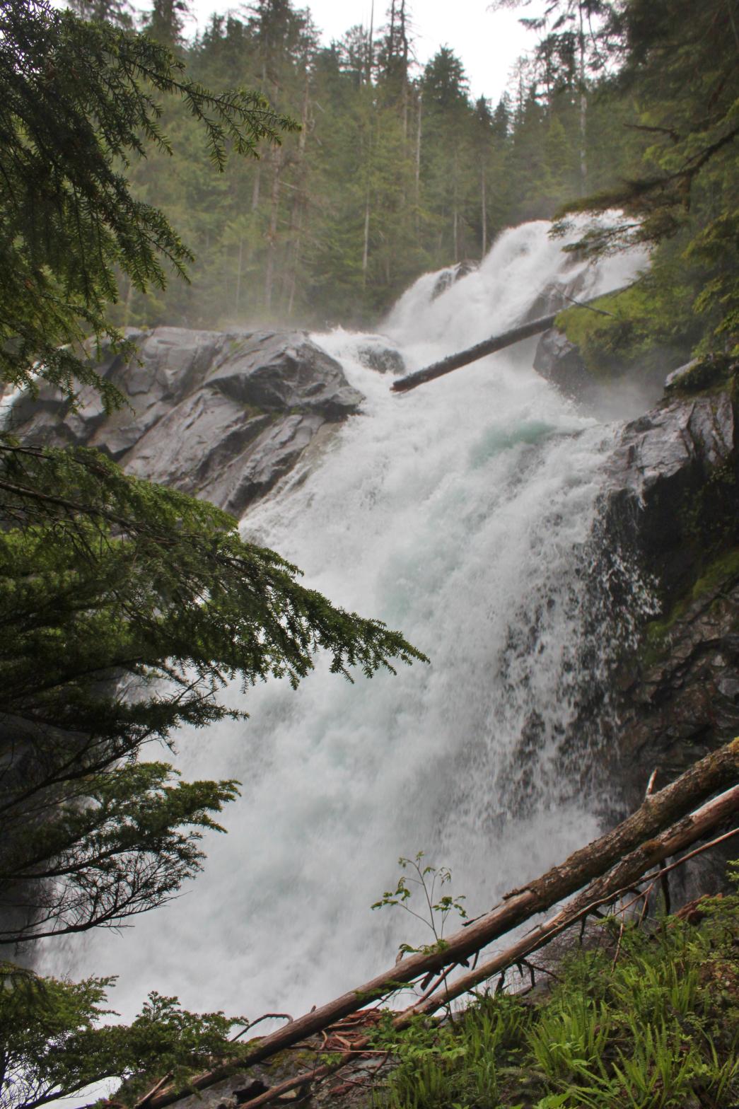 This
amazing waterfall occurs where the West Fork of the Foss River dumps over a
massive rock face. The falls begin with a 45' tall plunge in a narrow
crack in the rock. Below there it spread out and cascades about 125'
in two drops, getting steeper towards the bottom. The main section of
the falls drops on the right, while a small amount gracefully slides down
the left hand segment. While this is a difficult waterfall to get to,
it is worth the effort. If you've made it this far, continue up the
river to Upper Foss River Falls and on to Delta Lake. You won't be
disappointed. This
amazing waterfall occurs where the West Fork of the Foss River dumps over a
massive rock face. The falls begin with a 45' tall plunge in a narrow
crack in the rock. Below there it spread out and cascades about 125'
in two drops, getting steeper towards the bottom. The main section of
the falls drops on the right, while a small amount gracefully slides down
the left hand segment. While this is a difficult waterfall to get to,
it is worth the effort. If you've made it this far, continue up the
river to Upper Foss River Falls and on to Delta Lake. You won't be
disappointed. |
|
DIRECTIONS - Follow the directions to Lower Copper Creek Falls. Cross
the creek and head downstream towards the river. You'll eventually
find a trail heading upstream (look for pink ribbons). Follow this
very rough trail for about 1/2 a mile to the falls. NEARBY WATERFALLS - Angeline Falls, Big Heart Falls, Lower Copper Creek Falls, Middle Copper Creek Falls, Shoestring Falls, Upper Foss River Falls |
|
ADDITIONAL PICTURES (CLICK TO ENLARGE) AND
VIDEO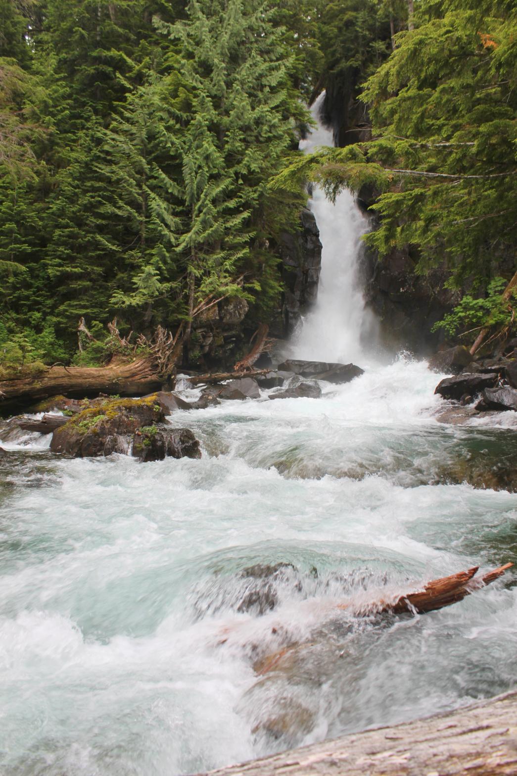
 |
|
HOME KING COUNTY LINKS BEST IN THE NW WATERFALLS FOR KIDS FLICKR FACEBOOK STORE |
|